
- Hikes in Arizona
- Northern Arizona
- Inner Basin (Lockett's Meadow)
Inner Basin (Lockett's Meadow)
Location
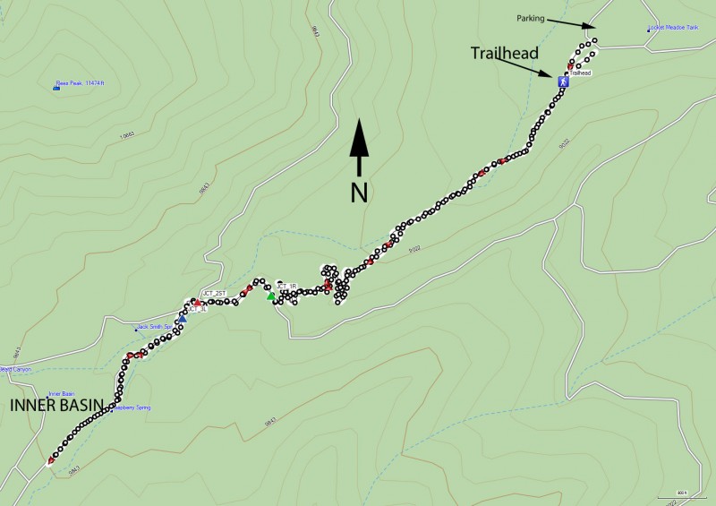
From the Flagstaff area, take HWY 89 towards Page, AZ. About 12 miles from Flagstaff (between Mile marker 430 and 431) is the turn off, signed as 'Forest Access' and 'Schultz Pass road'. After 0.6 miles, you come to an intersection. Turn right here onto Lockett Meadow Road. (FR 552). This road is OK for passenger cars if you take it slowly. Take this road for about 4.4 miles (5.0 miles from HWY-89) to the trailhead at Lockett Meadow. Follow the one-way road through the camping area to the day use parking near the trailhead.
Hike details
Season
- April
- May
- June
- July
- August
- September
- October
Solitude
Difficulty
Permits
Hike Lockett's Meadow to the Inner Basin near Flagstaff, Arizona
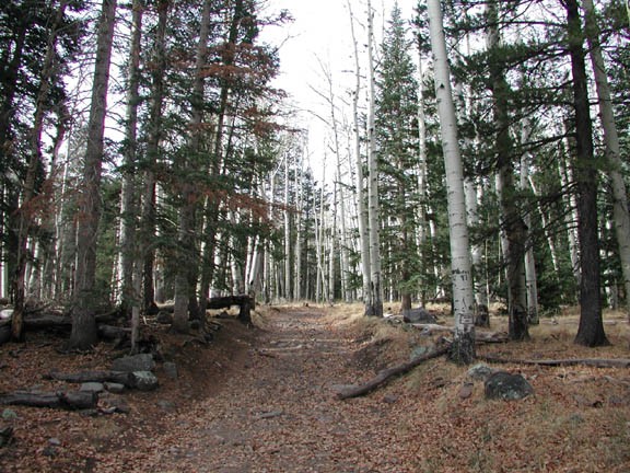
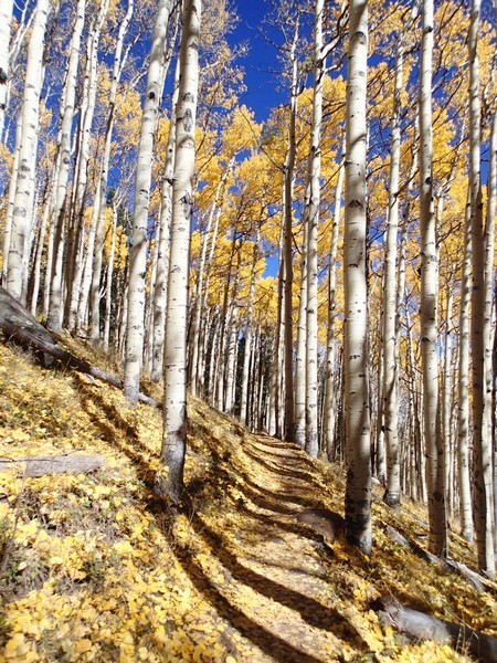
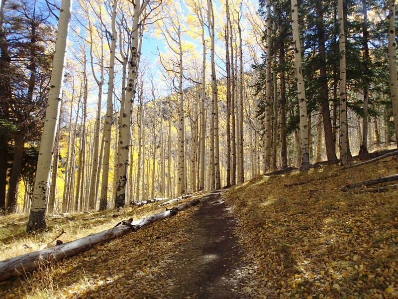
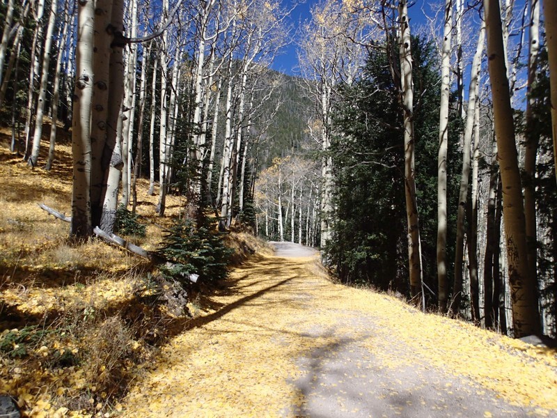
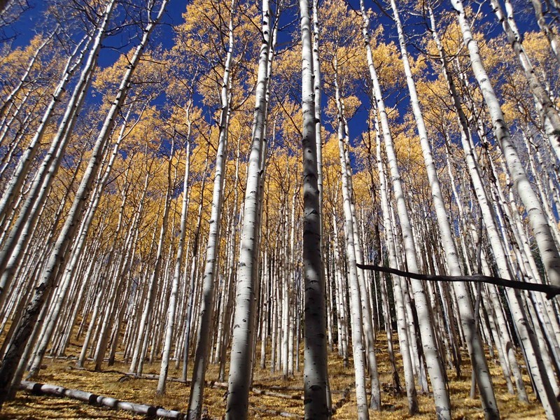
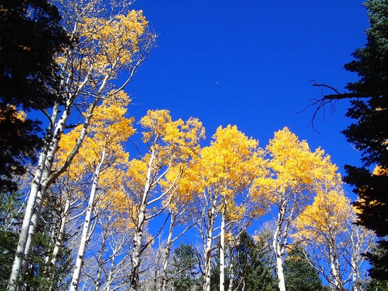
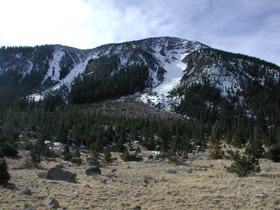
This is a well marked trail that takes you through the magical Flagstaff forest in the shadow of the San Francisco Peaks. There are many grade A photo opportunities, especially in the Fall, when the leaves are changing color. This hike has changed a bit since we last took it, so this write-up has changed as well.
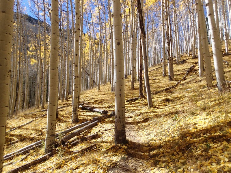
From the parking lot, the Inner Basin trail is marked by a sign. The trail itself is a wide dirt road, closed to vehicles and easy to follow. The hike climbs steadily up a pine and aspen forest.
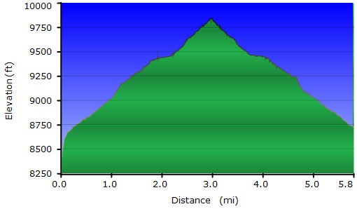
After 1.5 miles, you reach a dirt road (yes, the same one that started at the parking lot) and some cabins (JCT_1R on the map). There is a trail sign that points you to the right on a closed dirt road to stay on the Inner Basin trail. There are a few water wells and pumping stations along this route. Another 0.3 miles gets you to more buildings related to water pumping and a natural spring water faucet. Follow the signs that point you to Inner Basin (JCT_2ST on the map) to continue along the trail another 0.3 to the inner basin. There is another signed trail junction (JCT_3L on the map). Stay left to stay on the Inner basin trail. The Inner Basin is a meadow with nice views of the San Francisco peaks and is a lovely place to lay out a blanket and relax.
If you want, you can take the road back to the parking lot, but this detour adds about 1.5 miles to the length of your hike.
Bring a blanket, laying out on the meadow is relaxing and re-energizing. The trail actually continues up to the Weatherford Trail, some 2.3 miles from the cabins (and about 1500 ft more of elevation gain).
This is a great Arizona hike. Enjoy!
