

- Hikes in Arizona
- Phoenix Area and Central Arizona
- St. Clair Mountain
St. Clair Mountain
Location
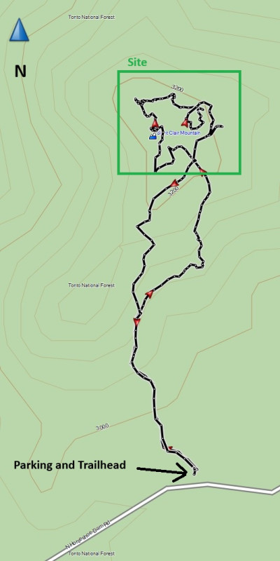
To get to the trailhead: From the Phoenix area, HWY-101 North to the Pima road exit and head North. Continue north on Pima until you reach the intersection of Pima Road and Cave creek Road. Make a right (East) onto Cave Creek Road. From Cave Creek Road, turn right onto Bartlett Dam Road and continue 6.3 miles to the turnoff to Horseshoe Dam road. Turn left here and drive 4.1 miles to the unsigned small parking area on your left. The last 2.5 miles of this road is well graded dirt. There is a small fence and no vehicles brown sign marking the hike start.
Hike details
- Water
- Wild Flowers
Season
- January
- February
- March
- April
- October
- November
- December
- July
- August
Solitude
Difficulty
Permits
Hike the St. Clair Mountain site close to Bartlett Reservoir near Phoenix, Arizona.
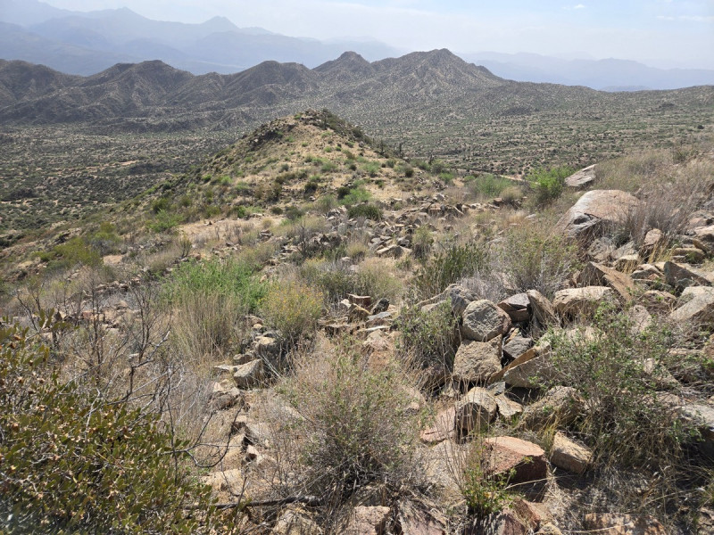
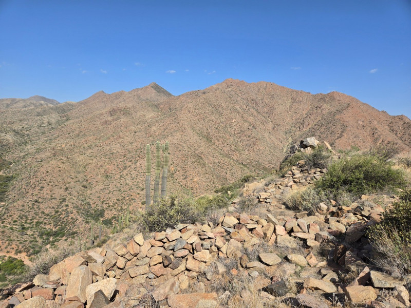
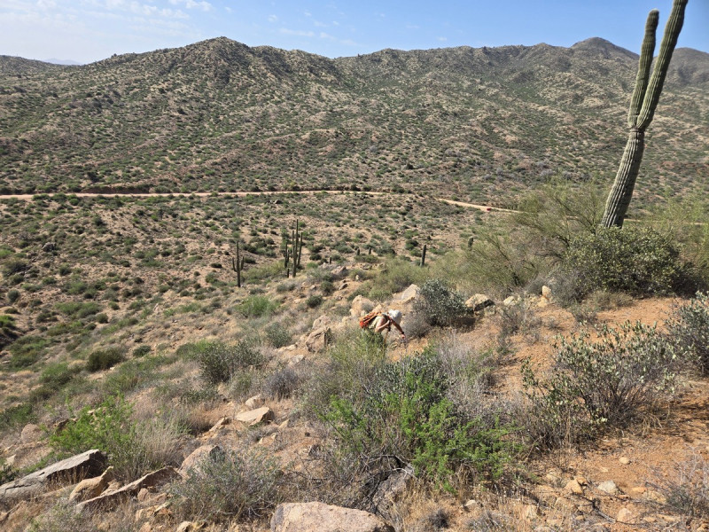
While there is a trail to this native american site, it can be difficult to stay on, so bring those route finding skills and don't be afraid to bushwhack to the site.
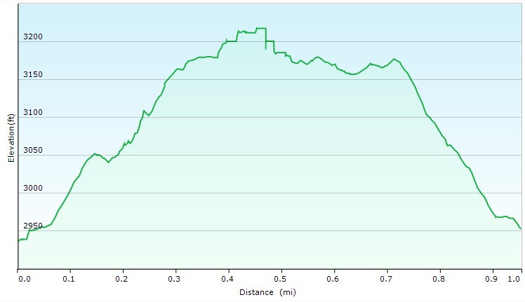
From the parking area, go past the fence and follow the trail. You can see generally the saddle you're headed to. This is less of a trail and more of a route, so it will be a bit brushy at times.
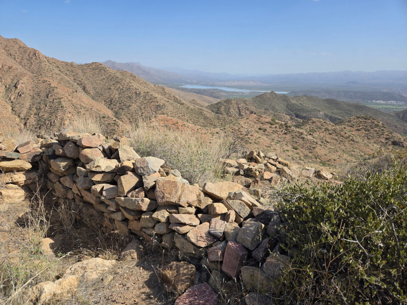
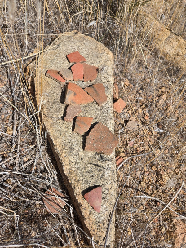
After only about 0.4 miles and about 300 ft of climbing, you'll see the rock walls all around to explore. This is a significant site, with pottery shards everywhere (watch your step!).
There are also some really nice views of Horseshoe Lake. Please be very gentle with this area and leave it as you found it for future generations to enjoy.
