

- Hikes in Arizona
- Phoenix Area and Central Arizona
- Agua Fria River (via Sunset Point)
Agua Fria River (via Sunset Point)

Location
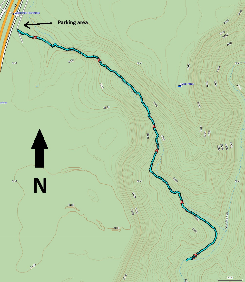
From the Phoenix area, take I-17 North to the Sunset Point rest area exit (#252). Turn right at the the first intersection and drive a short way to a dirt parking area.
Hike details
Season
- January
- February
- March
- November
- December
Solitude
Difficulty
Permits
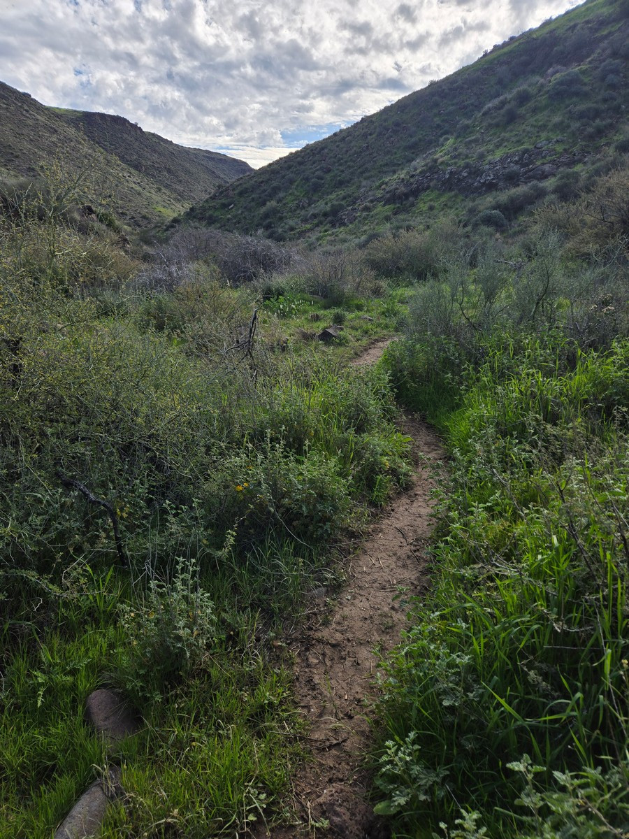
Hike to the Agua Fria river in the Agua Fria National Monument This hike was a wonderful surprise. We've passed by (and stopped at) the Sunset Point rest area for years, never realizing the hiking gem that was hidden just to the east of us. From the parking area, look for the faint trail headed to the large canyon to the east. Some helpful hikers have added pink ribbons to help people stay on the trail and it was appreciated. Once the trail gets into the canyon, it becomes much easier to follow, although it is still a rough trail that likely gets very little maintenance.
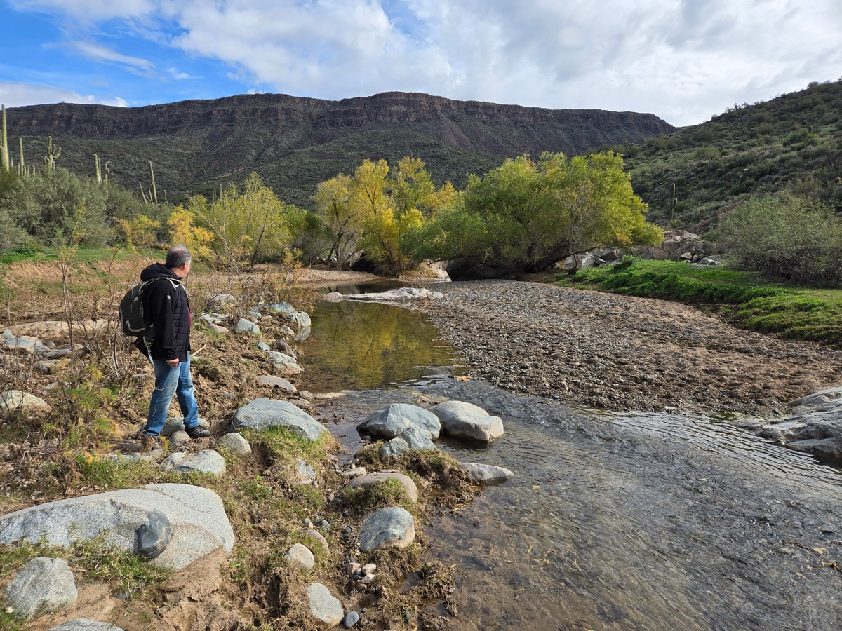
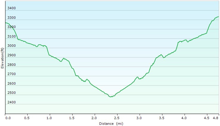
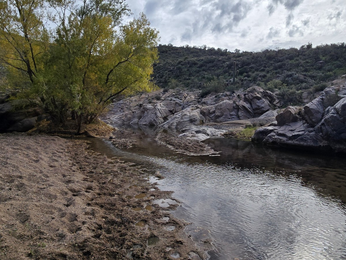
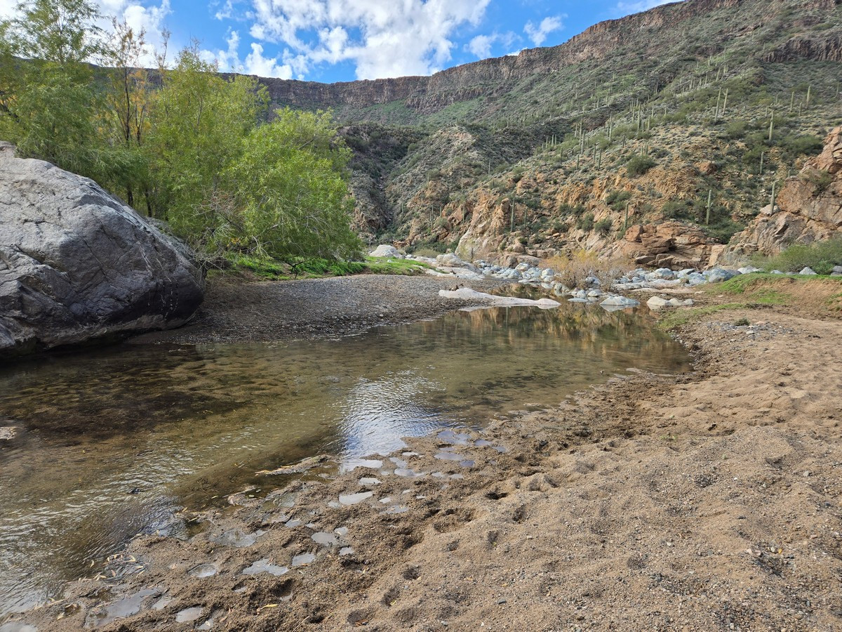
Although this area is typically brown desert, after winter rains it becomes green and lovely. Follow the rough trail through the canyon, keeping an eye out for pink ribbons and cairns to stay on the trail. You'll go through two barbed wire fences. Leave them as you found them (so, if they were closed, closed them behind you and vice versa). The trail can be a bit overgrown in places and there are some bushes with thorns on them. Long hiking pants are recommended. After 2.5 miles of a gradual descent, you'll reach the Agua Fria river. This is a seasonal river and typically has water flow during the winter and spring. The turn around point is at a lovely beach with cottonwood trees and comfy rocks to sit on and enjoy a snack.
When ready, return the way you came.
