
- Hikes in Arizona
- Superstition and Mazatzal Wilderness
- Peralta Regional Park
Peralta Regional Park
Location
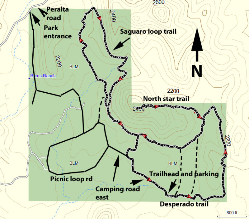
From the Phoenix area, take US-60 East, leaving the city limits. After leaving Apache Junction, continue about 8.5 miles, turning left onto signed Peralta Road (FR 77). After starting out as a paved road, this quickly turns into a well maintained dirt road. The signed Peralta Regional park appears on the left after about 5 miles on this road. Turn right here to enter the park. The roads in the park are all well graded dirt and while the junctions are signed, they are not signed well. From the entry road, take the first left (signed as Trailheads). You'll pass the 'main' trailhead on the right. Turn left at the signed intersection for the Picnic road loop. The next turn is another left onto Camping Road East (signed as Camping). Take this road to the Backpacking Trailhead and park here. There is a restroom at this trailhead, but no water.
Hike details
Season
- January
- February
- March
- April
- October
- November
- December
Solitude
Difficulty
Permits
Hike around the Peralta Regional Park near the Superstition wilderness, Arizona.
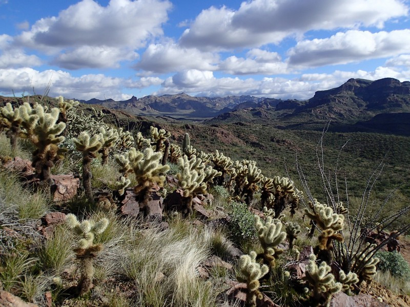
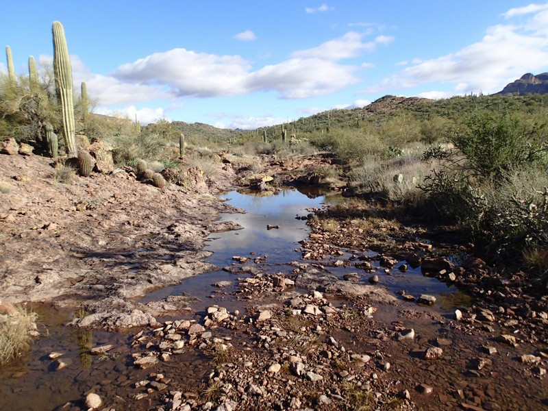
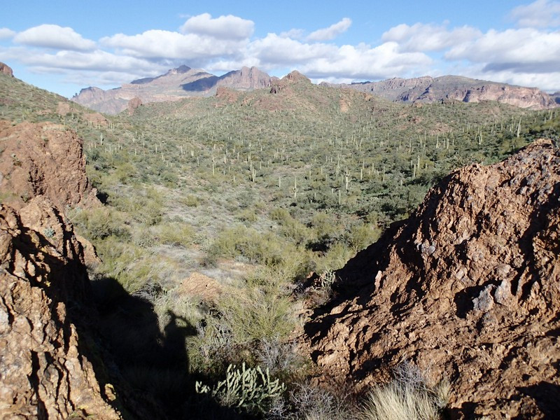
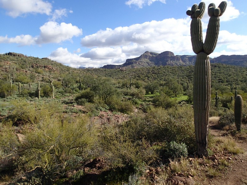
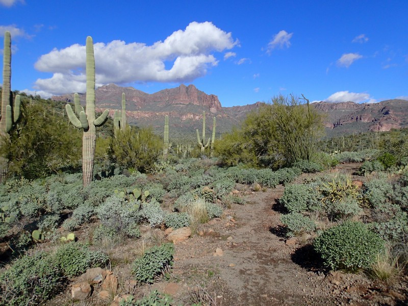
The Peralta Regional Park opened in mid January 2023 and features a variety of new trails in the Sonoran desert near the Superstition Wilderness. We made an interesting lollypop loop hike out of three of the trails in this park: Desperado Trail, North Star Trail, and the Saguaro Loop trail.
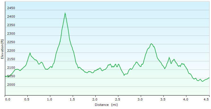
From the backpackers trailhead, take the nearby trail to the left (East). This is the Desperado trail. It is the longest trail and it loops around 3/4 of the circumference of the park. The entirety of this trail loop is through Sonoran style desert, with abundant Saguaro, Cholla,and Barrel cactus. The park was designed to mirror the nearby Superstition wilderness experience, so signs in the park and trailhead junctions are only basically marked and blend in with the desert. There are a few spur short cut trails on your left. Stay right at these two signed forks to stay on the Desperado trail. The trail bends north, then south west. Once it bends southwest, keep an eye out for a marked junction (after about 0.8 miles of hiking). Turn right here to take the one way North Star trail. This steep quarter mile trail section rewards some effort with great views of the park and the Superstition Wilderness and is well worth taking. After enjoying the views, backtrack to the Desperado trail again, this time turning right. From here, walk 0.6 miles (staying right at the spur trail junctions going off to the left) to reach the Saguaro Loop. This junction is unmarked, but it loops back to this point, so it doesn't matter if you turn right or left here. We arbitrarily chose left for a clockwise hike through the loop. As the name suggests, there are plenty of interesting Saguaro cacti on this section. The total distance of the Saguaro loop is 1.2 miles. As mentioned previously, the loop ends back at the trail junction with the Desperado trail, which you can follow back to the start, or take one of the spur trails more directly to your car.
