
- Hikes in Arizona
- Superstition and Mazatzal Wilderness
- Peter's Cave
Peter's Cave
Location
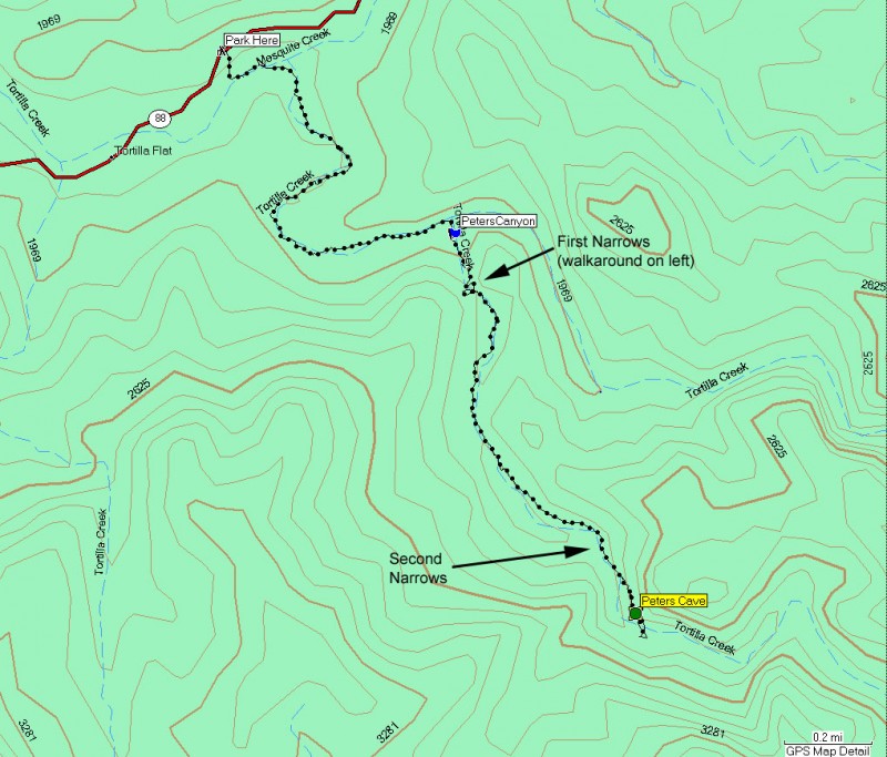
From the Phoenix area, take HWY 88 North East out of Apache Junction towards Canyon Lake. After you hit the tourist trap known as Tortilla Flats, go another 0.3 miles to a small pull off on the right. There is a rugged 4WD road down to Tortilla Creek here that marks the start of the adventure.
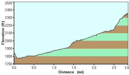
Hike details
Season
- January
- February
- March
- April
- October
- November
- December
Solitude
Difficulty
Permits
Hike to Peter's cave in the Superstition Wilderness, Arizona.
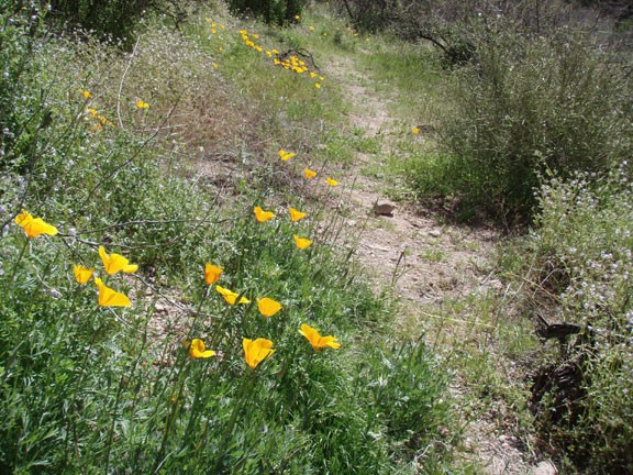
We managed to take this hike under rare circumstances: a wet winter and during wildflower season. The combination of these two events made this a very special hike. We were serenaded by canyon wrens and watched as frogs jumped into the water. It's well worth it to time this hike just after substantial rain.
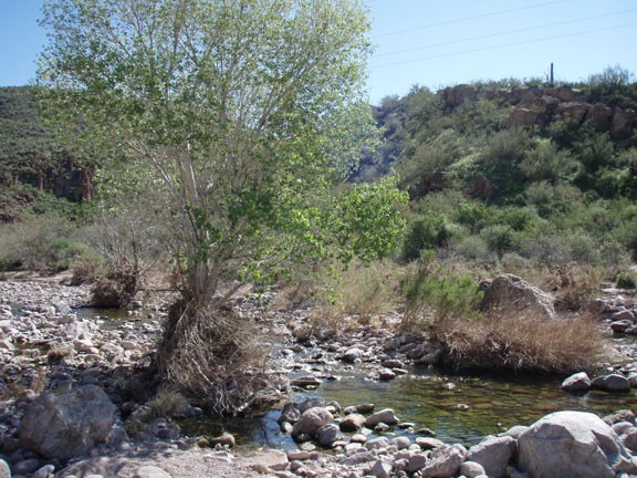
From the parking pull out, walk along the 4WD road down to Tortilla Creek. This area has a very different feel when there's water in the creek, so enjoy it if you're lucky enough to take this hike after a wet winter. Cross the creek, and walk to your left, keeping an eye on the right side of the creek. After about 0.2 miles, the creek will split, with Mesquite Creek continuing to follow the road and Tortilla creek heading south (right). Follow Tortilla creek to the right.
It's rare that you'll be following a trail on this hike, but there is a short one here on the left of the creek. The trails on this hike are typically marked by cairns, orange ribbon tied to trees, or white paint splotches on rocks. When a trail appears, it will certainly make the hike easier. If there is no trail (which is most of the time) boulder hop along the bottom of the creek (or along the side if the creek is running).
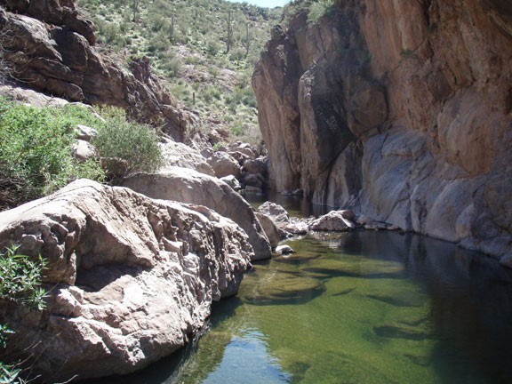
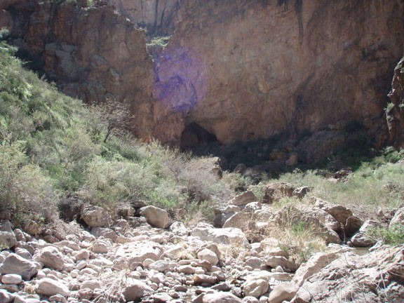
After about 30 minutes of walking up Tortilla Creek you'll see Peter's canyon come in from the right side. A GPS is nice here to prevent missing the canyon, but it's not too difficult to find, as Peter's canyon is the first canyon on the right side. Pretty quickly the canyon narrows and there are some substantial boulders to navigate. The best bet here is to stick to your left (while looking up canyon), where there is a walk around. Follow the cairns and you'll avoid the toughest boulders here.
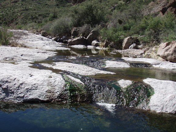
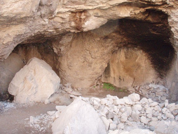
After these narrows, the canyon opens a bit and you'll enjoy some fast walking along the flat rock. Enjoy it while it lasts, as the second set of narrows arrives soon afterwards. Within these narrows is Peter's cave. You'll see it on the right hand side. There's a pretty good route up to the cave and it's worth exploring for a bit. Unfortunately, some folks have treated this cave badly, with some trash thrown behind the boulders. Hopefully you'll treat this area as it deserves by packing out all your trash.
This is a nice place to stop for lunch and relax a bit. When ready, return the way you came.
