
- Hikes in Arizona
- Superstition and Mazatzal Wilderness
- Barnhardt Trail
Barnhardt Trail
Location
To get to the trailhead: From the Phoenix area, take HWY87 North, leaving the city limits. You will drive about 50 miles from Fountain Hills to mile marker 239 (this is just past the turnoff to HWY-188). The Barnhardt Trailhead turn off to FR419 is well signed. Take this graded dirt road 5 miles West to the trailhead (the sign says 4 miles, but it's actually 5 miles). The graded road is in pretty good shape and most times of the year, passenger cars are probably OK.
Hike details
Season
- March
- April
- May
Solitude
Difficulty
Permits
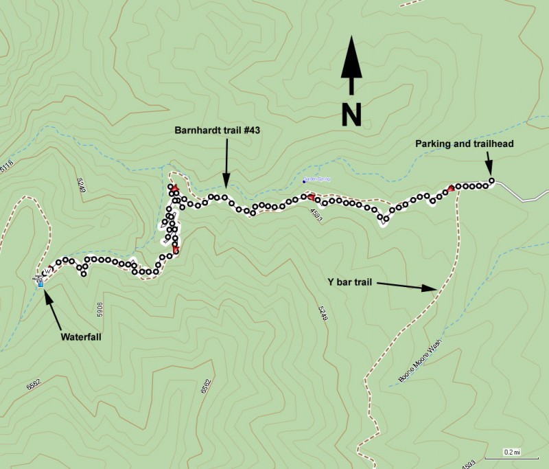
Hike along the Barnhardt trail in the Mazatzal wilderness in Arizona.
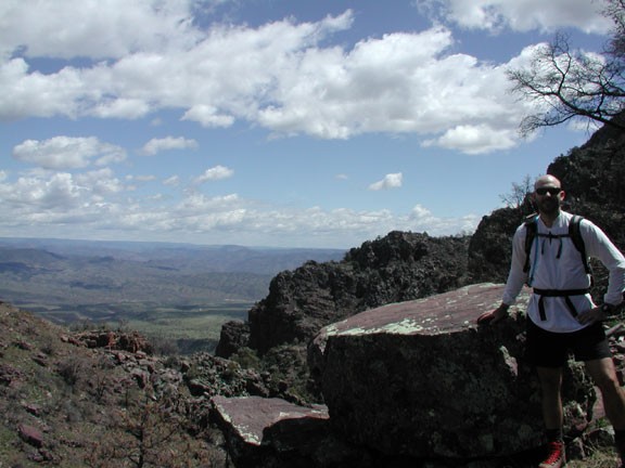
The Barnhardt trail travels back into the depths of the Mazatzal wilderness. For those looking for an introduction to this area, taking the Barnhardt trail to a waterfall makes for a nice moderate day hike.
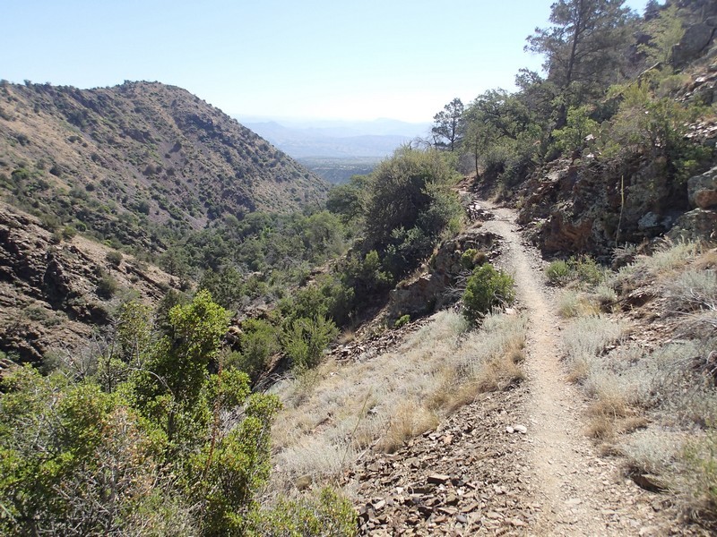
There are multiple trails that start at this parking area. Make sure you are on the Barnhardt Trail #43. Luckily, the trail start is well signed and easy to follow. This trail starts out rocky as it enters to the South side of Barnhardt Canyon. There is a creek through Barnhardt canyon that runs during the Spring months fueled by snow melt. The trail climbs steadily along this canyon, with good views of the creek below. The more water in this creek means a more impressive waterfall at the end of this hike. We were lucky enough to take this hike after the record rains of 2004/2005 so this creek was running very well.
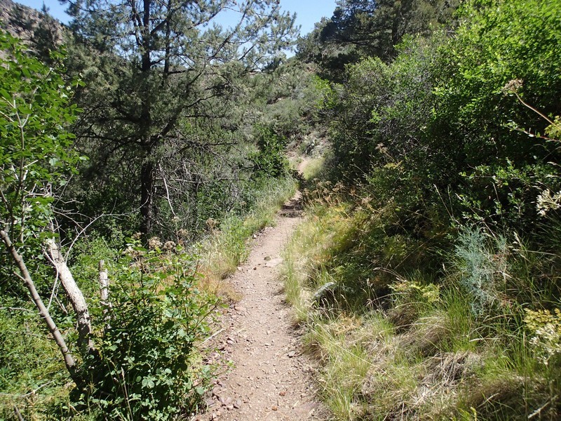
The trail is in good shape and adds to the sensation of elevation gain, as the trail in many places is cut from the cliff side. Parts of the trail cross through sections burned by the Willow fire during the summer of 2004. Already you can see the growth start to return, but sadly much of the shade is now gone (temporarily I hope) from this section of the hike.
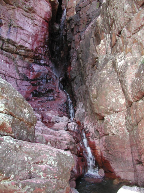
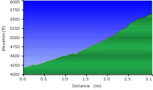
While looking for the waterfall, you will likely observe a number of washes flowing along the left mountain into the creek below. When we took this hike, there were three such 'false falls'. The true fall (and most impressive) is where the trail crosses the creek itself, and not one of it's tributaries. You will reach this point after 3.1 miles of steady uphill hiking. The most impressive part of the waterfall is not visible from the trail, so spend the extra 5 minutes scrambling back into the narrow canyon to see the reward for your hiking. This is a lovely place to stop and relax. The trail continues on here to join up with the Mazatzal trail system, but the waterfall makes for a good turn around point for a day hike.
When you've finished exploring, return the way you came. Be sure to enjoy the views on the way down.
