
- Hikes in Arizona
- Mogollon Rim
- Railroad Tunnel via AZ trail (Payson)
Railroad Tunnel via AZ trail (Payson)
Location
From the Phoenix area, take HWY 87 North towards Payson. Once in Payson, continue on HWY 87 towards the towns of Pine and Strawberry. Just as you're headed out of town, turn right onto the signed road for the Houston Mesa road. Take this paved road 10.1 miles through the small community of Whispering pines. The road turns to well graded dirt here. Turn right at the signed junction to the Washington Park trailhead. Continue 2.8 miles on FR32 and turn right at the sign for the Washington Park trailhead. Make a quick left after this turn and drive the final 1 mile to the end of the road and the Washington Park trailhead.
Hike details
Season
- April
- May
- June
- July
- August
- September
- January
- February
- December
Solitude
Difficulty
Permits
Hiking to the Railroad Tunnel via the Arizona Trail in Payson, Arizona
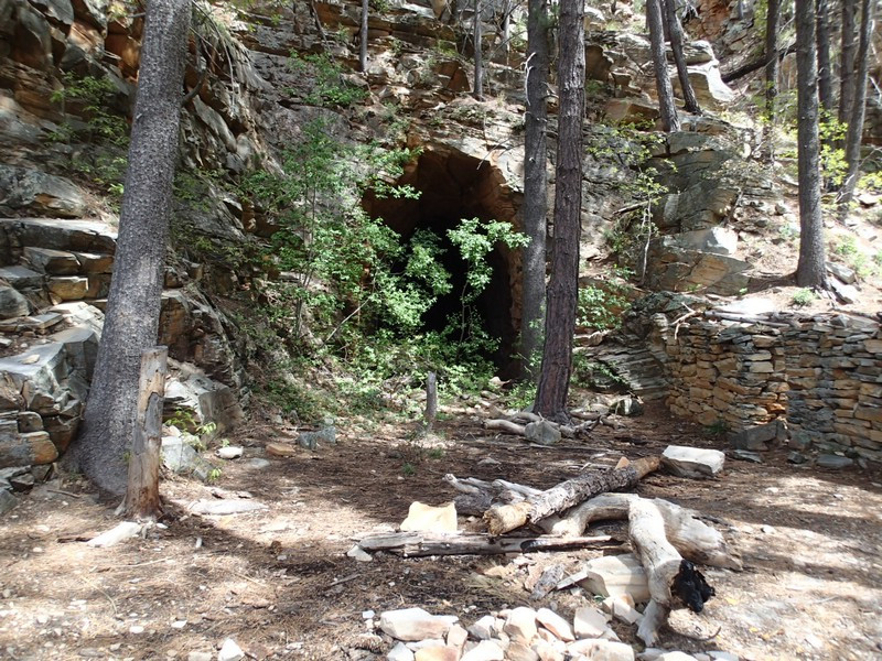
Back in the late 1800s, railroad engineer James Eddy had an idea for a railroad from Flagstaff to Globe through the Mogollon rim. He started with the goal of a 3100 ft tunnel through the rim but only got about 700 ft before the money ran out and the idea was abandoned. The result is a great hiking destination. There are two ways to get to this landmark, either from the top of the Mogollon rim or from Washington Park at the base of the rim. This hike describes the path from Washington Park.
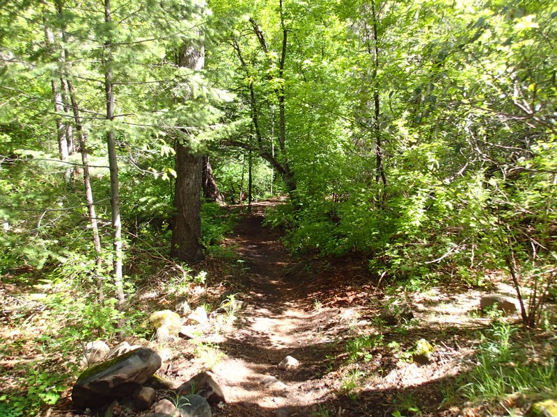
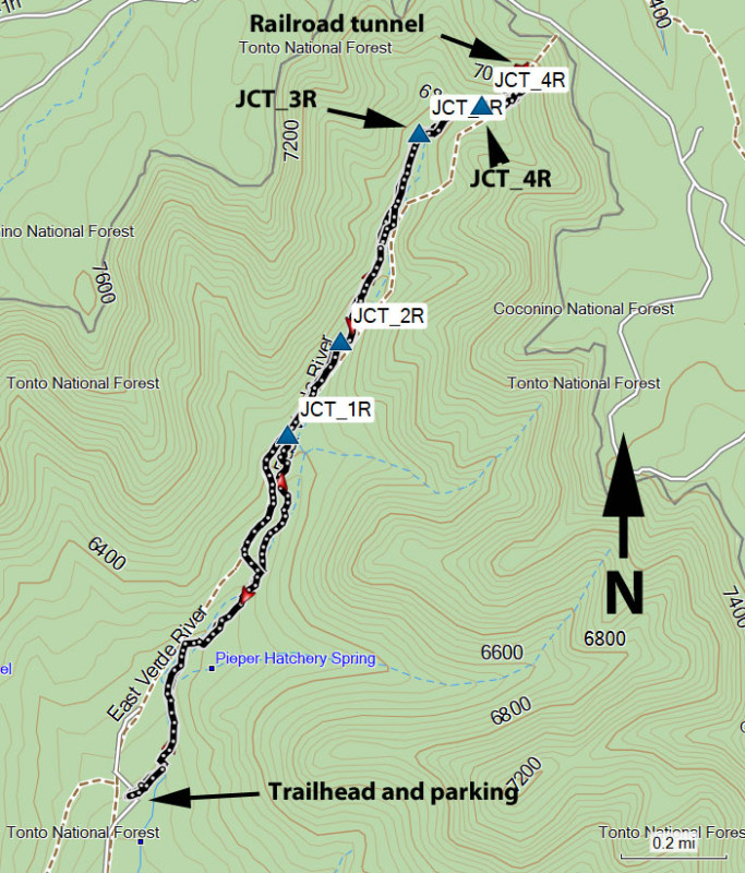
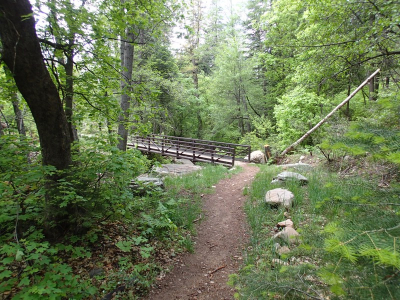
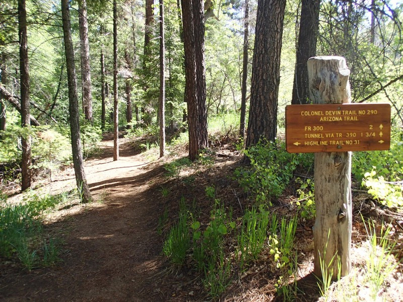
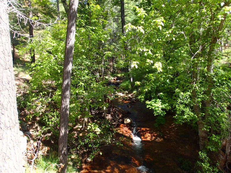
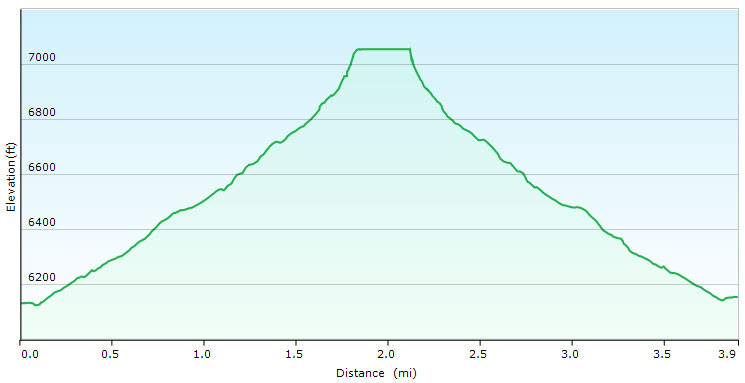
From the parking area, find the sign marking the Arizona trail. The Colonel Delvin trail is well worn and easy to follow as it closely edges along the perennial east Verde river fork. It was after a particularly wet winter that we did this hike and there were plenty of small springs feeding an impressively running creek. This trail featured nice shade and some old growth forest with some ferns along the base of the trees. This section of the hike was particularly scenic and enjoyable. After about 0.7 miles, turn right (JCT_1R on the map) onto a closed dirt road. Follow this road 0.2 miles to the second junction (JCT_2R on the map) and stay right again as it crosses the creek. Another 0.4 miles of hiking puts you at a signed junction to the Railroad Tunnel (JCT_3R on the map). Turn right here and hike 0.1 miles to another signed trail junction (JCT_4R on the map) stay right again and hike the increasingly steep 0.25 miles to the obvious tunnel. This last section features a very faint and rocky trail, so use those route finding skills to stay on the path.
The railroad tunnel is impressive in how much they were able to excavate in the late 1800s, but the folly of trying to tunnel through the Mogollon rim seems pretty obvious when you look around and consider how remote this area was.
After exploring this unique area a bit, return the way you came.
