
- Hikes in Arizona
- Phoenix Area and Central Arizona
- Granite Mountain (McDowell Sonoran Preserve)
Granite Mountain (McDowell Sonoran Preserve)
Location
From the Phoenix area, take state HWY-101 North to the Pima Road exit. Drive north on Pima road and after six miles, turn right onto Dynamite road. Go east on Dynamite Road (which eventually turns into Rio Verde Road) and after 8.3 miles turn left onto signed 136th street (also signed for the Granite Mountain trailhead). After 2.1 miles of driving on this road, you'll reach the well signed Granite Mountain trailhead. There are restrooms at this facility, but no water. Please respect the residents of this area and do not park along 136th street.
Hike details
Season
- January
- February
- March
- April
- October
- November
- December
Solitude
Difficulty
Permits
Hike around Granite Mountain in the Scottsdale Sonoran Preserve near Phoenix, Arizona
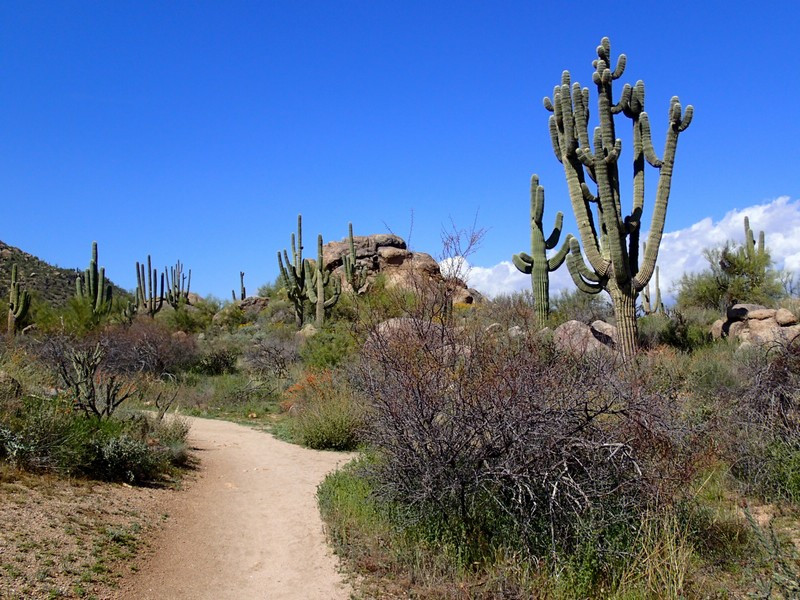
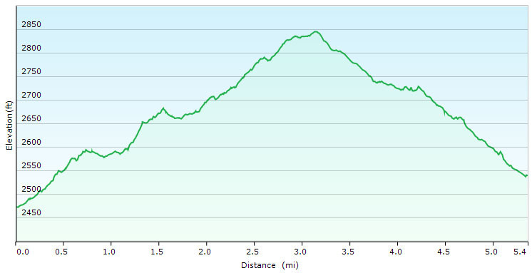
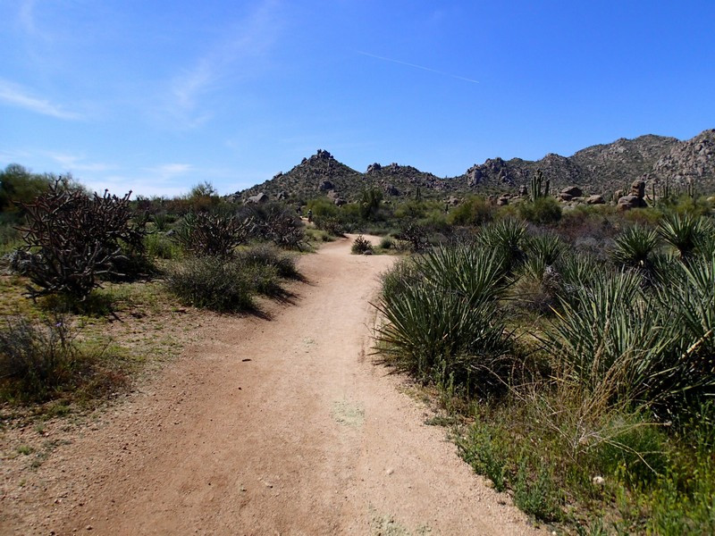
There is a vast network of trails in the Scottsdale McDowell Sonoran Preserve to enjoy. One fun loop hike is around Granite (sometimes called 'little Granite') Mountain.
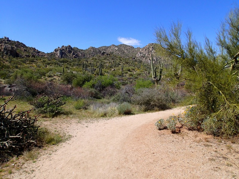
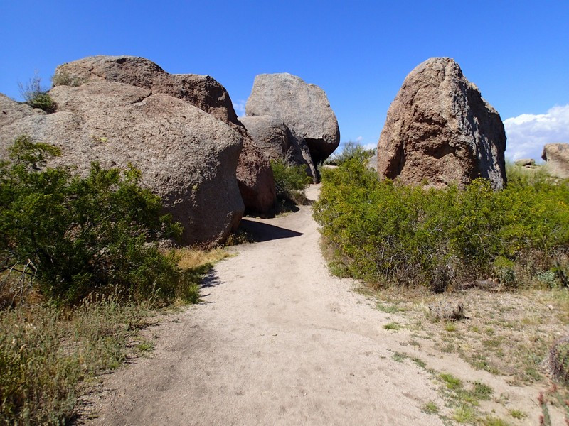
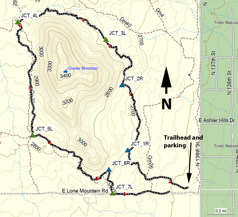
From the Granite Trailhead parking area, head north east on the signed Bootlegger trail. All the trails here are easy to follow and all trail junctions are well signed. After 0.7 miles of hiking on this trail, stay right at the signed junction (JCT_1R on the map). Granite Mountain is easy to spot and this hike circles around it in a counter clockwise direction. After 0.6 miles, stay right at the signed junction (JCT_2R on the map). From here the trail hugs the base of Granite Mountain, providing good close up views of some unique rock formations.
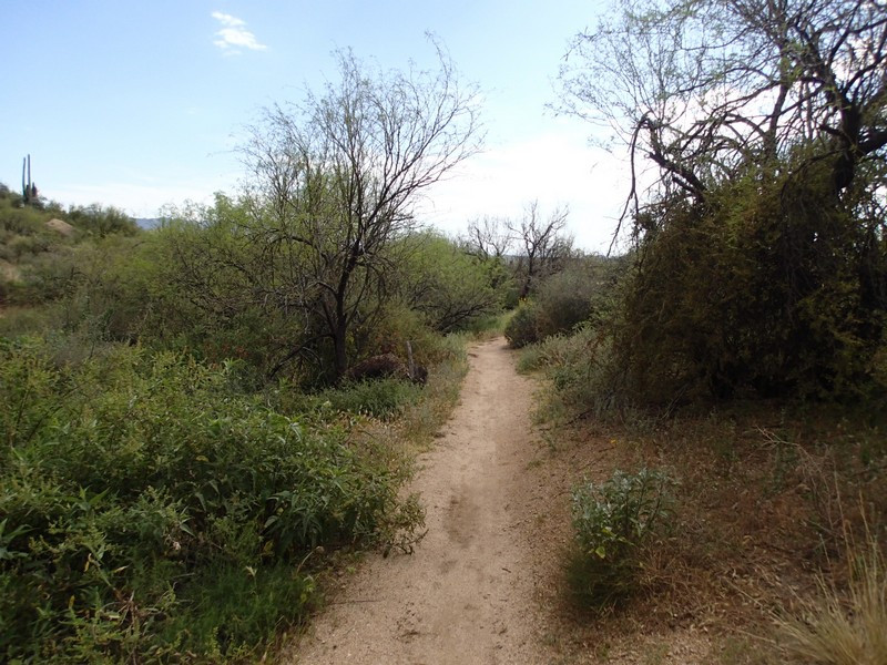
After 0.2 miles, there's a spur trail to a scenic view peeling off to the right. Stay left. Another 0.4 miles gets you to the signed junction with the Cow Poke trail (JCT_3L on the map). Stay left here and enjoy walking through the impressive Saguaros in this section of the trail. Walking 0.5 miles gets you to the junction with the Coyote Canyon trail (stay left) and 0.5 more miles gets you to the signed junction with the Branding Iron trail (JCT_4L on the map). Stay left again. It's about a mile to the next junction with the Balanced Rock trail (JCT_5L on the map). Stay left again. One more mile of hiking completes the loop around Granite Mountain, but there's still a bit of walking left to return to the trailhead. Stay right at the signed junction with the Granite Mountain trail (JCT_6R on the map) and then another 0.3 miles will get you to the final trail junction with the Powerline Road (JCT_7L on the map). Turn left here and walk this closed dirt road the final 0.6 miles to the trailhead.
There are plenty of other hiking trails in this area to explore. Enjoy!
