
- Hikes in Arizona
- Phoenix Area and Central Arizona
- Go John Mountain Loop
Go John Mountain Loop
Location
To get to the trailhead: from the Phoenix/Mesa area, take HWY-101 North to the Cave Creek Road exit. Take Cave Creek Road North to the Carefree Highway, turning left (West) on to the Carefree Highway. After about 2.8 miles, turn right (North) onto 32nd Street (clearly signed for the Cave Creek Recreation area). After about 2.7 miles, you will reach the parking area for the Go John trail. The trailhead for the Slate trail is East of the parking area. There are restrooms and water at the trailhead. As of December, 2021, there is a $7 fee to enter the park area.
Hike details
Season
- January
- February
- March
- April
- October
- November
- December
Solitude
Difficulty
Permits
Hike the Go John Mountain Loop trail near Cave Creek, Arizona.
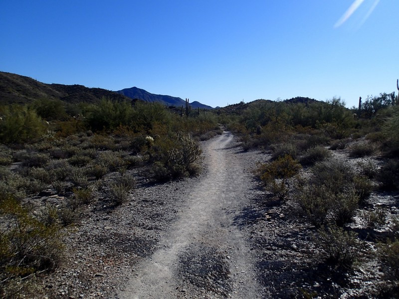
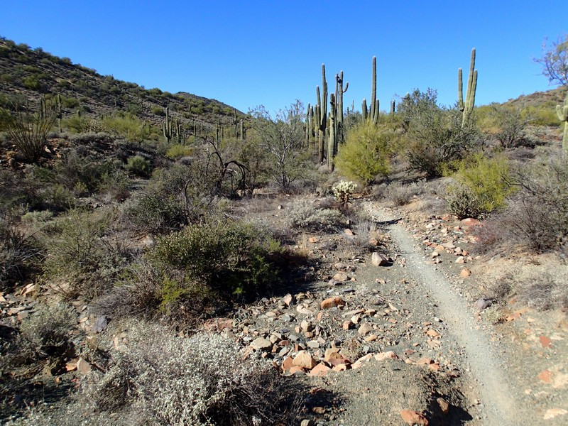
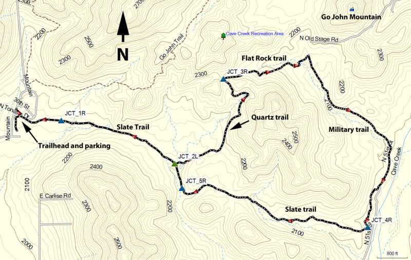
Although this trail is not officially named the Go John Mountain Loop, it makes sense given the trail path and its proximity to this local landmark. Mostly this is a fun and easy hike through the sonoran desert outside of Cave Creek. From the parking area, look for the signed start to the Slate trail on the East side of the parking area.
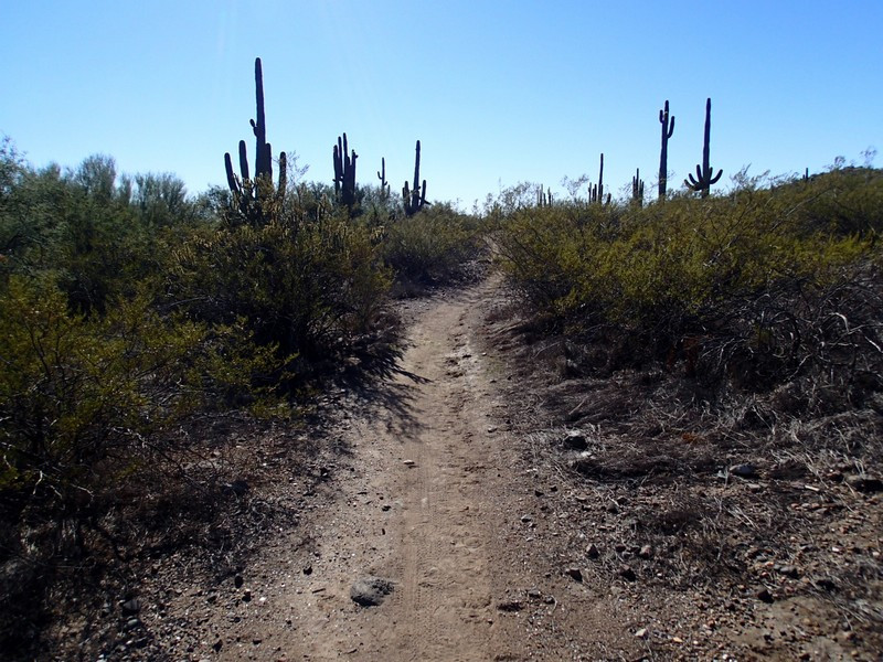
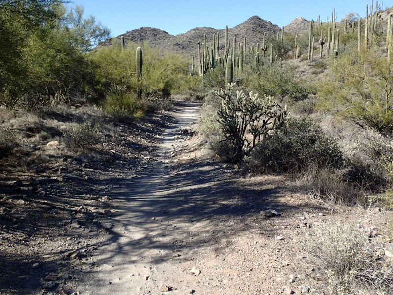
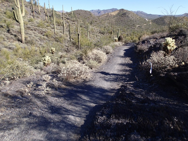
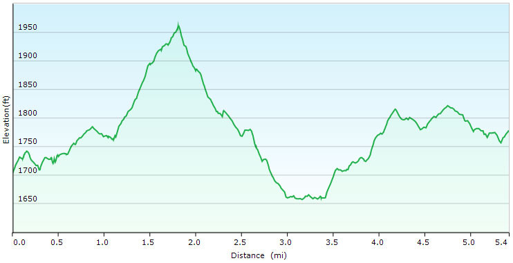
The trail heads due east through this lovely sonoran desert. You'll enjoy the company of Saguaro and Prickly Pear cacti all around. This is a really good hike choice in the spring when the wildflowers are out. After 0.2 miles of hiking, stay right at the signed junction with the Jasper trail to stay on the Slate trail (JCT_1R on map). After 0.6 miles of additional hiking turn left on the signed Quartz trail (JCT_2L on map). Walk another 0.8 miles on the Quartz trail and take a right at the signed junction with the Flat Rock trail (JCT_3R on map).
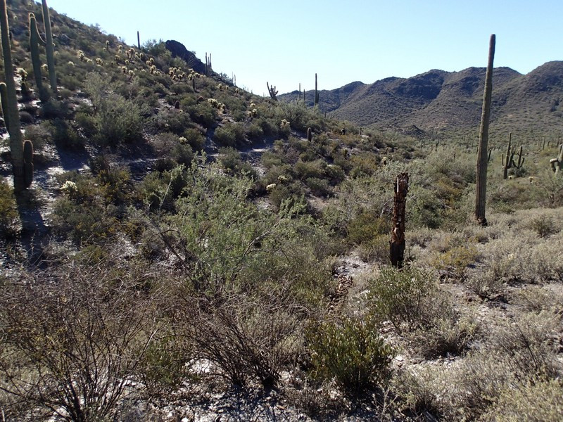
On this section, you'll enjoy views of Go John Mountain to your left. After 0.5 miles of hiking on the Flat Rock trail, you're now hiking outside of the Cave Creek Regional park and in the small P.A. Seitts Preserve. The trail will shift southeast and there are some signs of civilization here before heading back west, turning right at the trail junction (JCT_4R on the map) to rejoin the Slate trail. After about a mile of hiking from this last trail junction, you'll stay right (JCT_5R on the map) to stay on the Slate trail and follow this trail back to the parking area.
