
- Hikes in Arizona
- Sedona
- Sugar Loaf and Thunder Mountain
Sugar Loaf and Thunder Mountain
Location
To get to the trailhead: from the Phoenix area, take I-17 North toward Flagstaff. Just after Verde Junction, take HWY-179 west towards Sedona. Once in Sedona, take HWY-89A South. After 3.1 miles, turn right onto Dry Creek Road. After 0.5 miles, turn right onto signed Thunder Mountain road. After about 0.6 miles of driving on Thunder Mountain Road, you'll see a sign on your left marking the Thunder Mountain Trailhead. Turn left here and drive a few hundred yards to the parking and trailhead area. There is no fee to park here.
Hike details
Season
- April
- May
- October
- November
Solitude
Difficulty
Permits
Hike the Thunder Mountain trails to Sugar Loaf Mountain near Sedona, Arizona.
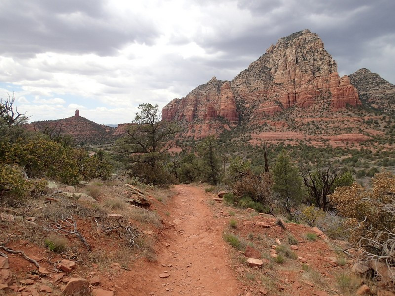
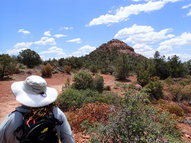
West Sedona hold many hidden hiking areas not frequently visited by many of the tourists that flock to Sedona. If you're looking for a hike away from the crowds, the Thunder Mountain trailhead may be a good pick for you. We made a loop hike out to Sugar Loaf mountain from this trailhead and enjoyed it greatly.
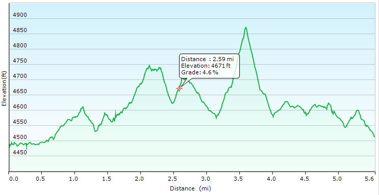
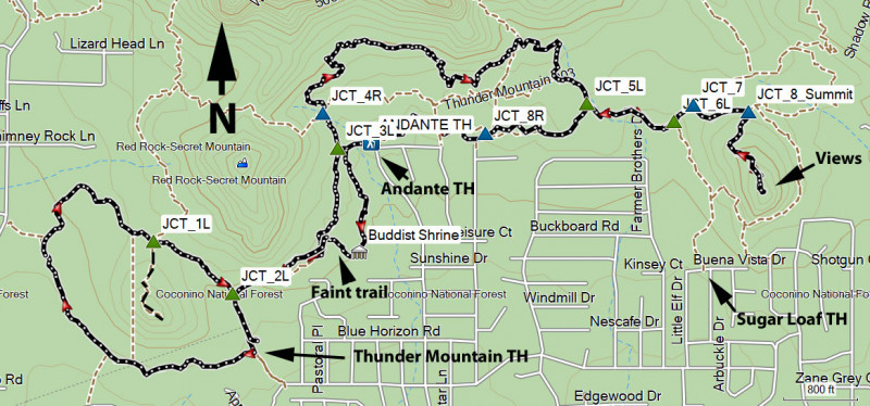
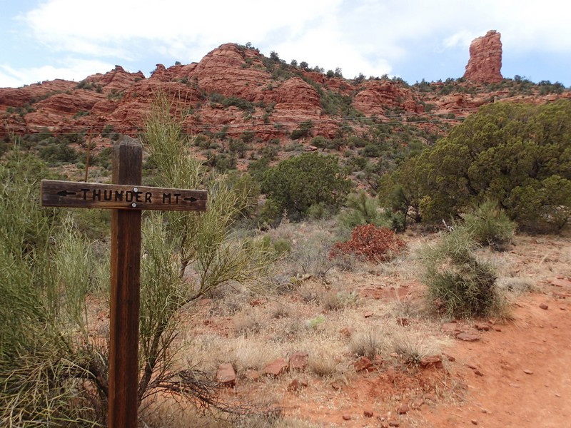
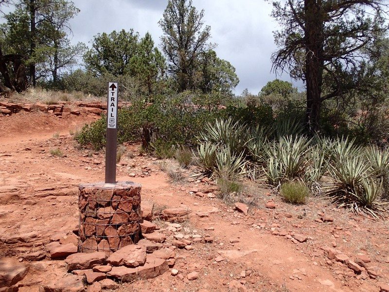
From the parking area, turn left onto the little Sugar Loaf trail. This trail gives you a taste of the red rock walking to come. After about a mile of hiking you'll reach the signed junction for a scramble to the top of Little Sugarloaf (JCT_1L on the map). Stay left here to complete the loop around little Sugar loaf, reaching another trail junction (JCT_2L on the map). Head left here to enjoy views of Chimney Rock to your left. Continue hiking as you stay left at the trail junction to the Andante TH (JCT_3L on map) and reach the trail junction with the Thunder Mountain trail (JCT_4R on the map). Turn right onto the Thunder Mountain trail as it heads east and gains some elevation. After about a mile of hiking this section, you'll reach another trail junction (JCT_5L on the map). Stay left here as the trail heads towards Sugar Loaf mountain. to the east. After 0.3 miles of hiking you'll reach the signed junction with the Sugar Loaf trailhead (JCT_6L on the map). We'll stay left here and then right at JCT_7. Route finding is tricky in this section, but hopefully your skills have lead you to the signed path to the top of Sugar Loaf Mountain (JCT_8_Summit on the map). Turn right here and head up the trail as it gains about 250 ft of elevation to the summit of Sugar Loaf Mountain.
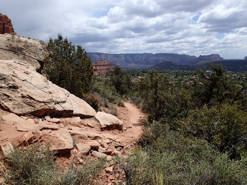
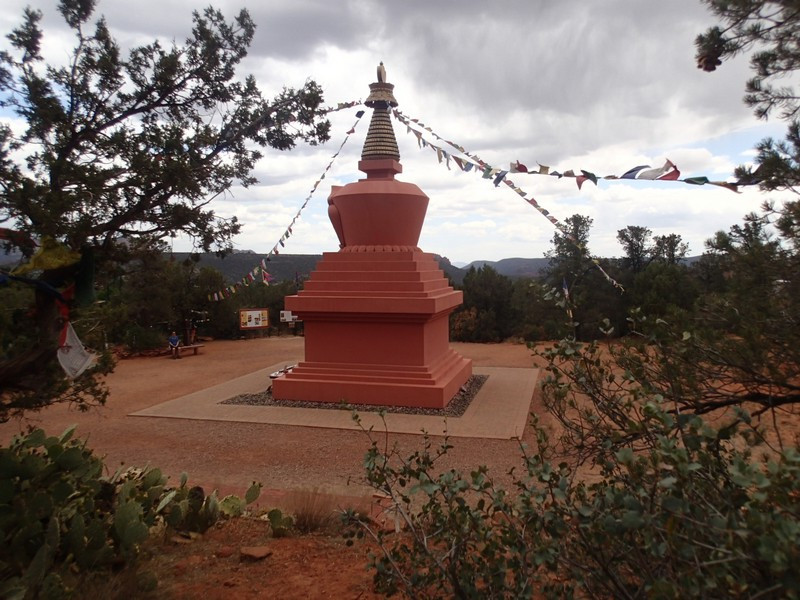
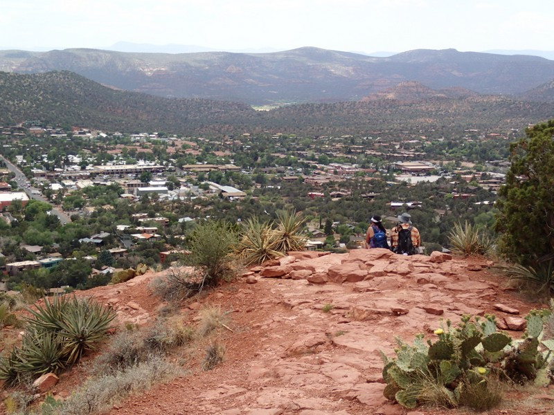
The views from the top of this small mountain are really impressive. To the north, you get a good view of Coffeepot Rock and Capital Butte while to the south you'll enjoy views of Sedona and the surrounding mountains. Backtrack to the previous junction, heading left this time back to JCT_5L. This time, we'll stay left at this junction to take a different, more direct route back that skirts along a neighborhood and includes a short detour. About 0.6 miles along this section of trail gets you to the Andante Trailhead, which is another way to access this hiking area. Pass through the trailhead and take the trail on the other side. Just before you reach the trail that gets you back to your car (JCT_3L), turn left and head towards the interesting looking Tibetan prayer flags and Buddhist looking shrine. This is the Amitabha Stupa and it's worth checking out. You can either backtrack to JCT_3L or bushwhack your way on faint trails to get back to the Thunder Mountain trail. Stay left at JCT_2L to quickly reach the trailhead and your car.
