
- Hikes in Arizona
- Phoenix Area and Central Arizona
- Geronimo Trail (South Mountain)
Geronimo Trail (South Mountain)


Location
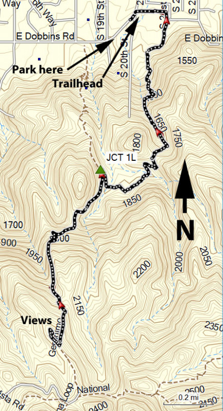
To get to the trailhead: From the Phoenix area, take the I-10 freeway to the Baseline Road exit. Take this exit West and make a left onto 20th street. Follow this paved road 0.8 miles to where it bends into Dobbins Road. At this bend is the trailhead, but there is no direct parking there. Park along the wide pullout on the South side of Dobbins Road. Obey all 'no parking' signs, as I've seen reports of vehicles being towed. Please do not park in the neighborhood either.
Hike details
Season
- January
- February
- March
- April
- October
- November
- December
Solitude
Difficulty
Permits
Out and back hike from the Geronimo Trailhead in South Mountain park in Phoenix, Arizona.
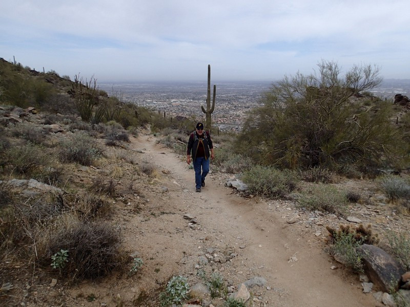
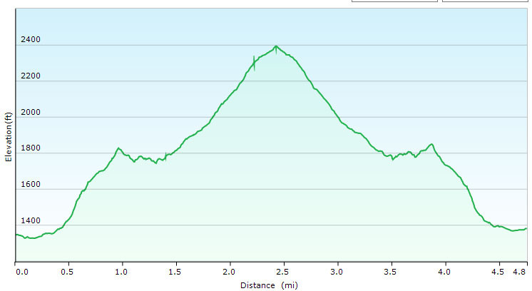
The Geronimo trailhead is a bit tricky to find, but once you've found it, it is not difficult to follow the Geronimo trail. After skirting the edge of the nearby neighborhood, you'll walk along a boy scout obstacle course. After passing this, the trail climbs steadily. It's a bit of a rocky trail in places but we found it enjoyable. After about 1.1 miles of hiking, you'll reach a signed trail junction (JCT 1L on the map) stay left here. After 2.5 miles of hiking, you'll reach the ridgeline. At the top, if you go South, you'll hook up with the National trail. Go North instead (right) and walk the short way to some great views of the Phoenix area and South mountain. When ready, return the way you came. Keep an eye out for mountain bikers, as they like to zip down this trail.
