
- Hikes in Arizona
- Phoenix Area and Central Arizona
- Gateway Loop Trail (McDowell Mountain Preserve)
Gateway Loop Trail (McDowell Mountain Preserve)
Location
From the Phoenix area, take state HWY-101 North to the Bell road exit. Take Bell road East (right) until you reach the intersection with Thompson Peak Parkway. Turn left here and drive about 0.5 miles to the turn off into the signed Gateway to the McDowell Sonoran Preserve (also signed as Carla way). Turn right to enter the trailhead. There are restrooms and water at this trailhead.
Hike details
Season
- January
- February
- March
- April
- October
- November
- December
Solitude
Difficulty
Permits
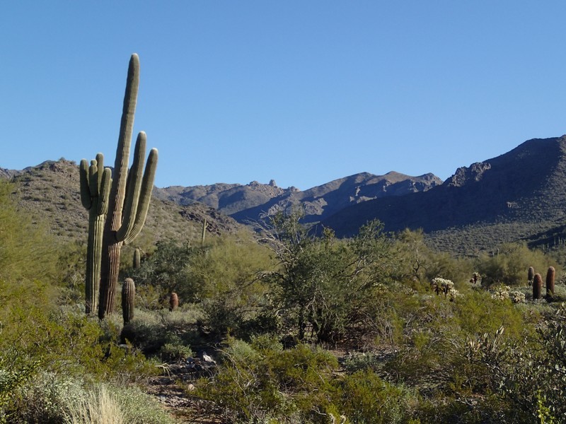
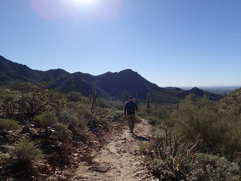
Hike along the Gateway Loop trail in the McDowell Mountain Preserve near Phoenix, Arizona.
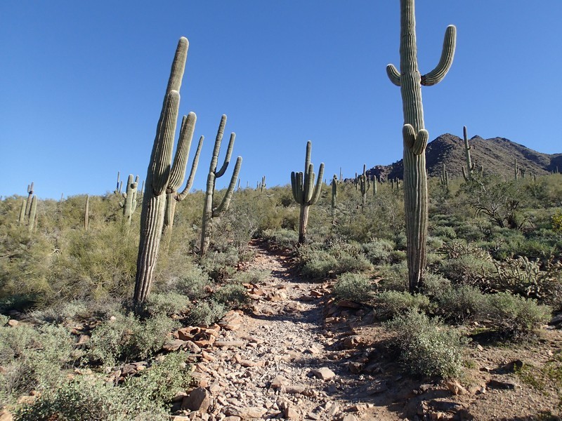
The McDowell Sonoran preserve holds a fantastic variety of desert trails to hike. To the beginner, the multitude of trails may seem daunting. A good introduction to this area is the easy Gateway Loop trail hike. This trail is well signed and easy to follow throughout its length. The typical sonoran cactii make their appearances here (Saguaro, Barrel cactus, Cholla). The only drawback to this trail is that it is quite popular. You'll have to share it with other hikers as well as the occasional mountain biker.
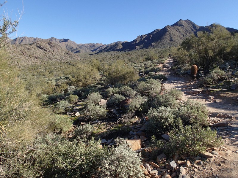
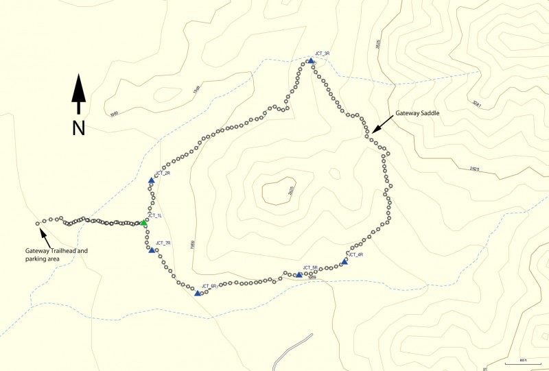
From the trailhead, walk across the metal bridge to start hiking on the Saguaro trail. You'll pass through an ampitheater and hike about 0.3 miles to the start of the signed Gateway Loop trail (JCT_1L on the map). You can take this lollypop loop in either direction. We chose clockwise and the instructions below reflect this choice.
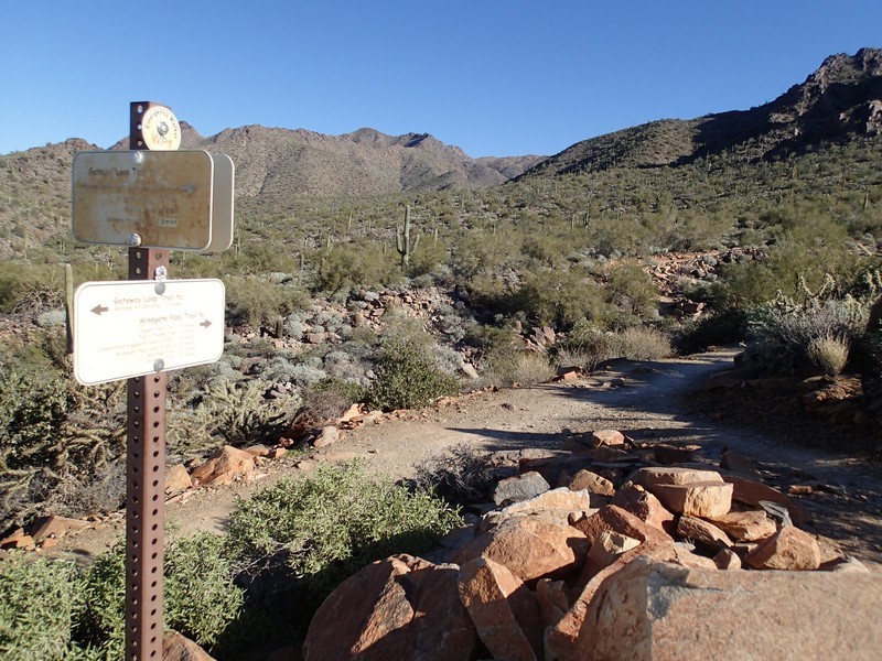
JCT_1L Turn left here to start the loop. From this point, every trail junction is signed. If you don't want to think too much about navigation, just remember to turn right at every trail junction from here until you reach this point again.
JCT_2R Turn right here at the junction with the horseshoe trail
JCT_3R Turn right here at the junction with the windgate pass trail
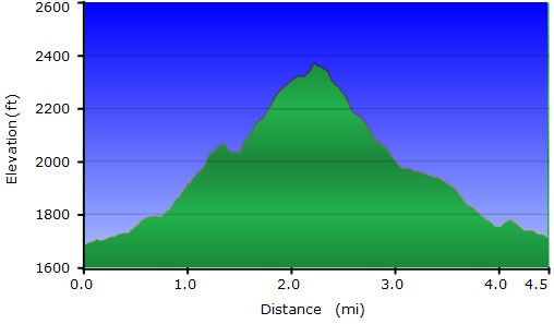
After about 2 miles of hiking, you'll reach the highest elevation point of the loop at the Gateway Saddle (elevation 2,375 ft).
JCT_4R Turn right at the junction with the Bell Pass trail
JCT_5R Turn right at the junction with the Paradise trail
JCT_6R Turn right at the junction with the Levee trail (via the Crossover trail)
From the last trail junction, it's another 0.2 to return to the loop start (JCT_1L). Turn left here and hike the remaining 0.4 miles to the trailhead.
