
- Hikes in Arizona
- Phoenix Area and Central Arizona
- Dixie Summit Loop hike (Phoenix Sonoran Preserve)
Dixie Summit Loop hike (Phoenix Sonoran Preserve)
Location
From the Phoenix Area, take I-17 North to the Jomax road exit. Take the exit and turn right onto Jomax road. After 0.3 miles, turn left onto Norterra Parkway. Drive 1.3 miles and turn right onto North Valley Parkway. Go 0.3 miles and turn left onto Copperhead trail. After 0.1 miles, turn left onto Melvern trail. After 0.2 miles, turn right onto Desert Vista trail. After 0.3 miles, you'll see the signs for Desert Vista trailhead and the parking area. There is no water or facilities at this trailhead.
Hike details
Season
- January
- February
- March
- April
- October
- November
- December
Solitude
Difficulty
Permits
Hike the Dixie Summit Loop hike in the Phoenix Sonoran Preserve in Arizona.
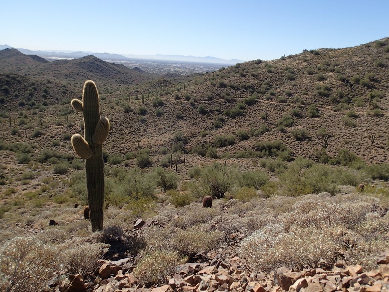
The cities of Phoenix and Scottsdale should be applauded for making a sincere effort to preserve the desert areas within their borders. Scottsdale has done an excellent job with the McDowell Sonoran Preserve and now Phoenix is also doing an excellent job with the Phoenix Sonoran Preserve. The Desert Vista trailhead is a good starting point for hiking access to the southern section of the Phoenix Sonoran Preserve. Although there are numerous trails here, the Dixie Mountain Loop is a good introduction to the area.
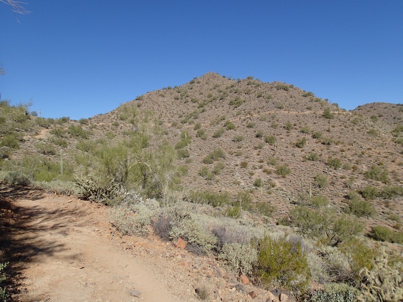
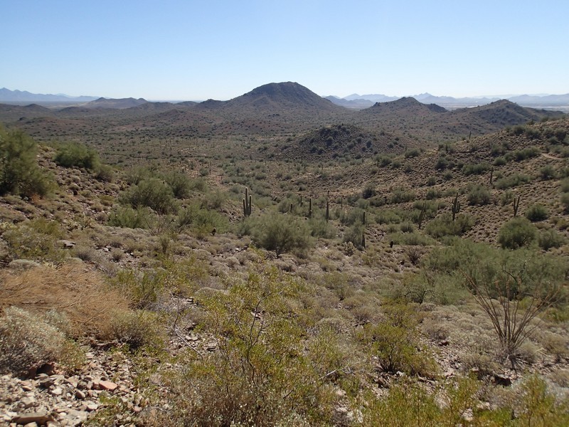
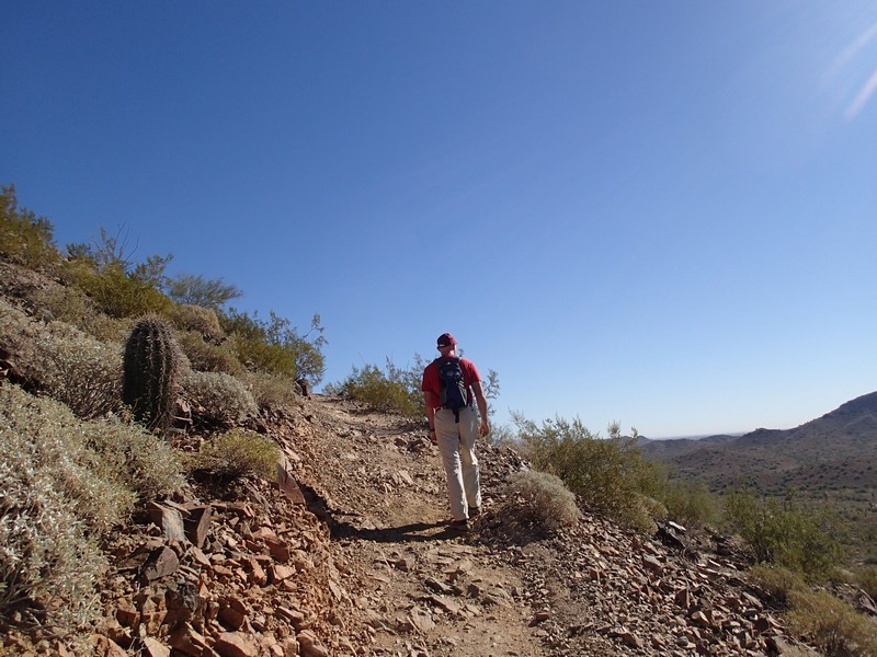
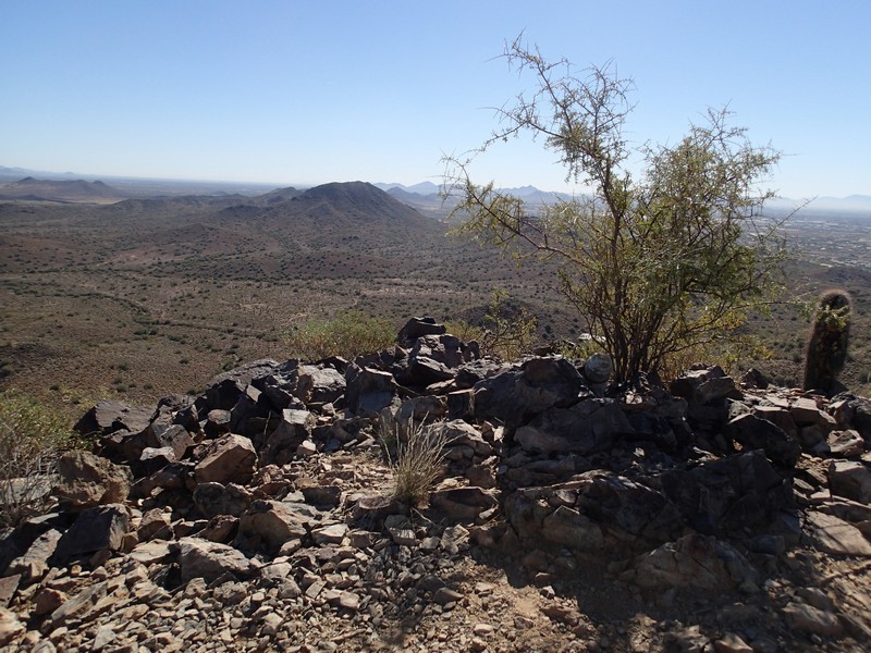
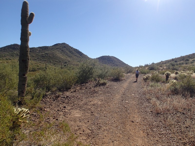
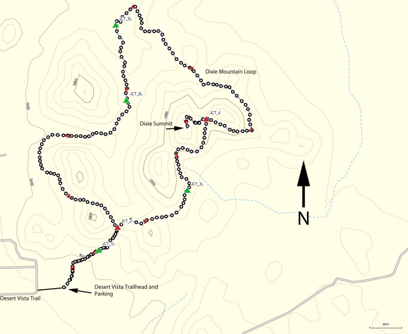
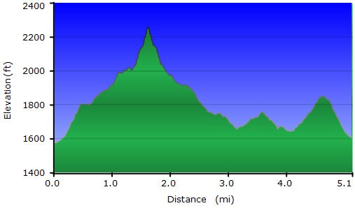
From the parking area, start hiking on the Hawks Nest trail. The trail junctions in this area area all marked, so trail navigation is pretty straight forward. The easy to follow trail heads generally East through Sonoran desert. Saguaro, prickly pear, and barrel cactus abound. After 0.25 miles of hiking, stay left at the junction with the Desert Tortoise trail (JCT_1L on the map). Very soon (0.1 miles) you'll reach the signed junction for the Dixie Mountain loop (JCT_2 on the map). Since this is a loop hike, you'll come back to this location. We decided to go right here and take the loop in a counter-clockwise direction. Another 0.4 miles of hiking gets you to the junction with the Valle Verde trail (JCT_3L on the map). The trail now climbs more steeply here as it heads up to a saddle and the junction with the Dixie Summit trail (JCT_4 on the map). It's a short 0.2 miles to the top of Dixie mountain on this spur trail. From the top of Dixie mountain, there are good views of North Phoenix, Union Peak, Camelback mountain, and many other points of interest in the North Phoenix area.
Backtrack down to the Dixie Mountain trail and turn left now. The trail descends 1.3 miles to a signed junction (JCT_5L on the map). Turn left here and hike 0.3 miles to the next trail junction (JCT_6L on the map) with the Western Vista trail. Stay left here and hike the 1.2 miles back to the start of the Dixie Mountain Loop (back to JCT_4). Turn right at this junction to hike the final 0.4 miles back to the trailhead start and parking area.
Since this is a popular area, it is also enjoyed by mountain bikers and equestrians. Please be polite and move to the side to let these folks pass so we can all continue to share access to this area.
