Ready for a hike?  We've got hundreds of well documented Arizona hikes.
This is the source for everything you need to know about Arizona Hiking.

Main menu

Cart Empty

You are here: ArizonaHiking.org

North Bass Camp (from Colorado River)

Updated
Hiking to the North Bass Camp from the Colorado river
Great views along the Hike to the North Bass Camp from the Colorado river
great viiews of the Colorado river along the hike to the North Bass Camp from the Colorado river
Hiking to the North Bass Camp from the Colorado river
North Bass Camp remains - Grand Canyon
map: Hiking to the North Bass Camp from the Colorado river
Elevation plot: Hiking to the North Bass Camp from the Colorado river

Location

How to Get There
This hike is accessed from a river rafting trip on the Colorado River. Carbon canyon is located at river mile 108.2 on river right.
city
Grand Canyon
state
AZ
country
USA
Region
Grand Canyon and Marble Canyon area

Hike details

Distance
3.20 [Miles] Total
Hike Distance- Details
3.2 miles for the out and back to the camp.
Time
2.50 [Hours]
Time-details
It took us about 2.5 hours total.
Elevation Change
700 Total gain/loss [Feet]
Elevation Details
It's about 700 ft of climbing.
Hike Trail Type
Out and Back
Special Features
Water

Season

Best Season
  • April
  • May
  • September
  • October
Worst Season
  • January
  • December
Date Hike completed
October 19, 2014

Solitude

Solitude
High
Solitude Details
Very good. You'll likely have this hike all to yourself.

Difficulty

Difficulty Rating
Moderate
difficulty detail
The 700 ft climb with no shade is a bit of work. That makes this a moderate difficulty hike.

Permits

Be Aware of
Route finding

Hike to the North Bass Camp in Grand Canyon national park, Arizona.

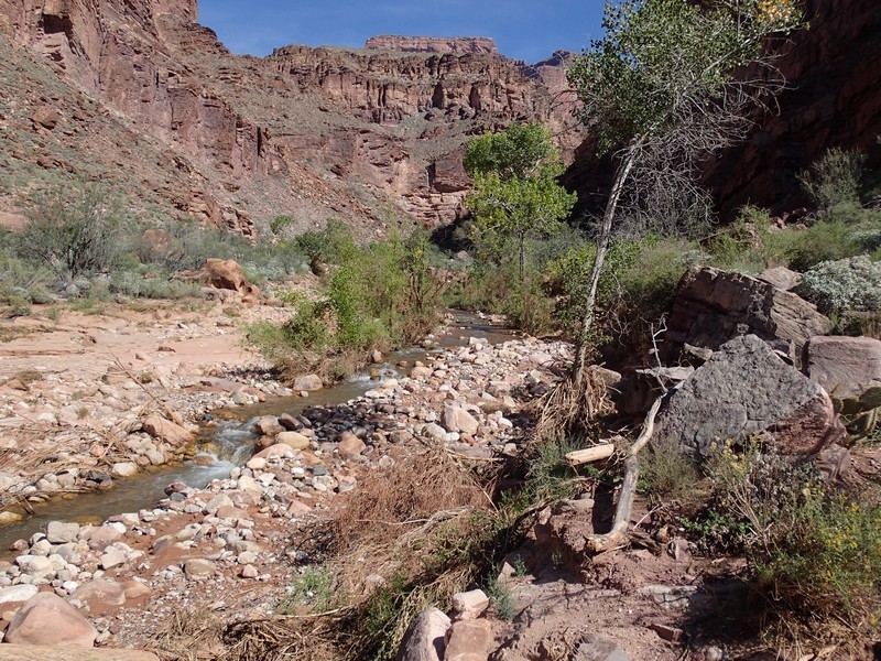
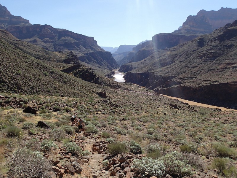
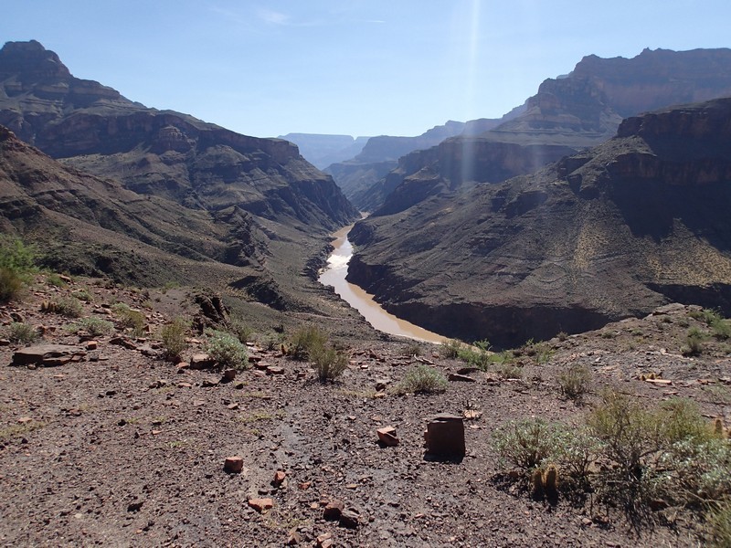
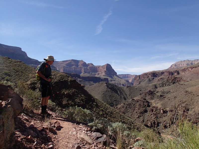
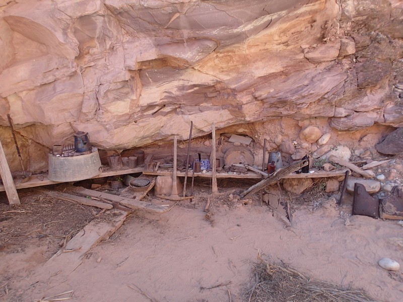
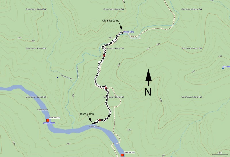
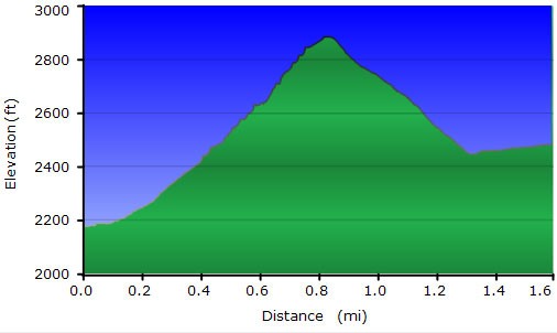
The camp at North Bass is a popular one. It is a large camp and has some great hiking opportunities. The ability to hike up to a historic camp in Shinumo canyon is one of the neater hikes here. From the beach, look for the cairned path near the back of the camp that quickly switch backs up the wall. Thankfully the trail is well worn and not too difficult to follow for most of the time. There are a few sections that are tricky, but keep an eye out for the cairns and you’ll be able to stay on the trail. This hike climbs steadily up to a high saddle (about 700 ft of climbing) with great views up and down the Colorado River. There is little shade here, so this can be a hot hike. From the saddle, the trail drops 400 ft down into Shinumo creek. This is a lovely place, with a perennial creek shaded by Cottonwood trees. Walk up the creek (there’s a decent trail on the right side of the creek to follow) for 0.25 miles to a large bolder on the right and you’ll see a shelf with a bunch of historic stuff from that camp. It’s worth checking out for a few minutes to visualize what this camp looked like back in the early 1900s.


Map

Swap Start/End
Adding markers to the map ...
Facebook