
- Hikes in Arizona
- Prescott Area
- Peavine Trail - Watson Lake Loop hike
Peavine Trail - Watson Lake Loop hike
Location
From the Phoenix area, take I-17 to the junction of HWY-69. Turn left onto HWY-69 towards Prescott. When you enter the city of Prescott Valley, turn right on the signed road for Prescott Lakes Parkway. Take this road 1.8 miles to the intersection with Sundog Ranch Road. Turn right and take this road 0.1 miles, turning left at the signed trailhead for the Peavine trail. There are restrooms here at the trailhead. Cost to park at the trailhead is $2 as of May/2014 (self parking kiosk).
Hike details
Season
- April
- May
- September
- October
- January
- February
- December
Solitude
Difficulty
Permits
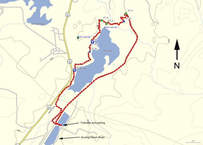
Hike the Peavine trail around Watson Lake near Prescott, Arizona.
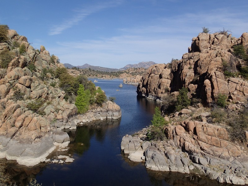
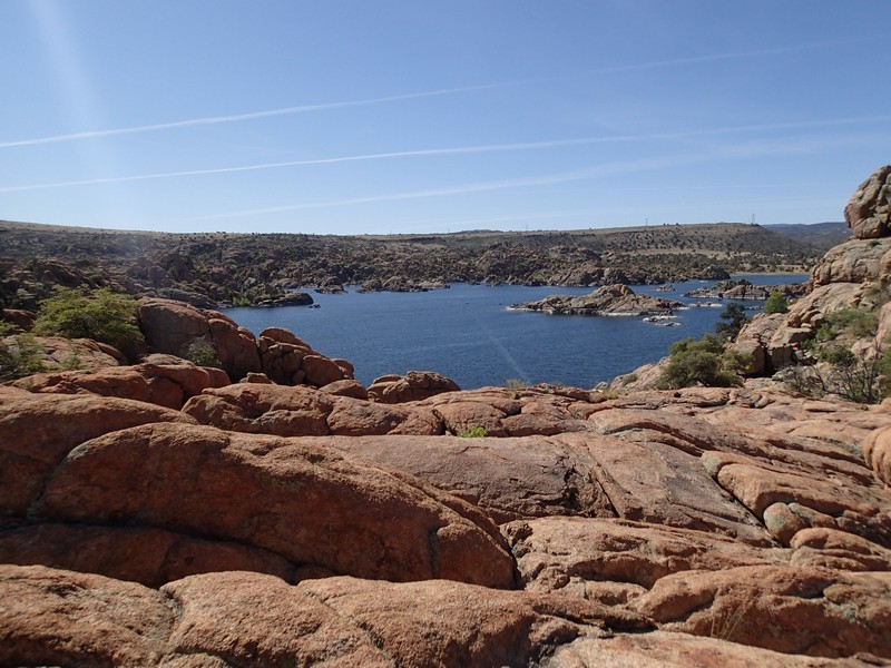
Watson lake is a true jewel of the Prescott area. There are many ways to enjoy the lake, including kayaking along it's shores or technical climbing in the myriad of rocks surrounding the lake. However, there are also some fantastic hiking opportunities around the lake. If you would like to get a flavor of all the different hikes available, I'd recommend making a loop hike with the Peavine trail combined with some of the other trails around Watson lake.
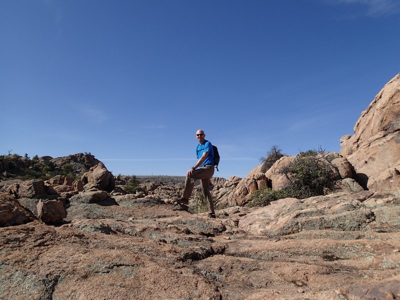
From the trailhead off of Sundog Ranch road at the southern tip of the lake, head counter clockwise along the easily followed Peavine trail. This trail started life as a railroad bed, but after retirement has turned into a popular mountain bike and hiking path. The trail heads North East along the Eastern edge of Watson lake. You'll be sharing the trail with mountain bikers and birders in this section. There are a number of trail junctions on your left that peal off to other trails near the lake shore itself. Continue to stay on the wide Peavine trail. After 2.2 miles of hiking along the Peavine trail, you'll finally leave the trail to the left (JCT 1L on the map). The Peavine trail continues all the way to Granite Dells road, but we'll turn left onto the signed junction with the 'Over the hill' Trail.
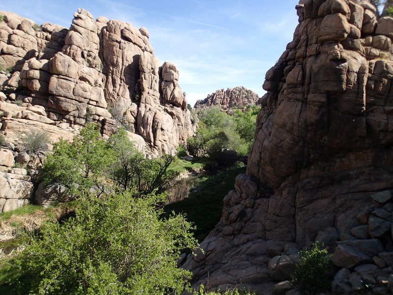
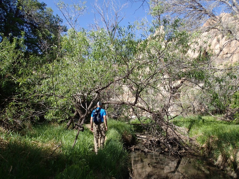
This section of the loop is markedly different than the Peavine trail. Now you'll be boulder hopping through the spectacular rocks of the Watson Dells. Route finding is made easier here by the white paint dots that mark the trail. Your progress will be much slower, as the trail is rougher but very enjoyable. About 0.3 miles from the previous trail junction, you'll stay right (JCT 2R on the map) to stay on the 'Over the hill' trail. Keep following the 'Over the hill' trail as it heads generally West along the rocky Northern edge of the lake. When you near the dam, you'll drop into Granite creek. This beautiful riparian area is hidden from view by the surrounding rocks, which makes it feel like an undiscovered treasure. The creek supports a variety of green, leafy trees and brush. There are wild grapevines down here as well. You'll reach the signed junction with the Flume trail (JCT 3L on the map). Although it's very tempting to stay along the creek, turn left here and start climbing out of the canyon.
This next section of trail requires some minor route finding, as there are a number of trails (marked in tongue and cheek fashion as 'steep' or 'steeper') that will get you to your next destination, the 'Northshore Trail'. Every time we reached one of these 'steep' or 'steeper' selections, we stayed left to stick to the lake (JCT 4L on the map). The Northshore trail features the best views of Watson lake you'll see on this loop hike. There are less paint dots to follow, but that means the trail is more easily found. Continue heading generally South along this trail.
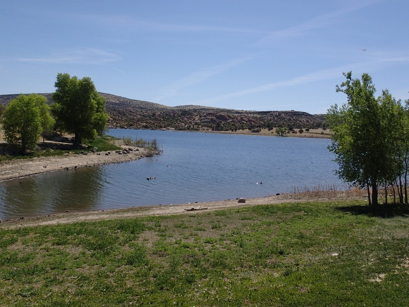
You'll know you're nearing automobile trail access again when you see more people on the trail. TH2 on the map provides access to this trail section as well as a small boat ramp. Walk across the paved road here to stay on the trail. You'll soon reach a signed four way trail junction (JCT 5ST on the map). Stay straight here. Another 0.1 miles will get you to another trail junction (JCT 6R on the map). Stay right here to continue generally South along the Western edge of the lake. The trail flattens out and continues to hug the shoreline until you reach another automobile access point for the trail (TH3 on the map). There is ample parking here, a restroom, and another, larger boat ramp. Walk straight across the parking lot to continue along the shoreline. For a short while, the trail follows the contour of the road, so the road noise will follow you... thankfully not for long.
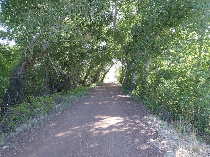
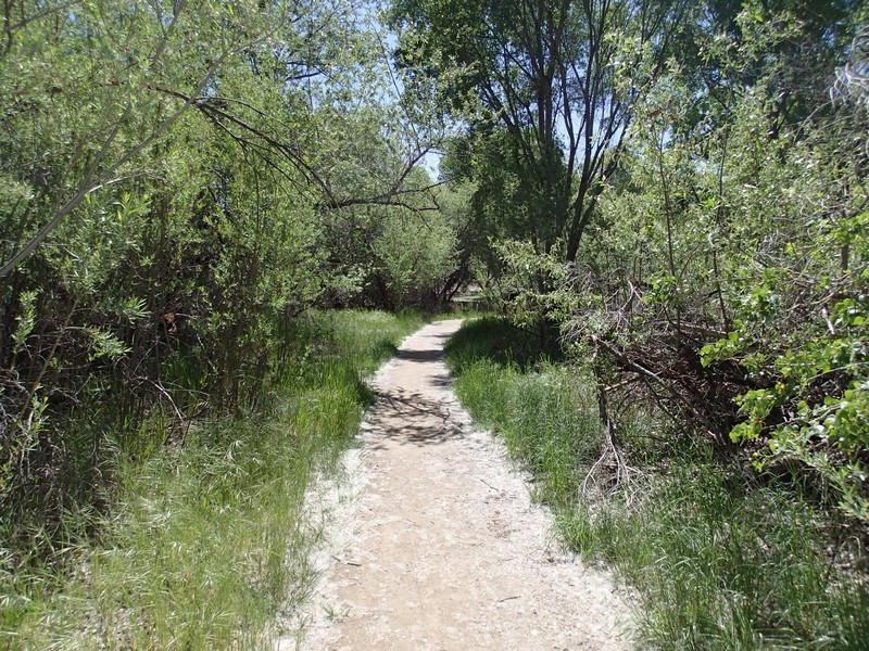
As the lake begins to peter out, you'll notice the trail change yet again. You're now entering the Watson Woods Riparian Preserve. This section is a final, delightful walk through the woods before reaching the end of the loop hike. Cross the bridge across Granite creek, which is now likely dry, depending on the time of year. From the bridge, it's a short walk through the heavily shaded forest back to where you started the loop.
