
- Hikes in Arizona
- Phoenix Area and Central Arizona
- Deem Hills
Deem Hills
Location
Hike details
Season
- March
- April
- October
- November
- December
Solitude
Difficulty
Permits
Hike the Deem hills trails near Phoenix, Arizona.
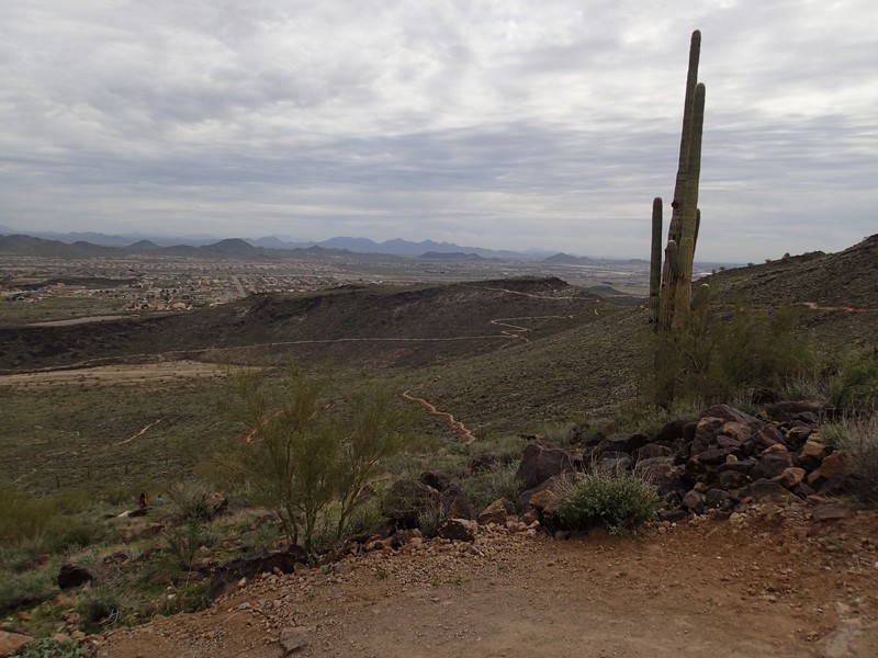
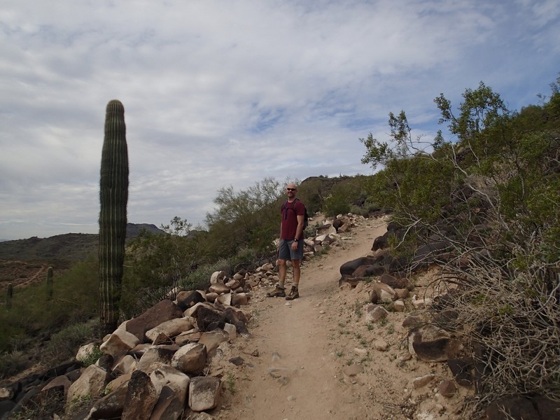
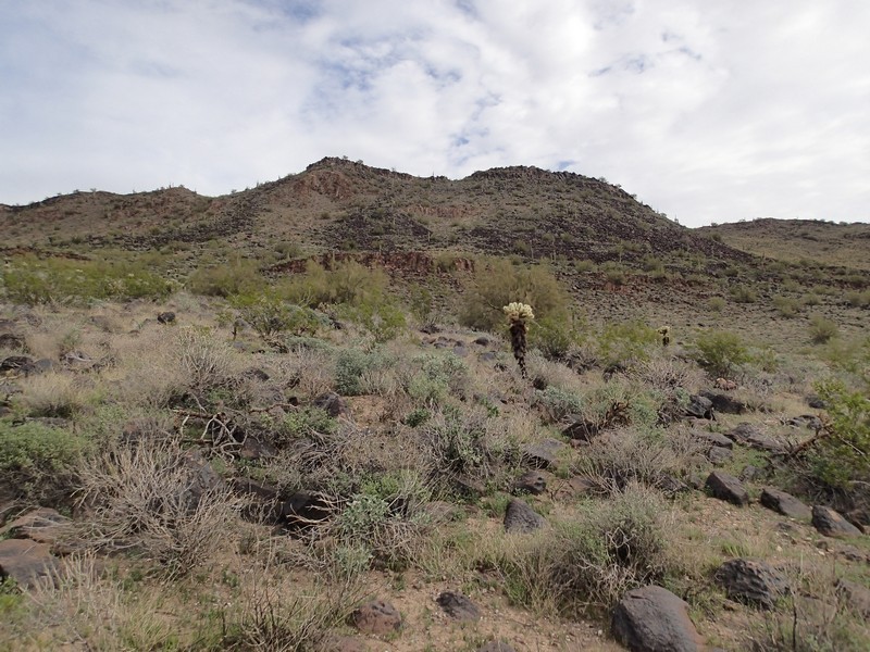
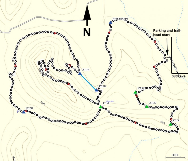
The Deem Hills are located on the north edge of the Phoenix area. This is a great destination if you are looking for some desert hiking not too far from civilization. There are multiple trails in the area. The city of Phoenix has done a good job marking the trails and junctions to ease navigation. However, there is still some route finding ability needed. We decided to start on the Circumference trail, which wraps around the hills, but decided to add a detour to the top of the hills in an effort to add some additional spice to the hike.
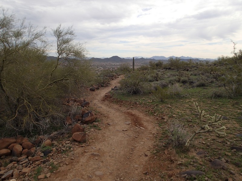
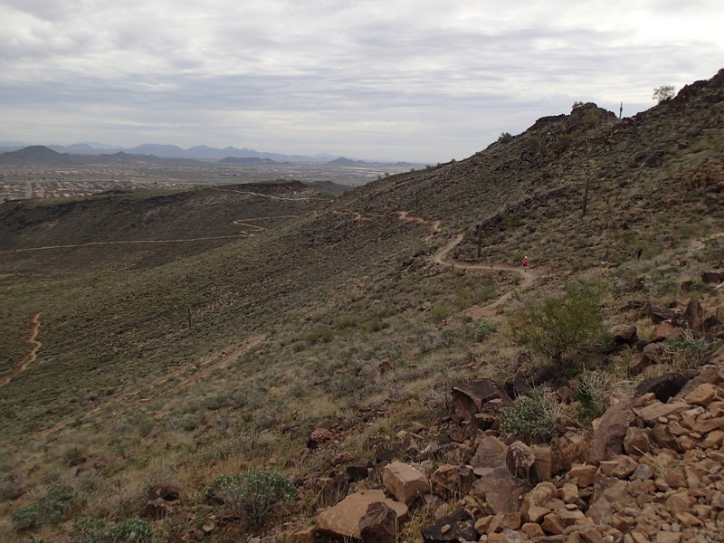
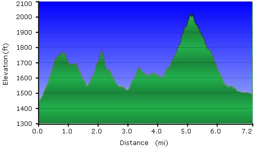
From the parking area, head South (left) on the easy to follow trail. This is the Circumference trail, and when you see trail junctions look for this trail name to stay on course. The trail is well maintained and easy to follow. It also isn't very rocky, which is unusual for trails in the Phoenix area. However, the result is that mountain bikers enjoy this trail too. Be sure to move to the side when a mountain biker approaches. If you go clockwise on the trail, as we did, you'll gain some gentle elevation up to the first trail junction with the Basalt trail (Jct 1L on the map). Stay left here to stay on the Circumference trail. The next trail junction is with the Paradise trail (Jct 3L on the map). Again, stay left here. After more climbing, you'll reach another trail junction just under the saddle of the two hills that make up Deem Hills (Jct 4L on the map). Again, stay left. You'll leave the trail junctions behind for a while as the trail descends again. You'll see mixtures of homes and desert off in the distance. The trail changes direction from West to North, and then heads East as you near the canal. Gaining elevation again, the trail bends back southeast to the junction with the Ridgeline trail (Jct 7R on the map). If you would like a bit more exercise with the reward of good views of the area, turn right here to the Ridgeline trail (as we did). If not, stay left to head directly to Jct 8R on the map.
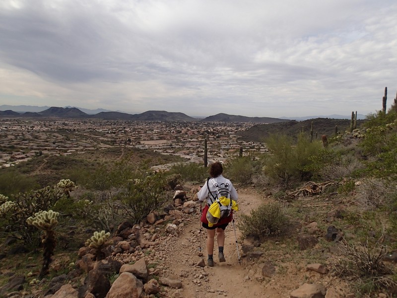
The Ridgeline trail switchbacks up the side of Deem Hills. You'll get improved views of the surrounding area, including the large Canal to the North. Eventually, the trail tops out at nearly 2000 ft, where you get the best views to the West and East. As we paused to enjoy the views, we saw a coyote weaving his way along the rocks on the opposite peak. The trail starts to head Southeast to the saddle that you passed earlier (Jct 4L on the map). This time, stay left and head back to the Circumference trail, where you intersect it at Jct 8R on the map. Turn right here to get back on the Circumference trail. The trail descends again as you head towards the Canal. Before reaching it, you'll intersect a dirt road (Road_stay_right on the map). Turn right here and hike along the dirt road for a few hundred yards until you see the trail leave the road again. It's a short 0.7 miles from this point back to the trailhead start and your car.
