
- Hikes in Arizona
- Mogollon Rim
- East Webber Creek
East Webber Creek
Location
To get to the trailhead: from the Phoenix area, take HWY-87 North toward Payson. Stay on HWY -87 as you head towards the town of Pine. After about 12 miles drive from Payson, you'll pass mile marker 265. Turn right on the signed Control Road. Take this well graded dirt road for 6 miles to a signed intersection. Turn left here for the Geronimo Trailhead. After two miles of driving you'll see the signed trailhead and parking on your right.
Hike details
Season
- June
- July
- August
- January
- February
- December
Solitude
Difficulty
Permits
Hike east webber creek on the Mogollon rim, Arizona.
If you've already done Pine Canyon and you're looking for a similar hike with fewer people, then the East Webber Creek trail may be a good pick for you.
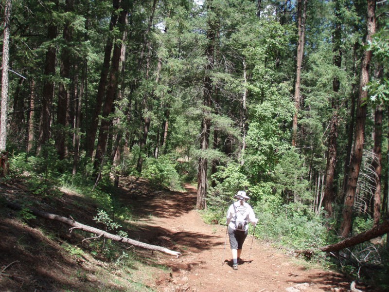
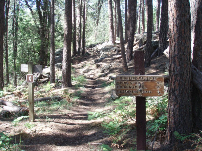
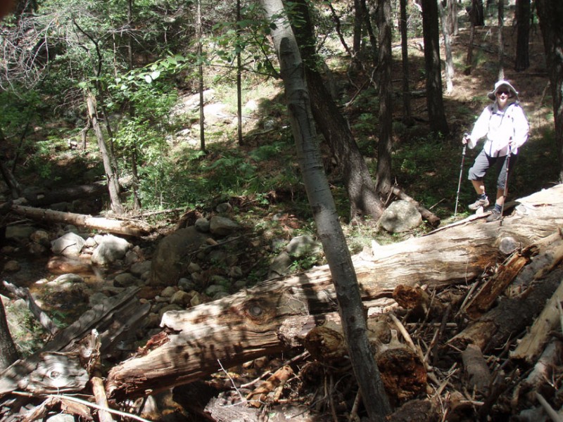
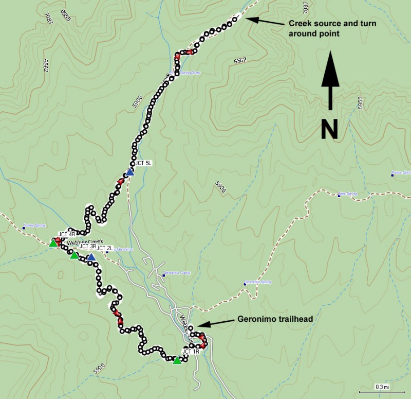
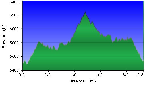
From the parking area, you'll actually cross the dirt road and start opposite the parking area. Look for a small brown trail marker. This trail is actually the Geronimo trail, but you need to hike this trail to get to the East Webber trail. The trail itself is well worn, but there is a fair bit of route finding, so keep a good eye out for trail junctions. The first trail junction (JCT 1R on the map) is signed, so you'll turn right here for the sign for Geronimo trail. This section of the trail is actually a closed road. Although you're walking in a pine forest, there isn't much shade here due to the width of the road/trail. The hike stays like this for the first three miles or so, heading generally North-west. There are a few signed junctions you'll reach to help you stay on the Geronimo trail. Stay left at Jct 2L on the map. Then stay right at Jct 3R on the map. After two miles of total hiking, you will reach a four way signed trail junction (Marked as Jct 4R on the map). You want to turn right here following the signs for the East Webber trail. The trail heads generally North-East now as you get closer to East Webber creek. After about 1 mile of hiking from the previous trail junction, you'll finally arrive at East Webber creek and a signed trail junction (Jct 5L on the map). When we did this hike, there was a great deal of dead fall from previous forest fires. So it may take a bit of route finding to find the trail junction. Turn left here and begin walking up canyon. The creek is nearby now and the trail narrows up to a true trail feel. There is a significant amount of shade and the trail is still easy to follow from this point.
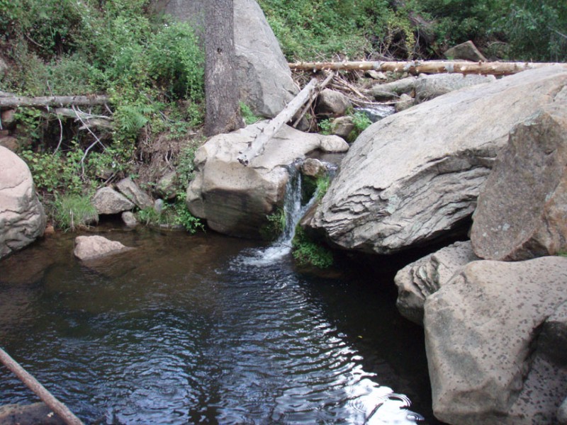
The creek will be your periodic companion and you will need to cross it a few times. The creek crossings aren't difficult and you can keep your feet dry without any trouble. The trail becomes a bit overgrown in places, with sticker bushes (that appear to be blackberry) tearing pants and shirts. Luckily they don't last too long, but this would be much less pleasant if you were wearing shorts and a short sleeve shirt. The further up canyon you wander, the tougher the trail gets. About 0.7 miles from the previous trail junction, you'll reach a pretty waterfall, called Patton Spring draw. Continue up the trail, which is becoming more overgrown and more difficult to follow. Look for diamond signs or ribbons hanging from the trees if the trail is too tough to see. About 0.8 miles up canyon is the first of two springs. The second spring is another 0.25 miles up canyon. It's a very pretty spring, as it flows through etched rock. This is your turn around point. When ready, return the way you came.
