
- Hikes outside of Arizona
- United States - National Parks
- Quandary Peak
Quandary Peak
Location
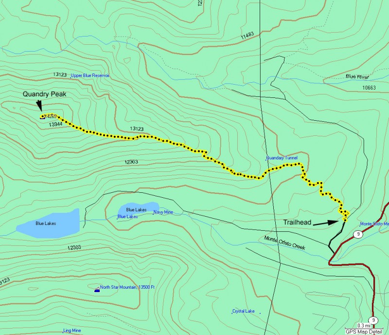
From the town of Breckenridge, Colorado, take HWY-9 south. About 7.5 miles from Breckenridge, turn left onto signed Blue Lakes Road. A few hundred yards from the highway you will make another right hand turn onto FR851 and drive a mile to the trailhead. The sign marking the turn to FR851 is confusing (at least it was to us). The first time you see the sign, it looks like the Quandary peak trail is left. In actuality, the trailhead is to the right. After turning right and driving a mile, the trailhead is signed on the left side of FR851 and easy to find.
Hike details
Season
- July
- August
- January
- February
- December
Solitude
Difficulty
Permits
Hike up to 14000+ foot Quandary Peak in Colorado.
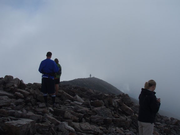
If you've ever wanted to climb a 14er (otherwise known as a +14000 ft mountain) then Quandary peak is a good choice. The trailhead is accessible by car, the trail is easy to follow, and the climb itself is non technical. There are two things to watch out for if you decide to take on the challenge of this hike. The first is the weather, which is quite variable during the summer. You do not want to be anywhere near this hike if there are lightning storms around, as the climb is very exposed. The second is the possibility of altitude sickness. Only take this hike after you've spent a day or so at altitude. If you find yourself experiencing dizziness, nausea, headaches, and shortness of breath, you must turn around and descend. Altitude sickness is nothing to play around with.
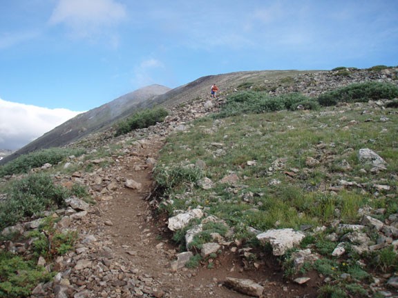
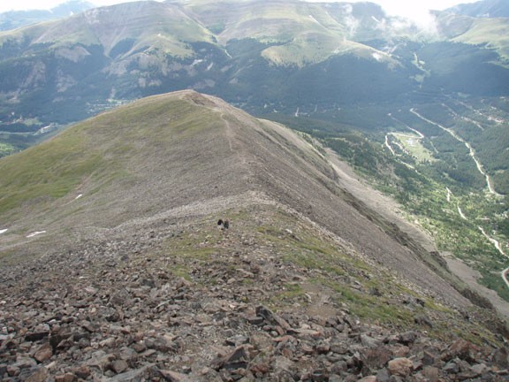
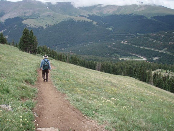
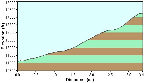
From the signed trail on the left side of FR851 the trail starts the long climb through a pine forest. After leaving the tree line behind, the trail switches back to reach a ridgeline, which you will be following for the remainder of the climb. Some of the sections are quite rocky. Although the trail is never hard to follow, these rocky sections mean slower progress.
The other thing that will slow your progress is climbing at such a steep incline at elevations of 13000 ft. The fat alpine rodents will cheer you on as you huff and puff up the ridgeline. The last 1000 ft of climbing is slow, due to the combination of altitude, incline, and rocky trail conditions. As a Phoenix desert dweller, I found myself climbing about 100 ft and then sucking wind for a few moments to catch my breath.
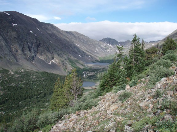
Eventually your hard work is rewarded in many ways. The sense of accomplishment to climb a 14er would be a fitting reward for your work on its own. However, Quandary peak also provides stunning views of the surrounding +14000 ft peaks, Breckenridge, and the Blue lakes.
