
- Hikes outside of Arizona
- United States - National Parks
- Emerald Pools (Zion National Park)
Emerald Pools (Zion National Park)
Location
To the trailhead: Park at the visitor center and take the free shuttle to the Zion Lodge stop. The well signed trailhead starts across the road from the tram stop.
Hike details
Season
- August
- September
- January
- February
- December
Solitude
Difficulty
Permits
Hike to the Emerald pools in Zion National park
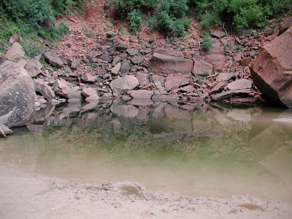
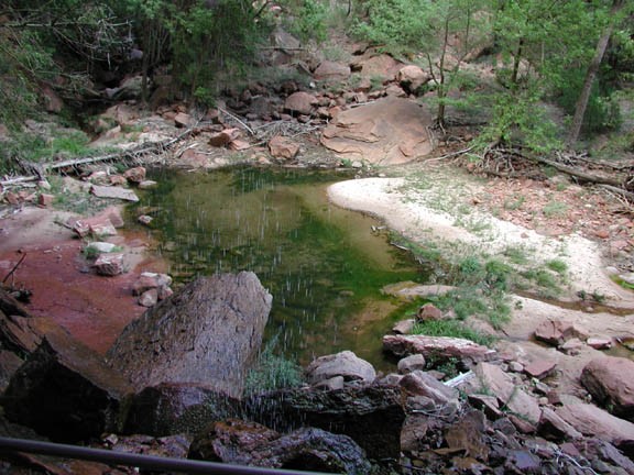
This is one of the shorter day hike trails in Zion National Park. It is also well shaded and cool so it is quite popular hike for the middle of the day. Although there are several routes to take to see the pools, we took the trail to the middle and upper pools, then descended to the lower pool. From the lodge, cross the bridge across the Virgin River and head south for a bit, following the trail marker for the 'middle pool'. This trail soon makes a turn perpendicular from the river and begins a moderate climb up the wall. This paved trail is well marked and easy to follow. After about a mile, the trail reaches a pool, but this is not the 'middle pool'. This pool is one of the springs that feeds the lower pool. The water cascades off the rock ledge here. Continue past this pool to the signed junction with the 'upper pool'. The 'upper pool' trail is more rocky but not difficult. An additional 0.3 miles gets you to the upper pool. This part of the trail is shaded by many trees and on three sides by a rock amphitheater. The upper pool is the water runoff collected by the water leaking from the top and sides of this sandstone amphitheater. When we were here in the afternoon, bats were busily flying up above us. We watched the bats for a few minutes before heading back down.
After retracing your steps 0.3 miles, you reach the trail junction for the lower pools. Follow this trail down to the lower pool. The trail cuts under an overhang which has a steady stream of dripping water that feeds the lower pool. Personally, I thought this was the most scenic pool. The water and shade makes this a pleasant place to stop and take a few pictures.
When you are finished, continue down the paved trail 0.6 miles to the start.
