
- Hikes outside of Arizona
- United States - National Parks
- Hermitage Point (Grand Tetons National Park)
Hermitage Point (Grand Tetons National Park)
Location
To get to the trailhead: Drive south on HWY-89 into the park. Travel 11 miles on this road and turn right (west) into the Colter Bay area. Drive nearly one from the turnoff and head towards the boat launch area. The well signed trailhead is at the parking lot for the boat launch.
Hike details
Season
- July
- August
- September
- January
- February
- December
Solitude
Difficulty
Permits
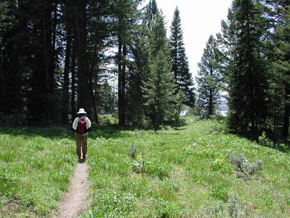
Hike to Hermitage point in Grand Tetons National park
The most endearing part about this hike is the variety of different attractions. This loop features lily pad covered ponds, beaver homes, meadows, forests, and wonderful views of Jackson Lake and the Grand Tetons behind. There are supposed to be Moose in the area too, but we were not fortunate enough to see one.
There are many trails in this area and taking a wrong turn is a possibility. Most of the trail junctions are signed to help you navigate this area. Starting on the dirt road from the trailhead, the path skirts along the edge of Colter Bay. After walking about 0.4 miles, you reach a junction for the Heron Pond and Swan Lake trails. For this loop, we will start on the Heron Pond trail and return on the Swan lake trail. The Heron Pond is the right fork, heading South and a little East. Heron Pond trail passes a nice lily pad covered pond with a beaver nest in the middle. We were lucky enough to see Mr. (or Ms?) beaver out for a morning swim.
After about 1.0 miles along the Heron Pond trail you reach another junction. Stay right at the junction and follow the trail as it continues along the edge of Jackson Lake (although you can't see it for a while). This section of trail features open meadows and eventually a very nice view of the lake with the mountains behind. You will follow this trail for 0.8 miles, then stay right at the trail junction, and walk another 2.2 miles to Hermitage point. More meadows and stunning views await at the point. Continue on the same trail as it curves around to the east side of the pennensula for 2.2 miles. Stay right again at the trail junction and hike another 0.7 miles to the four way trail junction. Turn left here towards Heron Pond and Swan Lake. After 0.5 miles of hiking, you will reach a familiar four way trail junction. Here, take a right towards the Swan Lake trail.
After a brief climb you will be hiking along the edge of Swan Lake, which is a lily covered pond. After about 1 mile of hiking on this trail, you return to the very first trail junction. Keep going straight on the dirt road for another 0.4 miles back to your car.
