
- Hikes in Arizona
- Mogollon Rim
- Sundance Canyon
Sundance Canyon
Location
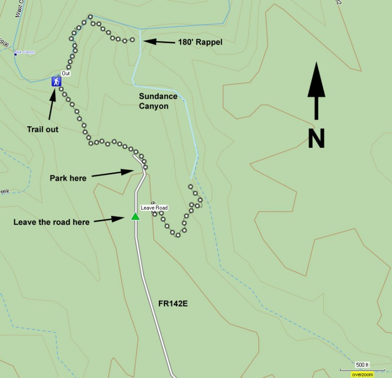
Take HWY-87 north from Payson, past the towns of Pine and Strawberry. After passing the town of Strawberry, turn left onto HWY-260 (Northwest). Drive 3.1 miles on HWY-260, turning right onto signed FR144. Take FR144 for 1.8 miles, turning left onto FR149. Take FR149 1.2 miles and turn right onto road FR142. Take FR142 for 1 mile and turn left onto FR142E. Take FR142E 2.7 miles to a parking area.
Hike details
Season
- June
- July
- August
- January
- February
- December
Solitude
Difficulty
Skills
Permits
hike, rappelling, and swimming through Sundance canyon on the Mogollon rim in Arizona.
Sundance Canyon is not a typical hike, but a technical canyoneering adventure. The skills needed to successfully navigate through the narrows of Sundance Canyon are not trivial. You will also need to be comfortable scrambling, down climbing, rappelling off of natural and fixed anchors, as well as be able to swim in a wetsuit.
WARNING: Make sure you have experience with rappelling and cold water swimming before considering this canyon. On the scrambling down the canyon, we passed a beautiful wreath of roses, along with a piece of rappelling sling, clearly meant as a memorial for a fellow canyoneer. Mistakes can have serious consequences here. Even if you have all of these skills, make sure you take a buddy with you.
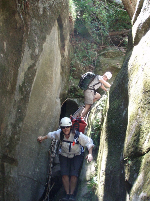
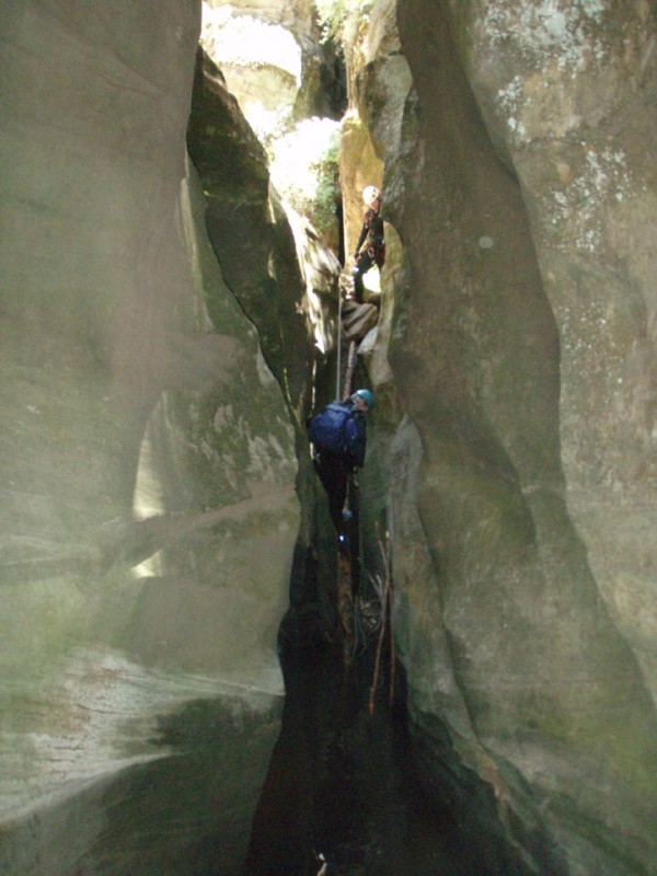
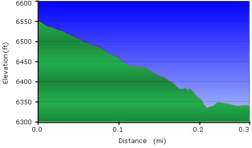
From the parking area at the end of FR142E, start walking back up FR142E for a few hundred yards. Keep an eye out on your left (East) to look for a scramble into the woods. There is no set trail, you'll have to rely on your route finding skills. The cross country walk isn't difficult and before long you'll find yourself at the bottom of a canyon known to the canyoneering community as Sundance Canyon (so you won't find this name on any maps).
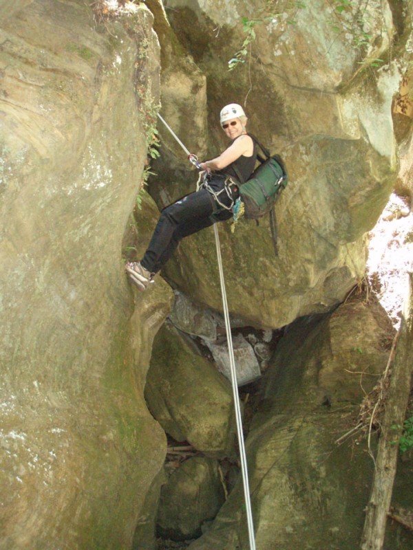
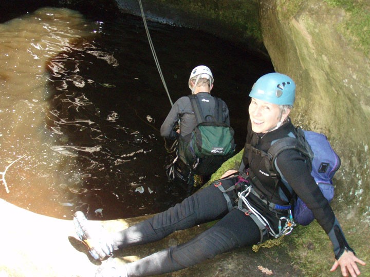
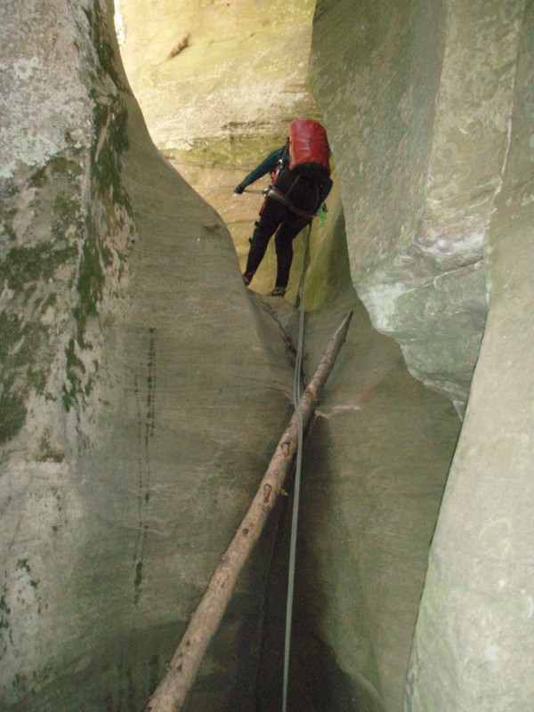
Once at the bottom of Sundance Canyon, head left. You'll be boulder hopping and scrambling down to the narrows. There is some down climbing required, but no rappels needed in this section. When you start to see the canyon narrow and the walls climb higher with a short drop into a pool, you'll know you've reached the technical section of this canyon. Put on your wetsuit and your harness.
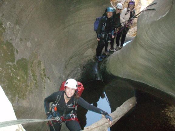
The first rappel drops about 20 ft into a small pool. We used a tree about 10 feet back from the pool as the anchor. You may be able to bushwhack around this rappel, but we chose the rappel. After this rappel, continue to walk down canyon until reaching the second rappel. We used a tree about 30 ft back up canyon as an anchor. The rappel was about 10 ft into the cold pool. Once the first few folks rappelled down, we realized the water was deep enough to slide into. The last two folks in our group slid down the slide into the pool. The third rappel uses another dead tree as the anchor and drops 30 ft into a keeper pothole. The cold water and sloping edges make this a bit of a challenge to get out of, but none of us had any trouble. At a lower water level you may need to rely on your buddies for a boost out. The fourth rappel (30 foot) uses two bolts on the left side of a canyon and ends in a serious water filled keeper pothole. Make sure you have a plan for getting out of this pothole before you get in it! This is the most dangerous part of this adventure, as the cold water will quickly drain your energy. Luckily there was a dead tree that made it very straight forward to get out of the keeper hole, but the next flash flood can easily wash this away.
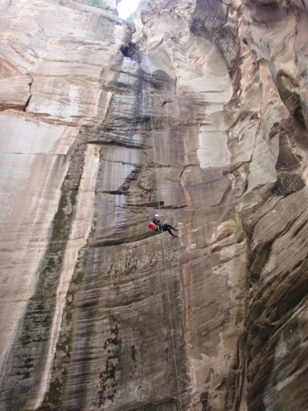
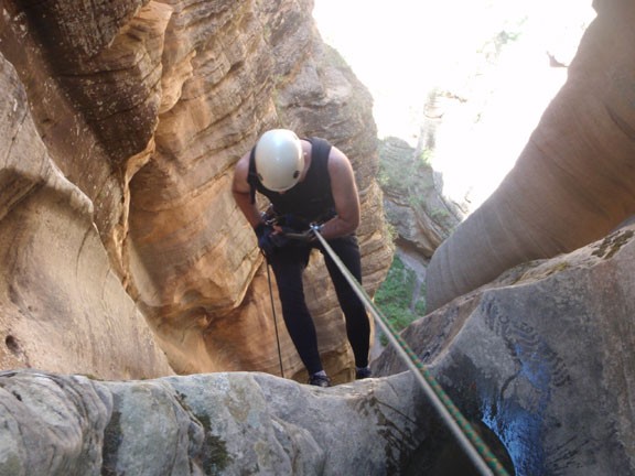
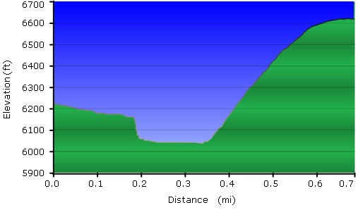
The fifth and final rappel is a memorable one. Use the three bolts on the right side of the canyon to set up your anchors for the 180 foot rappel. We used two 60 meter ropes for this rappel, which made for a heavy pack but we had no trouble with both ends of the rope reaching the ground. The rappel itself is magnificent... it seems to go on forever. Probably 2/3rds of the rappel is free hanging and finaly ends in a large alcove next to west clear creek.
You can remove your wet suit and harness now, as it's straightforward rock hopping and scrambling to get to West Clear Creek. Turn left at the lush perennial creek and walk about 0.2 miles to the trail out on your left. There are usually a hand full of people hanging around here in case you can't see the exit (it's not easy to spot until you're on the trail). This steep but easy to follow trail leads back to your car in a short 0.3 miles.
