
- Hikes in Arizona
- White Mountains and Eastern Arizona
- Panorama Trail #635
Panorama Trail #635
Location
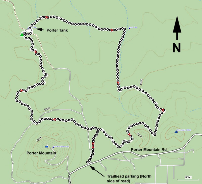
To the Trailhead: From the Pinetop-Lakeside area, head on HWY-260 south towards the Lakeside Ranger station. Just past the ranger station, turn left on signed Porter Mountain Road (FR45). Take this paved road for 5.0 miles and look on your left for a signed dirt road to the Panorama Trail #635. After turning left, A short drive on this road ends at the trailhead and parking area.
Hike details
Season
- June
- July
- August
- January
- February
- December
Solitude
Difficulty
Permits
Hike the panorama trail in the White mountains of Arizona.
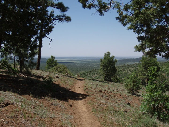
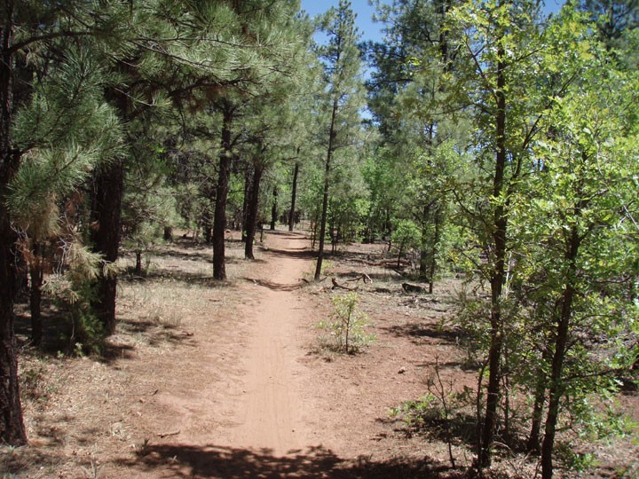
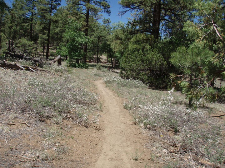
From the signed trailhead, take the easy to follow and signed trail (not the road) North through the pine forest. After about 0.5 miles, you'll reach a signed fork. You can take this loop hike in either direction, but we chose clockwise (turn left here), so the hike write up reflects this.
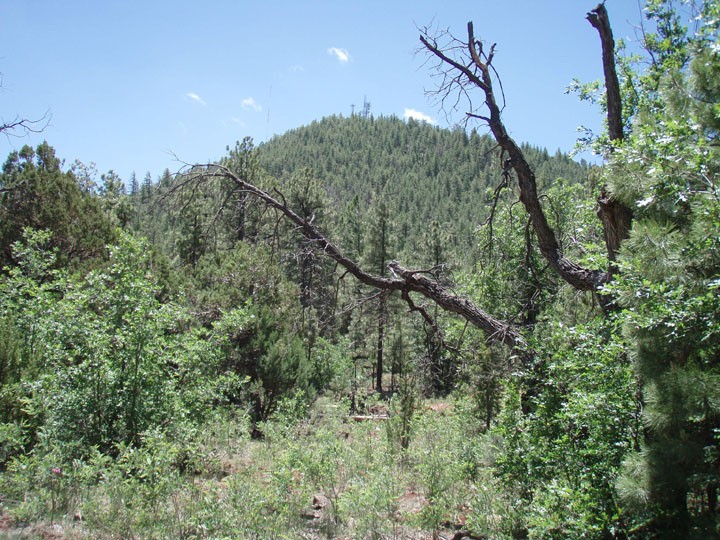
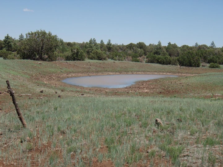
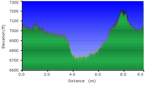
The trail heads West here and skirts the edge of Porter Mountain. This mountain is easily spotted through the trees, as it has radio towers atop it. After about a mile of hiking from the trail junction, the trail turns in a Northern direction again as you head towards Porter tank. After 3.4 miles of total hiking, you'll reach a signed trail junction with the Sawmill connector trail (Jct 1R on the map), which if you took it would eventually reach the Timber Mesa trail. Instead, turn right here, staying on the Panorama trail #635 as it drops gently down off of a mesa. The hiking so far has been all through a pine forest with sporadic shade. Once you reach Porter tank, the trail turns East and changes from pine to scrub oak and Juniper. The shade also disappears, but the trail is still easy to follow. The trail heads through some very scenic meadows as it reaches South Tank. When we did this hike, Porter tank was dry but South Tank still had some water in it. The trail turns South from the tank, heading for the Twin Knolls, which are two prominent hills giving wide views of the surrounding area. It's a bit of a climb to reach the saddle of the Twin Knolls, but the views are well worth it. The trail heads West as it skirts around the base of the Western most hill, quickly reaching the initial trail junction and completing the loop. At this signed junction, hike the 0.5 miles back to the trail head and parking area.
