
- Hikes in Arizona
- Northern Arizona
- Elden to Sunset Trail to Heart Trail loop hike
Elden to Sunset Trail to Heart Trail loop hike
Location
From the Flagstaff area, take HWY 89 towards Page, AZ. After you pass the junction for HWY-66 and I-40, and after you pass the Flagstaff mall, McDonalds, and Safeway on your right, check your left for the sign for the Mount Elden Trailhead.
Hike details
Season
- June
- July
- August
- September
Solitude
Difficulty
Permits
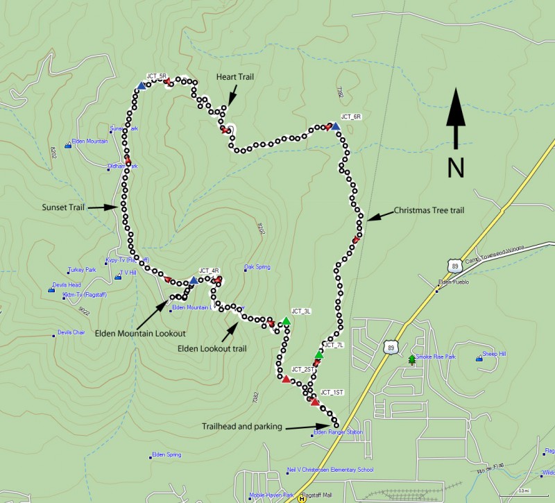
Hike up Mount Elden using the Sunset trail and the Heart trail near Flagstaff, Arizona.
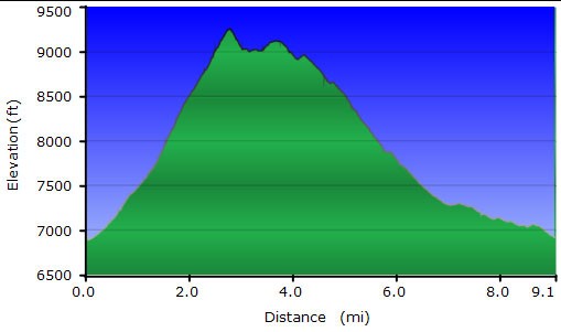
Distances:
From Elden Trailhead to Elden summit : 3.0 miles.
From Elden summit to Heart trail along the sunset trail: 1.7 miles
From Heart Trail to Christmas Tree trail: 2.5 miles
From Christmas Tree trail to Fat Man's Pass: 1.7 miles
From Fat Man's Pass to Elden Trailhead: 0.6 miles
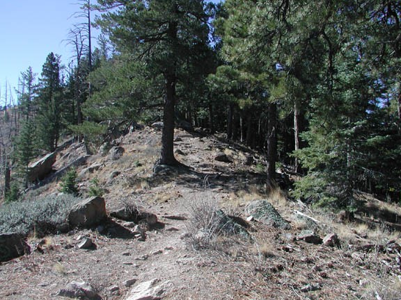
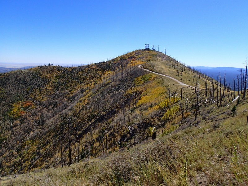
This trail starts innocently enough up a trail called Fat Man's Loop. There are several trails in the area, but they are flat and skirt the base of the mountains. The junctions are well signed and the trail is easy to follow. Just keep following the signs that lead you at first on Fat Man's Loop (JCT1_ST on the map), then to Elden lookout trail (JCT2_ST on the map). The trail you want goes up. At the top of Fat Man's Loop, the lookout trail (JCT_3L on the map) goes up via a series of switchbacks.
Once you get to the top, break out lunch and enjoy the view. You have great views of Flagstaff, Sunset Crater, and the San Francisco peaks from the top.
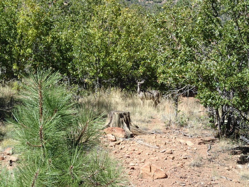
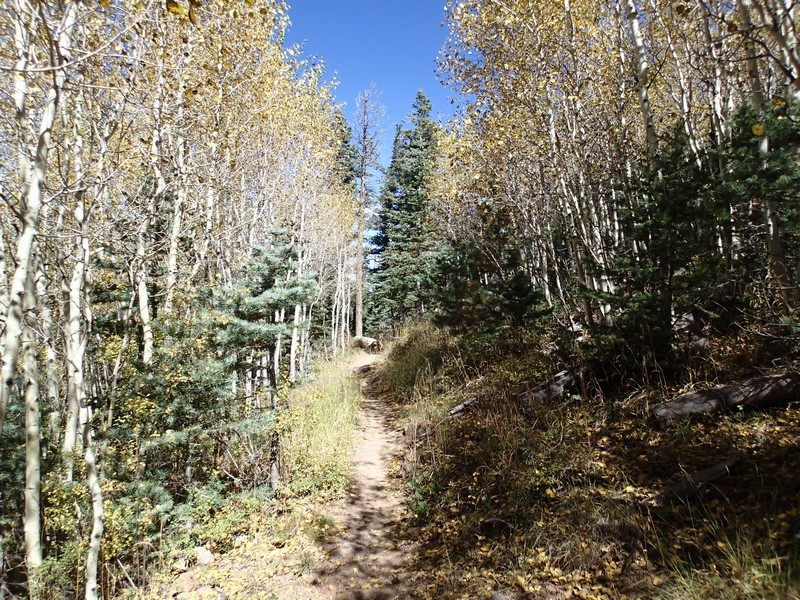
From the peak of Elden, backtrack along the Lookout trail to the junction of the Sunset trail (JCT_4R on the map). This trail follows the ridgeline of Elden back towards the Heart Trail (JCT_5R). There are many nice views here of the results of the fire and the healing forest left behind. After about 1.7 miles, you will reach the signed junction of the Heart trail. The Heart trail descends steeply down through the burned and tree-less area 2.5 miles to the Christmas Tree trail. This section has some excellent unobstructed views of the area. Turn right onto the Christmas Tree trail (JCT_6R on map) and walk 1.7 miles along a flat trail through a shady pine forest. This is a good place for wildlife spotting, as I saw about 4 deer here during my last hike through. The Christmas Tree trail links back up with the Fat Man's Pass trail (JCT_7L on map) and eventually back to the Elden trailhead. During this section of Fat Man's Pass trail, there are a number of spur trails that lead to the left. Just keep going straight until you see the signed junction leading you back to the trailhead and your car.
Bring some snacks as well as plenty of water. Dress in layers, as the top of the peak is windy and chilly.
Watch the weather closely. If dark clouds begin to form or you hear thunder or see lightning, call it a day and hustle down the mountain. Lightning strikes the peak of Elden on a regular basis and you don't want to be near it when it does.
This is a great Arizona hike. Enjoy!
