
- Hikes in Arizona
- Mogollon Rim
- Mack's Crossing
Mack's Crossing
Updated
Location
How to Get There
This hike is located near Clints Well, AZ.
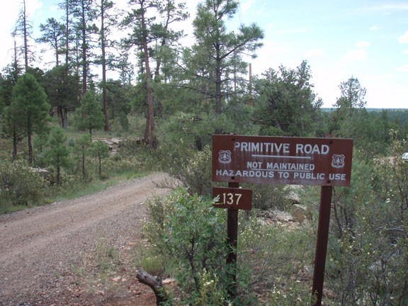
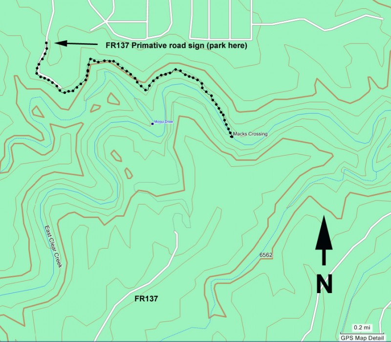
To get to the trailhead: from the Phoenix area, take HWY-87 Northeast through Payson, Pine, and Strawberry towards Winslow, AZ. After passing the intersection with Lake Mary Road (FH3), drive an additional 13.9 miles, turning right onto signed Enchanted Lane road (about a half mile past mile marker 304). This road transitions from pavement to well graded dirt. After 0.2 miles, turn right onto signed Green Ridge Drive. Drive 0.5 miles and turn left on Douglas Fir way. This road bends left and after 0.2 miles you'll see the sign on the right for FR137 - Primitive road. Park here... this road is not passable for cars, although ATVs can make it.
To get to the trailhead: from the Phoenix area, take HWY-87 Northeast through Payson, Pine, and Strawberry towards Winslow, AZ. After passing the intersection with Lake Mary Road (FH3), drive an additional 13.9 miles, turning right onto signed Enchanted Lane road (about a half mile past mile marker 304). This road transitions from pavement to well graded dirt. After 0.2 miles, turn right onto signed Green Ridge Drive. Drive 0.5 miles and turn left on Douglas Fir way. This road bends left and after 0.2 miles you'll see the sign on the right for FR137 - Primitive road. Park here... this road is not passable for cars, although ATVs can make it.
city
Clints Well
state
AZ
country
USA
Region
Mogollon Rim
Hike details
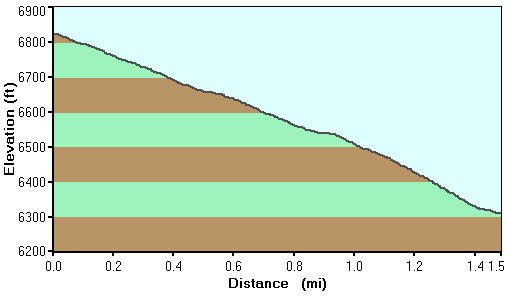
Distance
3.00 [Miles] Total
Hike Distance- Details
About 3.0 miles total hiking to the creek and back
Time
2.00 [Hours]
Time-details
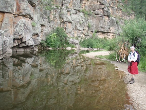
It took us just over 2 hours to complete this hike. It was only 30 minutes to the water, but we spent about an hour swimming.
Elevation Change
100 Total gain/loss [Feet]
Elevation Loss
500 Total Elevation Loss[Feet]
Elevation Details
about 500 ft total.
Season
Best Season
- June
- July
- August
Worst Season
- January
- February
- December
Season Details
Summer
Date Hike completed
July 02, 2011
Solitude
Solitude
Medium
Solitude Details
Fair. When we got to the swimming hole we had it all to ourselves, but we were passed by five ATV vehicles driving along the road.
Difficulty
difficulty detail
30 yr old Recommendation: This would be a very nice hike if you didn't have to share it with the ATV crowd. The swimming hole is lovely and if you would like seclusion you can walk downstream to find your own private swimming hole. The hike to horse crossing is an Easy hike.
Permits
Be Aware of
ATVs, swimming opportunities
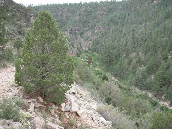
Hike and swim in Mack's crossing on the Mogollon rim, Arizona.
Since Arizona swimming holes are a great escape from the summer heat, hikes that lead to them tend to be in high demand. Surprisingly, the Mack’s crossing trail has stayed relatively crowd free even though the hike is an easy one. From the parking area, simply walk down the primitive road towards the bottom of East Clear creek. Since East clear creek is a pretty large drainage for the Mogollon rim, this canyon has water year round. The road continues to deteriorate as it descends, but as a result becomes a better hiking trail. At the bottom is a large pool in a very scenic canyon. By heading up or down stream you can easily find your own private swimming hole.
