
- Hikes in Arizona
- Grand Canyon / Marble Canyon
- Jackass Creek
Jackass Creek
Location
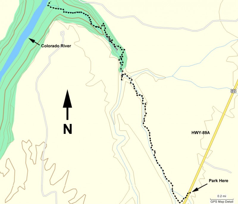
From Flagstaff, take US Highway 89 toward Page, AZ. At Bitter Springs, take HWY-89A (left) towards Marble Canyon. Between Mile markers 532 and 533 you’ll see Jackass Creek Canyon cross under the highway. Park next to the highway.
Hike details
Season
- March
- April
- May
- September
- October
- January
- February
- December
Solitude
Difficulty
Permits
Hike in Jackass creek in the Marble canyon area of Arizona.
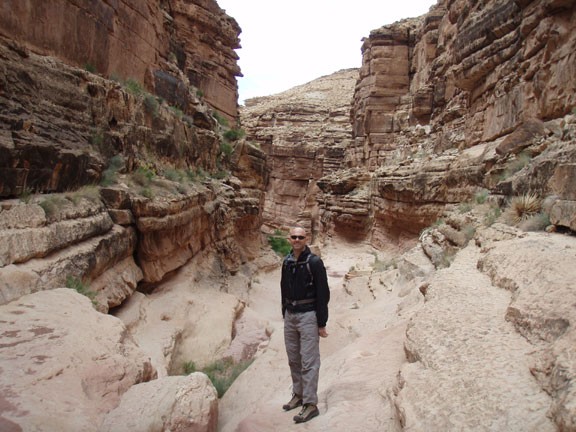
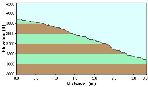
There are many great hikes that access the Colorado River in the Marble canyon area of Grand Canyon. Jackass Creek is another hike worth finding. Somewhere between Soap Creek and Rider Canyon in difficulty, hiking down Jackass Creek requires that a series of falls to be negotiated in order to reach your goal of the Colorado River.
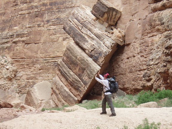
First, make sure you purchased a Navajo hiking permit and have it displayed in your car windshield before starting out. When we did this hike in May of 2010, the cost was $5 per person per day. From the bridge, hike West over a barbed wire fence and into the obvious wash. The walls start out low, but soon will lengthen as you hike deeper into the canyon. The hiking moves quickly through this section unless you spend some time admiring the towering sandstone narrows like we did. There are some huge boulders that have peeled away from the walls and are resting on the canyon floor, reminding us that this canyon is constantly changing.
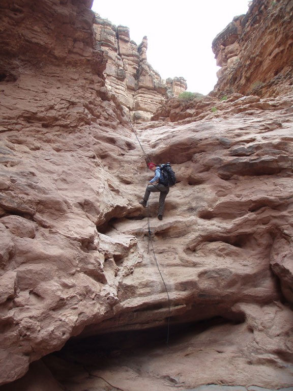
The first fall you reach is the most challenging. It’s a 30 foot down climb, but luckily there is usually a rope here attached to some bolts that makes it much easier. This rope does get washed away on occasion, so you may want to bring your own just in case. From this point, you’ll be negotiating more dry falls as you head down canyon, but all are circumvented without ropes. The scrambling is pretty aggressive at times, so take your time and make sure you’ve found the best route.
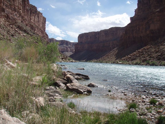
After 2.7 miles of hiking, the canyon walls will open up and you’ll be able to reach the shores of the Colorado River. This beach gives a good view of Badger Creek rapid, which is the first named rapid that Colorado River runners hit on their long journey through the Grand Canyon. Hopefully you’ll be lucky enough to watch some river runners go through the rapid as you rest. If you brought your fishing pole (and have a fishing permit) this is an excellent place to try your luck at landing a Colorado River trout.
When ready, return the way you came.
