
- Hikes in Arizona
- Sedona
- Sterling Pass
Sterling Pass
Location
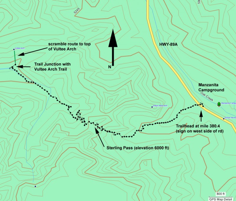
From the Phoenix area, take I-17 North to exit 298 to HWY 179 West into Sedona. At the intersection with HWY-89Ak, follow the signs to 89A North. Continue past Sedona and up Oak Creek canyon. Around mile marker 380.4 and across from the Manzanita Campground is the Sterling Pass trailhead (on your left). Park at one of the pull-outs on the West side of the road. The trailhead start is marked by an old metal sign. Make sure to get a Red Rock parking pass in Sedona before parking or you risk a ticket.
Hike details
Season
- April
- May
- October
- November
Solitude
Difficulty
Permits
Hike to Sterling Pass in Sedona, Oak Creek, Arizona.
Sedona has recently instituted a "Red Rock Pass", which is a fancy way of saying you need to pay to play. As of May, 2010, the fee is $5 per day per vehicle. There are plenty of places in and around Sedona to pay this fee and get the receipt, which you need to put on your vehicle dash to keep from being towed.
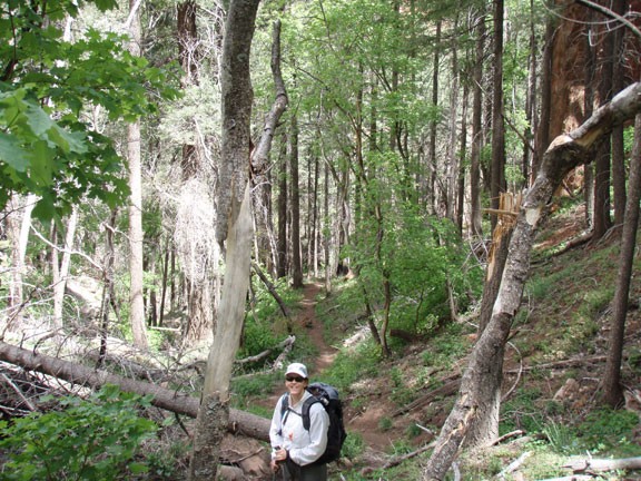
Parking at the trailhead is pretty limited. Hopefully you were one of the lucky few to find a parking spot and found the trailhead without difficulty. The well trod trail is easy to follow for the duration of the hike.
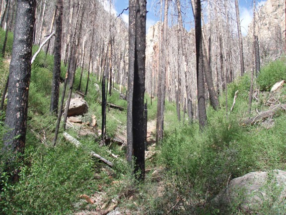
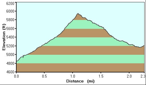
The Sterling Pass trailhead climbs up the West wall of Oak Creek canyon through the burned remains of a pine forest. The forest is starting to recover here, but there isn't much shade yet. Be sure to turn around once in a while as you hike up to enjoy the increasingly impressive views of Oak Creek Canyon.
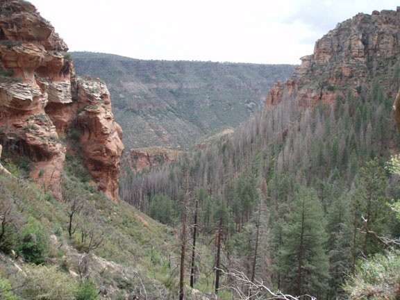
The trail tops out at Sterling Pass. This notch in the West wall of Oak Creek canyon provides views to both the East (Oak Creek Canyon) and West (Sterling Canyon). The burn reached the West side of this hike too, but some of the pine trees remain. Soon you'll be hiking along a normally dry creek. When we took this hike we had the benefit of recent rains, so this creek was flowing.
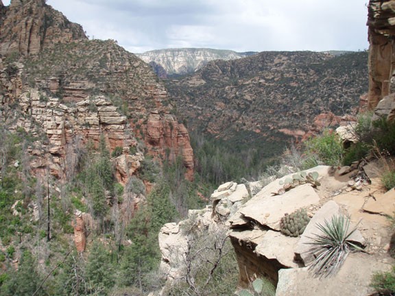
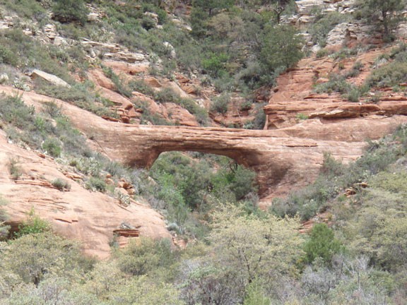
As you drop down into Sterling Canyon, you'll reach the signed junction with the Vultee Arch trail. If you look North you'll see Vultee arch on the wall of the canyon. Turn right at this junction and hike a few hundred yards to get a good view of the arch. The slick rock here is an excellent place to relax and have some lunch. See if you can find the plaque in the sandstone that marks the passing of Gerald and Sylvia Vultee, who died in a plane crash near this spot.
There is also a scramble route to get on top of the arch if you so desire.
When ready, return the way you came.
