
- Hikes in Arizona
- Superstition and Mazatzal Wilderness
- Apache Trail Canyon
Apache Trail Canyon
Location
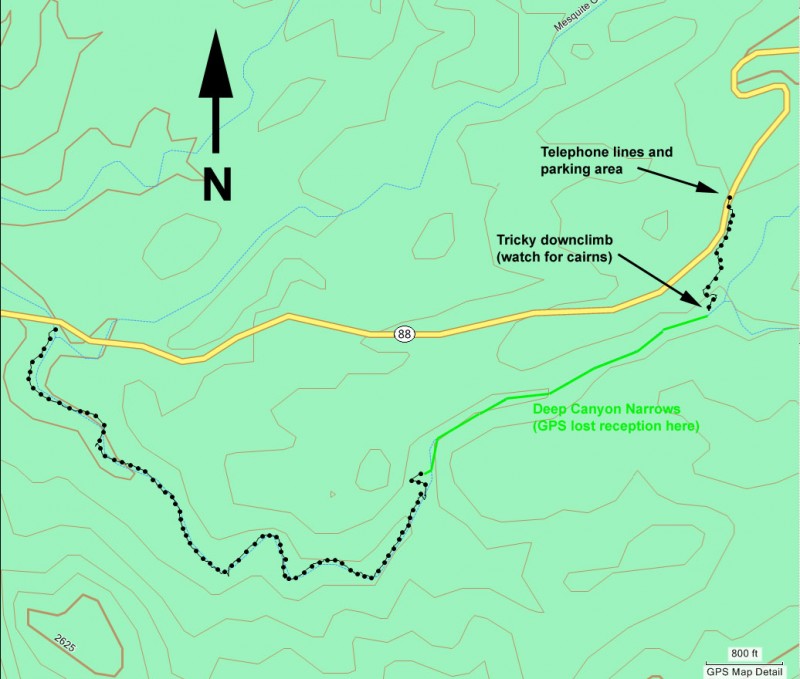
To get to the trailhead: from the Phoenix area, take US-60 East. Take the Idaho Road exit and go North. From Idaho Road, turn onto HWY88 towards Canyon Lake. When you reach the tourist trap of Tortilla flats, cross the creek and drive another 3.0 miles. Park in the dirt area on the left (North) side of the road near the power lines.
Hike details
Season
- January
- February
- March
- April
- November
- December
Solitude
Difficulty
Permits
Hiking and scrambling through Apache trail canyon near Phoenix, Arizona.
Apache Trail canyon was named by Tyler Williams in his book, Canyoneering Arizona (revised edition). Thanks to his exploring, hikers like us have another enjoyable adventure possibility in the Superstition Wilderness area. If you're interested in some fun boulder hopping and scrambling to interesting desert canyon narrows, then this is an excellent choice for a spring hike. However, the scrambling in this canyon is not trivial, so if you are not comfortable with scrambling with some exposure then this hike is not recommended.
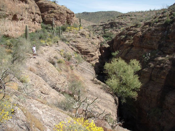
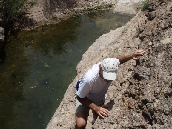
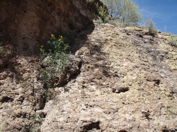
From the parking area, cross HWY-88 to the South side of the road. You'll need to use your route finding skills here to find the entrance into the canyon. Although it looks like further upstream it would be easier to get into the canyon, there is a 30 foot dry fall that you would need to rappel down. Walk cross country along the canyon downstream of the fall and keep an eye out for some cairns that mark the entry. The entry requires some strong down climbing skills. Some would prefer to be on belay for this down climb. We did notice a few slings with rap rings illustrating that some preferred to rappel into the canyon. This picture shows part of the down climb as taken from the bottom of it.
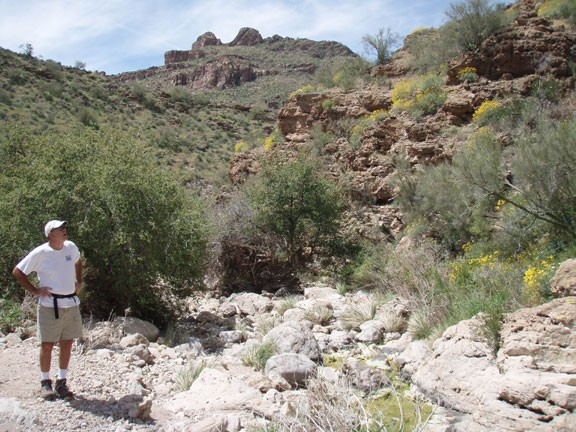
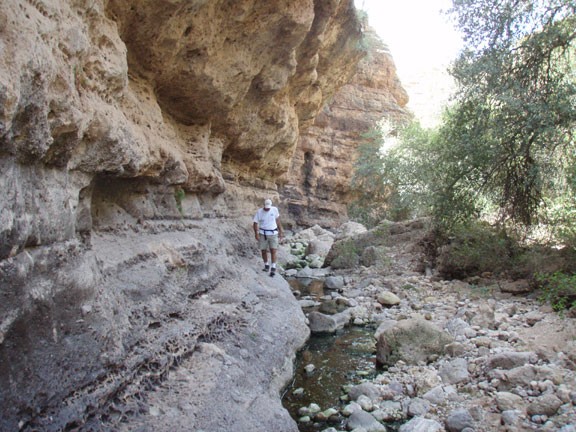
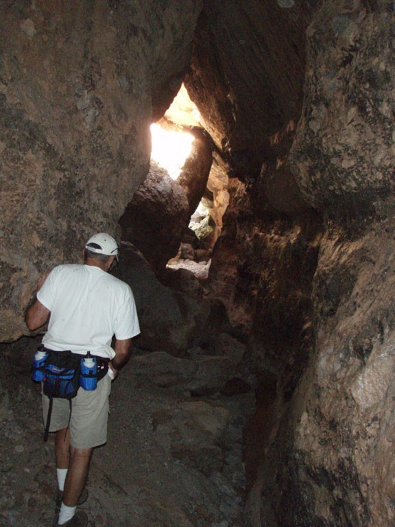
From the down climb, continue downstream. The canyon narrows quickly and there are substantial boulder jams that need to be navigated to continue progress. There is at least one challenging down climb in this section, along with one really neat cave formed by the boulders jammed in this section.
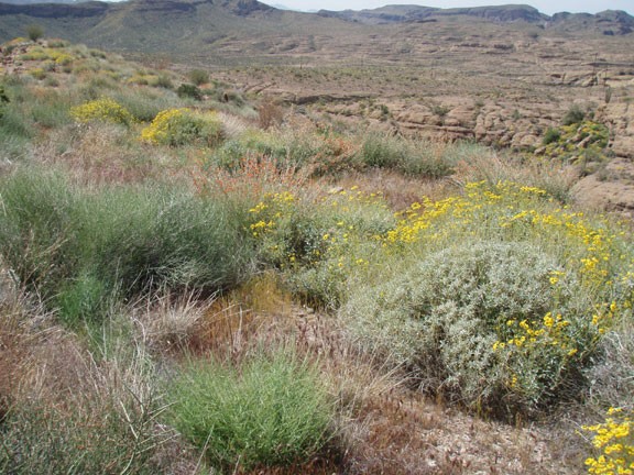
The narrows in the canyon will soon open, potentially exposing some water pools to scramble around if you want to stay dry. The further you go, the more the canyon opens. The hiking here is more boulder hopping than scrambling, so it is a welcome change. There are some remnants of what appears to be an old bridge that once spanned this wash, as well as a multitude of views to enjoy along this stretch.
When the canyon reaches the road, scramble up the loose rock to HWY-88. It's a quick 1.4 mile walk back to your car.
