Ready for a hike?  We've got hundreds of well documented Arizona hikes.
This is the source for everything you need to know about Arizona Hiking.

Main menu

Cart Empty

You are here: ArizonaHiking.org

Escudilla Mountain

Updated
Escudilla mountain aspen
Views from Escudilla mountain
fire lookout tower on Escudilla mountain
Escudilla mountain
Elevation plot: Escudilla mountain
map: Escudilla mountain

Location

How to Get There
This hike is located near Alpine, AZ.

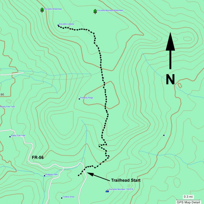
To the Trailhead: From the Alpine area, go 5.1 miles on HWY-191/180. Turn right onto the well graded FR56. Drive 4.6 miles to a signed road junction. Turn left and drive another 0.5 miles to the signed trailhead.
city
Alpine
state
AZ
country
USA
Region
White Mountains and Eastern Arizona

Hike details

Distance
6.00 [Miles] Total
Hike Distance- Details
6.0 miles to the lookout tower and back
Time
2.75 [Hours]
Time-details
2.75 hours
Elevation Change
2,400 Total gain/loss [Feet]
Elevation Gain
1,200 Total Elevation Gain [Feet]
Elevation Details
about 1200 ft gain.
Hike Trail Type
Out and Back

Season

Best Season
  • June
  • July
  • August
Worst Season
  • January
  • February
  • December
Season Details
Summer
Date Hike completed
May 02, 2009

Solitude

Solitude
Low
Solitude Details
Not much solitude on this hike. Expect to share this trail with between 15-20 people.

Difficulty

Difficulty Rating
Easy
difficulty detail
35 yr old Recommendation: The Aspen forest is beautiful, especially in the fall. The views are great too! This is an easy hike.

Permits

Be Aware of
Inclement weather, elevation

Hike up Escudilla mountain in Eastern Arizona.

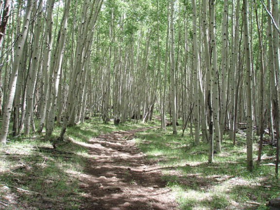
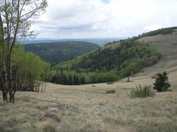
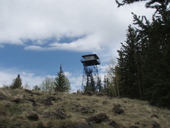
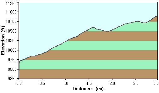
From the parking area, you'll follow along an old (now closed) dirt road. The trail is well worn and easy to follow for it's entirety. You'll start hiking through a lovely forest of Aspens as you climb gradually upwards. As the trail continues to climb, you'll emerge into some wide open meadows that provide great views. The trail levels out on a ridgeline (known as Profanity Ridge) and actually descends a bit before the final climb through a well shaded pine forest to the fire lookout tower at the top of the mountain.

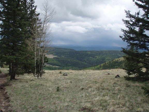
If the tower is manned, you can climb up and enjoy the views in all directions, including mount Baldy, the Blue Range, and even into the Gila Wilderness of New Mexico.

When ready, return the way you came. 

Map

Swap Start/End
Adding markers to the map ...
Facebook