
- Hikes in Arizona
- Prescott Area
- Pine Mountain
Pine Mountain
Location
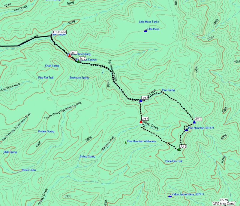
To the Trailhead: From the Phoenix area, take I-17 to the junction of HWY-69. Continue north on I-17 to the Dugas exit. Turn right (east) towards Dugas. For the first few miles, the road is paved, but soon turns to graded dirt. You will need a high clearance vehicle for this road, primarily because you need to cross Sycamore creek. Follow the signs to either Dugas, or once you pass Dugas, follow the signs to Pine mountain. The major road forks are signed, so it is not too difficult to navigate here. You should stay on Dugas road for the duration (FR 68) for 19 miles, finally arriving at the Salt Flat camping area and trailhead. Park here where available.
Hike details
Season
- April
- September
- October
- January
- February
- December
Solitude
Difficulty
Permits
Hike on the Pine Mountain trail near Prescott, Arizona.
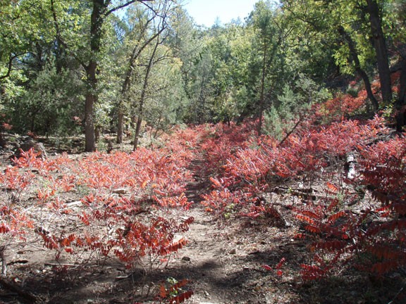
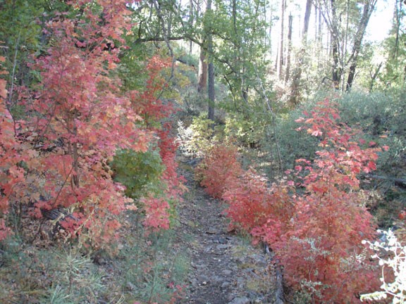
This hike is best taken during the fall, where you can fully appreciate the changing colors of the leaves in a forest surprisingly close to the Phoenix area. From the Salt Flat campground, find the trail marker and follow the trail across Sycamore creek to the entrance to the area, marked by a sign, a gate, and a trail register. The start of the trail follows along Sycamore creek, which soon has some water in it as you walk along it. There are many healthy trees along this section, including Oak, Pine, Cottonwood, and Sycamore. While providing shade, the numerous trees also drop plenty of leaves and pine needles, making it difficult to follow the trail. Time to put those route finding skills to good use!
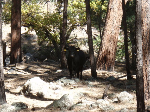
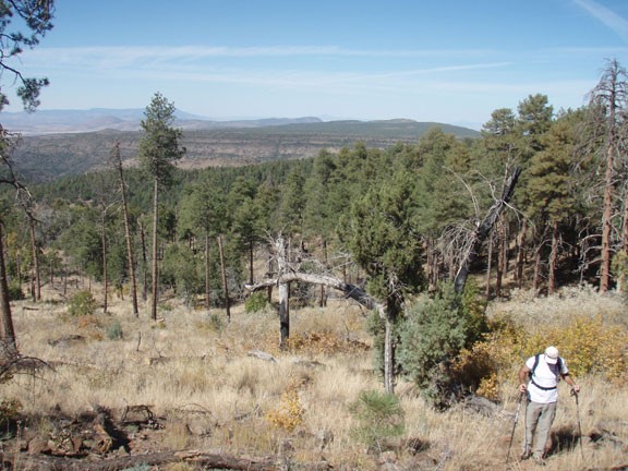
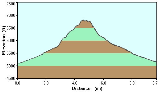
About 0.5 miles from the start, you'll see some stone walls that represent what's left of the Nelson ranch (Jct 1 on Map). Hiking another 0.5 miles along the Nelson trail will put you at the junction with the Pine Flat trailhead (Jct 2 on Map). Stay left on the Nelson trail. There are grazing cattle in this area, so keep a respectful distance. The next landmark you will reach is Willow spring, 2.7 miles from the trailhead start. Depending on recent rainfall, it is very possible the spring is not running. The junction between the Nelson trail and the Willow Spring trail is here as well. Turn right onto the Nelson trail (Jct 3 on Map) as it begins to climb out of the canyon. This section of the trail is interesting, as you are now traveling through a section of the forest that went through a burn back in 1989 and is recovering well. A half mile from Jct 3 you will reach another trail junction (Jct 4 on Map). Turn left here onto the Pine Mountain trail where you will continue your upward climb. This section of the trail features increasingly impressive views of the surrounding Pine Mountain Wilderness area.
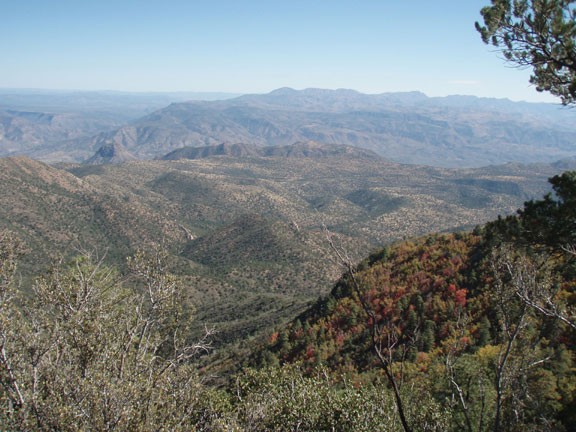
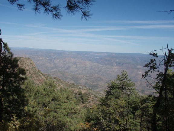
After your hard work climbing, you'll reach the junction with the Verde Rim trail (Jct 5 on Map). Turn left here and walk along the Verde rim, but be sure to enjoy the impressive views of the Verde river canyon to the East. Soon you'll reach Pine mountain, but unfortunately the trees block any views here. Don't worry, because as you continue along the Verde Rim trail the views open up again, this time to the North, where you can see Sedona and the San Francisco peaks. The views here truly emphasize the ruggedness of this area, as any signs of civilization are wonderfully absent.
The trail then starts a switch back descent with some prickly bushes. Wearing long pants is helpful here. This section of the trail doesn't seem to get much use, so there is a bit of bushwhacking too. When you reach the junction with the Willow Spring trail (Jct 6 on Map) turn left. This final trail section heads through a previously burned section of the forest that is slowly healing. You'll follow this trail all the way back through Sycamore canyon to the parking area.
