
- Hikes in Arizona
- Prescott Area
- Pine Lakes Trail #316
Pine Lakes Trail #316
Location
To the Trailhead: From the Phoenix area, take I-17 to the junction of HWY-69. Turn left onto HWY-69 towards Prescott. At the intersection between HWY-89 and HWY-69 towards the town of Prescott, turn left (HWY-69) and head towards the town of Prescott on Gurley Street. After passing through the downtown Prescott area, soon Gurley street turns into Thumb Butte Road. After the road changes to Thumb Butte road, the Thumb Butte day use parking area appears on the right after about 1.5 miles. There are toilets and water at this spacious trailhead.
Hike details
Season
- June
- July
- August
- January
- February
- December
Solitude
Difficulty
Permits
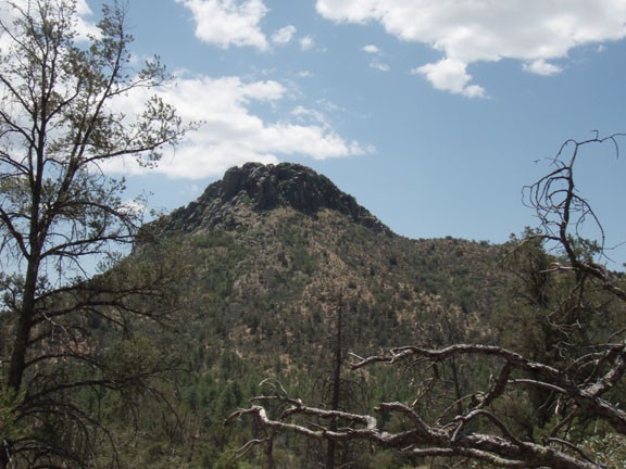
Hike the Pine Lakes trail in Prescott, Arizona.
If you're at the Thumb Butte day use parking area and don't feel like sharing a trail with a bunch of other hikers, you will like this hike.
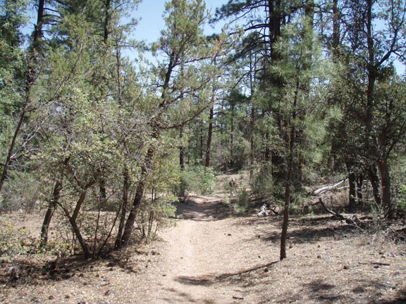
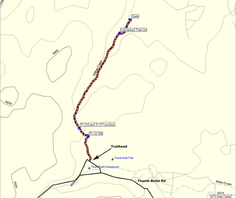
From the parking area, the marked trailhead for trail #316 leaves from the North West corner of the day use area, next to one of the picnic tables. The trail is well worn, but there are a few trail junctions to be mindful of.
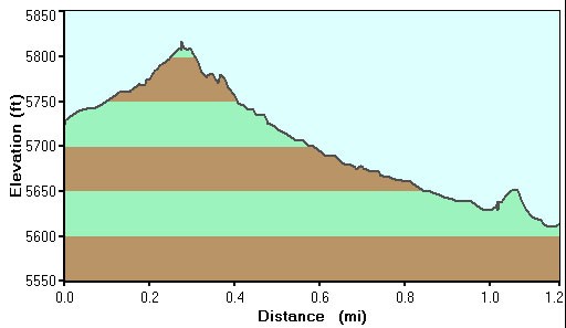
You'll go through a hiker gate through a barb wire fence and pass the trail junctions for trail #386 (stay right), trail #318 (stay right) and trail #317 (stay left). The forest here alternates between manzanita and pine trees. The further the trail goes, the more shade is available. You hike along willow creek (usually dry), walking the relatively flat grade until you reach a locked gate. The gate marks private property and is the turn around point of this hike.
Return the way you came.
