
- Hikes in Arizona
- Grand Canyon / Marble Canyon
- Hermit trail to Dripping Springs
Hermit trail to Dripping Springs
Location
From Flagstaff, take HWY 180 north towards the Grand Canyon. Once you enter the park, you'll head towards the Grand Canyon Village. During the busy season, you will need to take the shuttle from Grand Canyon Village to the Hermit Rest trailhead.
Hike details
Season
- April
- May
- September
- October
- June
- July
- August
Solitude
Difficulty
Kids in good shape can make this hike with adult experience and supervision.
Permits
SPECIAL CONSIDERATIONS FOR WINTER AND SUMMER TIMES:
, For Winter Hiking: Remember that the South Rim is damned cold in the winter. Snow and Ice will cover the trail for the first few miles. Crampons recommended.
, For Summer Hiking: Get an early start and don't hike during the heat of the day. Remember that the bottom of the canyon will be MUCH hotter than the top.
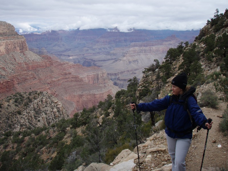
Hike the Hermit trail to Dripping Springs in Grand Canyon national park, Arizona.
Less crowded and with the same spectacular views, the hermit trail is hidden away at the west edge of the popular South Rim of the Grand Canyon. To get to the trailhead, take the (free) shuttle from the Grand Canyon Village to the Hermit Rest stop. Allow 60 minutes for this, as the shuttle makes seven stops on the way for the gawking tourists. At Hermit Rest is a gift shop, restrooms, and water.
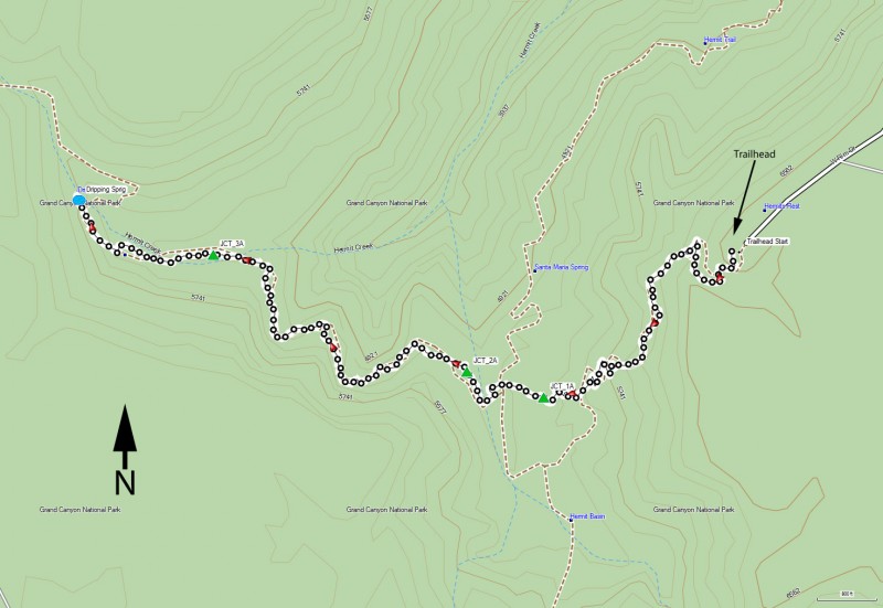
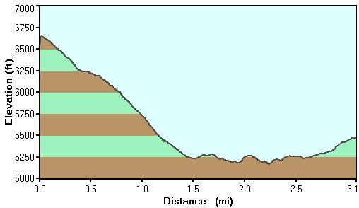
While the Hermit trail goes all the way to the Colorado River, taking the Dripping Springs fork to Dripping Springs makes for a nice 1/2 day hike. Although this trail is not maintained, it is still in reasonably good shape. As the trail descends down the white sandstone region, enjoy the work put in by the Santa Fe railroad when they built this trail in 1910. After 1.2 miles of hiking, you reach the junction of Waldron trail (JCT 1A on the map), which is an alternate route to the rim of the canyon. Stay on the Hermit trail by keeping right here. After 1.5 miles of hiking, you reach the junction of Dripping Springs trailhead (JCT 2A on the map). To the right is the Hermit Trail to Hermit creek. Stay left here.
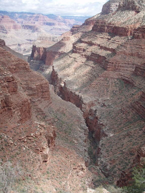
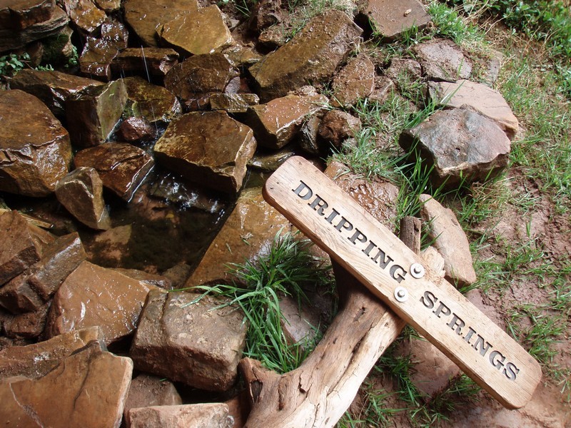
You will be walking along the top of the redwall as you skirt the edge of Hermit Canyon. The views of Hermit Canyon are impressive here. After 2.75 miles of hiking, you reach the junction of the Boucher trail (JCT 3A on map). There will be some brief climbing here as it soon ends at a box canyon. At the back of this canyon is Dripping Spring.
The spring is a nice place to take a break, with shade and comfortable places to sit. It also marks the turnaround point of our hike.
