
- Hikes in Arizona
- Superstition and Mazatzal Wilderness
- Ballantine Creek
Ballantine Creek
Location
To get to the trailhead: from the Phoenix area, take HWY-87 North toward Payson. After passing Shea Road (entrance into Fountain Hills) go an additional 20 miles to the well signed Ballantine Trailhead on the right side of the road. The trailhead is right at the dirt parking area.
Hike details
- Water
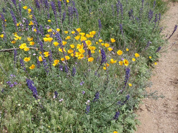
- Wild Flowers
Season
- January
- February
- March
- November
- December
Solitude
Difficulty
Permits
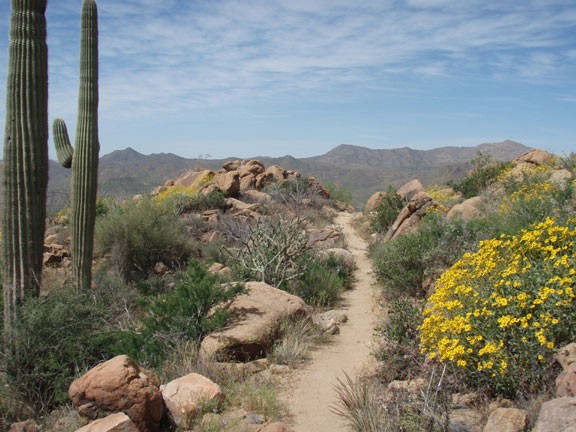
Hike to Ballantine creek in the Superstition Wilderness, Arizona.
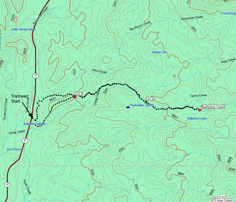
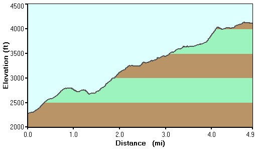
From the trailhead, there are two directions to pick from. Either direction gets you to the Ballantine trailhead and you can always take the other route on your return, so it doesn't matter which you choose. On this hike, we turned right here and started on the Pine Creek Loop South. From this point, the trail climbs steeply up to a hill overlooking the area. It's about 1.25 miles to the top of this hill for the views. Another 0.25 miles of hiking and a slight descent gets you to the intersection of the Ballantine trail and the Pine Creek North Loop (shown on the map as Jct 1). Turn right here to take the Ballantine trail.
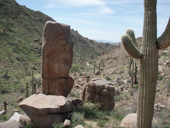
The trail is still in excellent shape as you make your way through the boulder garden. The climbing continues, but is never really steep. After another mile of hiking and climbing, you'll reach Camp creek. This is a seasonal creek and your best bet for finding water in it is shortly after a rain. After walking along the creek for 0.3 miles, you'll reach a trail junction (shown as Jct 2 on the map)... or more precisely, several trail junctions.
This can get tricky. You'll see a trail jutting off to the left. Stay right here. After a few dozen yards, there is another trail junction with a trail leaving to the right. You'll stay left here, along the trail that generally heads East and follows along Camp Creek.
The trail is still easy to follow as it tracks Camp Creek. Once the trail starts to leave the side of the creek, it gets a bit rockier and will be more tricky to follow. Watch for the cairns. This section climbs out of the Camp Creek drainage over a ridge. Be sure to look back for an impressive view of the Camp Creek drainage and the wilderness around.
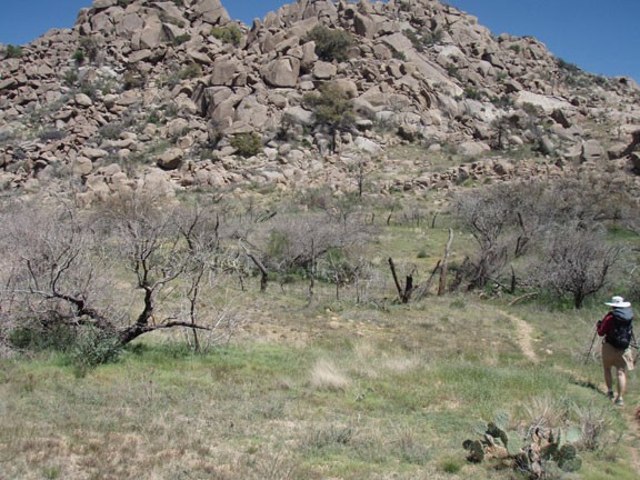
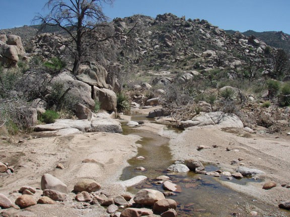
From the top of the ridge, it is easy to spot our turn around point, Ballantine creek. The trail flattens out here and passes through an old corral. If you're lucky (or planned this hike well) there is water in this seasonal creek. This is a good place to find a comfortable rock and have some lunch. As you look around, it is easy to notice that this area is recovering from previous fires. If you're observant, you probably spotted a pine tree or two in this area that managed to survive. After lunch, return the way you came.
When you reach Jct 1 on the map, make a right turn to take another route back to the trailhead (Pine Creek North trail). This section of trail is more gradual than the Pine Creek South trail and has better views of Pine Creek. A short 1.5 miles later will return you to your car.
