
- Hikes in Arizona
- Superstition and Mazatzal Wilderness
- Peralta Canyon to first water
Peralta Canyon to first water
Location
To get to the Peralta Trailhead: From the Phoenix area, take US-60 East, leaving the city limits. After leaving Apache Junction, continue about 8.5 miles, turning left onto signed Peralta Road (FR 77). After starting out as a paved road, this quickly turns into a maintained dirt road. The signed trailhead and parking appears after 7 miles on this road. There is a restroom here, but no water.
To get to the First Water Trailhead: From the Phoenix area, take US-60 East, leaving the city limits. Take the HWY-88 exit (Idaho Road). About 5.5 miles after leaving Apache Junction, turn right on to signed First Water Road (FR 78) Continue a little over 2 miles to the signed trailhead. There is a restroom here, but no water.
Hike details
Season
- January
- February
- March
- April
- October
- November
- December
Solitude
Difficulty
Permits
Hike from the Peralta canyon trailhead to the First Water trailhead through the heart of the Superstition Wilderness, Arizona.
This is a shuttle hike. If you can't sweet talk one of your friends into dropping you off at one end of the trail, you will have to use two cars. All the trails in this hike are well marked.
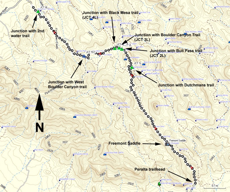
From the Peralta Trailhead:
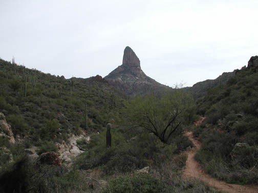
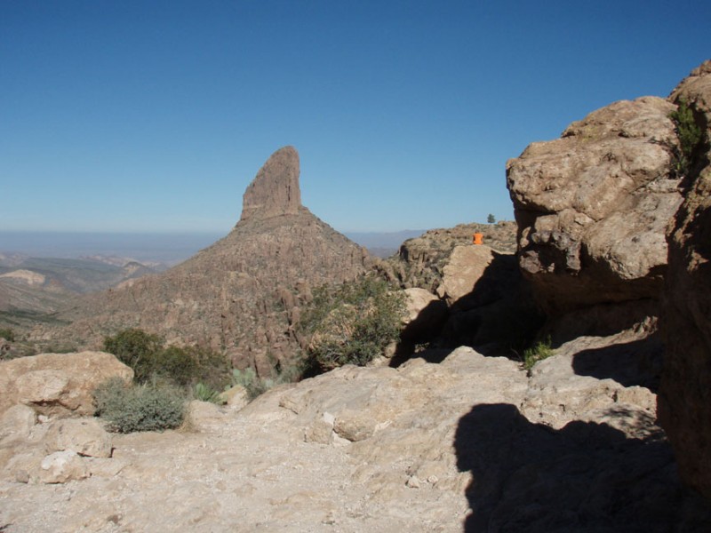
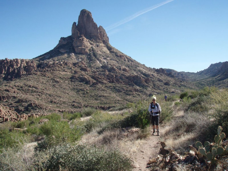
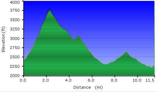
From the parking area, take Trail 102 (Peralta Trail) about 2.6 miles to Freemont Saddle. Your first view of Weavers Needle appears here. Nearly all of the elevation gain of this hike is to get to this point. Many day hikers will turn around at this view, so you will have some solitude for the remainder of your hike.
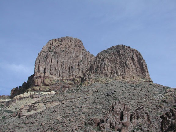
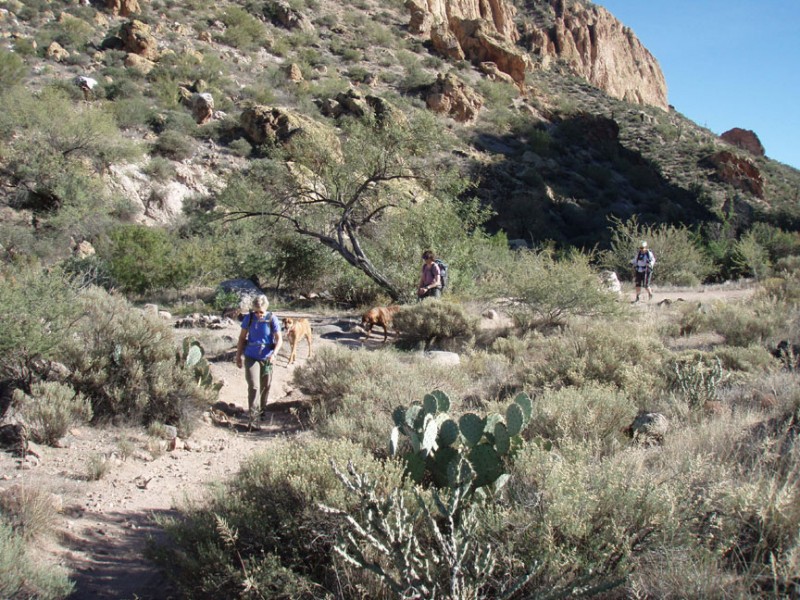
Continue on Trail 102 about 2.4 miles past Weavers Needle into east Boulder Canyon. This part of the canyon is very different than the one you just left. The interesting rock spires are still here, but there is a desert wash that, during rains, supports vegetation. There are some interesting views of the Needle that people rarely see from this side. As you continue you will be heading towards a light colored mountain, called Palomino Mountain. This makes a good landmark to judge your progress.
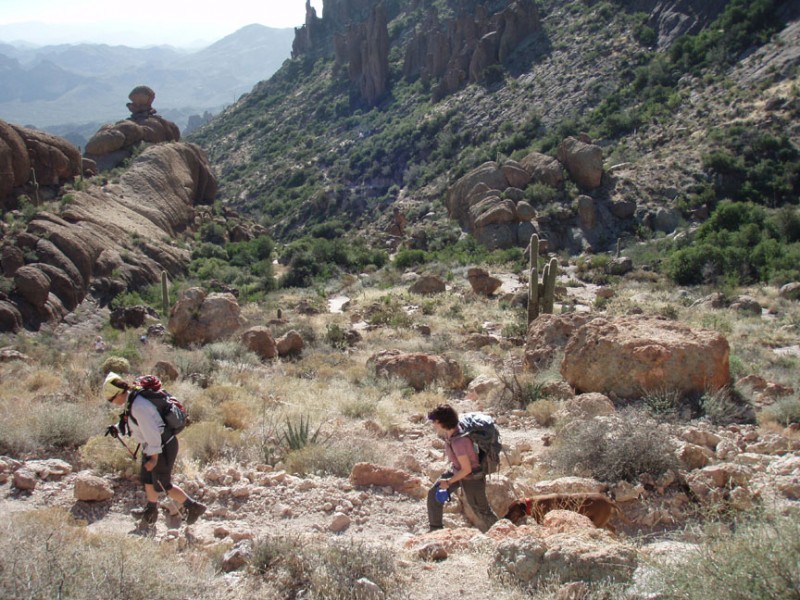
Continue on Trail 102 to Trail 104 (Duchman Trail), about 1.5 miles away (turn left at signed JCT 1L on the map). Walking through Boulder Canyon is another surprise, with huge rock walls towering on either side. Turn around once in a while to see another view of the Needle. As you start to emerge from East Boulder canyon, there are several signed trail junctions to navigate. The Bull Pass trail comes in from the right at signed junction JCT 2L on the map. Stay left here to stay on the Duchman trail (Trail 104). Soon after, the Boulder Canyon trail comes in from the North. Again, stay on the Duchman trail at this signed junction (JCT 3L on the map). After a little more hiking, the Black Mesa trail also joins from the North. Stay on the Duchman trail at this signed junction (JCT 4L on the map).
Continuing on Trail 104 1.4 miles, you will head towards Parker pass. There are several trails in the area, so use those route finding skills. There is another trail junction in this area, as the West Boulder trail comes in from the South. Stay on Trail 104 (Duchman trail) at this signed junction (JCT 5ST on the map).
From Parker pass, finish the final 3.0 miles to the first water trailhead. Stay left at the signed junction with the second water trail (JCT 6L on the map).
If you liked this hike, you might want to try some of the other hikes in the Superstition Wilderness.
