
- Hikes in Arizona
- Superstition and Mazatzal Wilderness
- First Water (Black Mesa to Dutchman Loop)
First Water (Black Mesa to Dutchman Loop)
Location
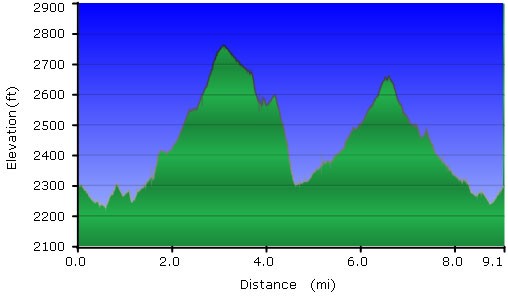
Hike details
Season
- January
- February
- March
- April
- October
- November
- December
- May
- June
- July
- August
- September
Solitude
Difficulty
Skills
Permits
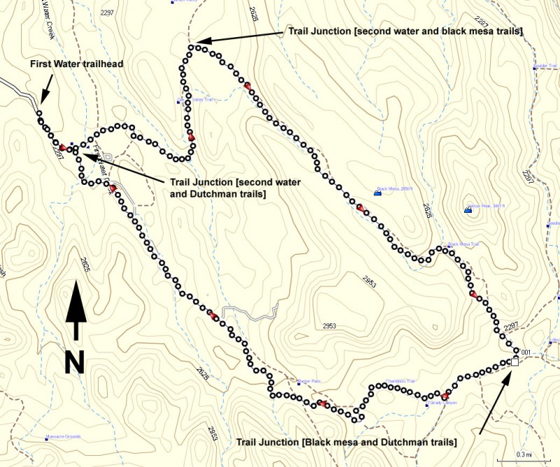
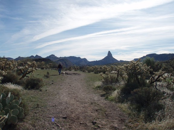
Loop hike from the First Water trail on the Black mesa trail and the Dutchman trail in the Superstition Wilderness, Arizona.
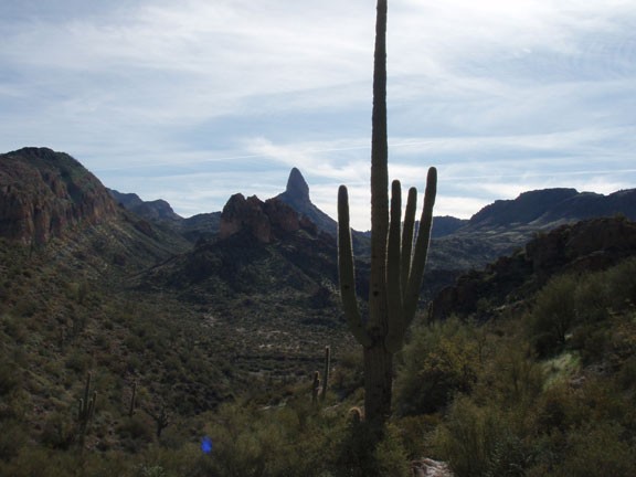
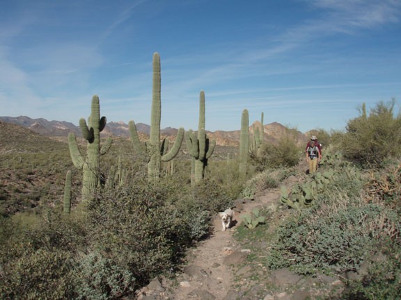
The first water trailhead leads to a signed fork after about 0.2 miles of hiking. Stay left here for the second water trail. After about 1.4 miles, this trail forks again. Taking a RIGHT at the signed second fork, will put you on the Black Mesa Trailhead. This trail winds through the desert, through a cool Cholla forest, finally reaching a great view of Weavers Needle. This area is known as Garden Valley.
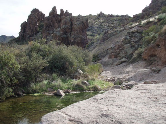
After about four miles of hiking, you will cross a wash and will need to start looking for the Dutchman trail, which will be our return path. The trail back to the South and East is after you cross the first wash, but before you cross the second wash. While it's signed, it's a little tricky to find. If you find yourself continuing toward weaver's needle after crossing the two washes, then you've missed it.
The Dutchman trail returns to your parking area via Boulder basin and Parker pass. After four miles, more cool rock formations, and easy walking takes you back to the start.
If you wanted to, you can also take this hike in the reverse direction, starting on the Dutchman trail (bear right at the first fork) and then return via the Black Mesa Trail.
