
- Hikes in Arizona
- Phoenix Area and Central Arizona
- Palo Verde Trail
Palo Verde Trail
Location
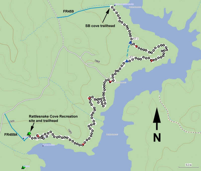
To get to the trailhead: From the Phoenix area, HWY-101 North to the Pima road exit and head North. Continue north on Pima until you reach the intersection of Pima Road and Cave creek Road. Make a right (East) onto Cave Creek Road. From Cave Creek Road, turn right onto Bartlett Dam Road and continue 13 miles into the park. After paying your fee ($6 per car as of 4/2013) continue on FR459 (Signed as North Lake Road) to the sign for Rattlesnake Cove. Make a right here and go an additional 0.7 miles to the parking area at the picnic tables. The signed trailhead is at the north end of the picnic area.
Hike details
- Water
- Wild Flowers
Season
- January
- February
- March
- April
- October
- November
- December
- July
- August
Solitude
Difficulty
Permits
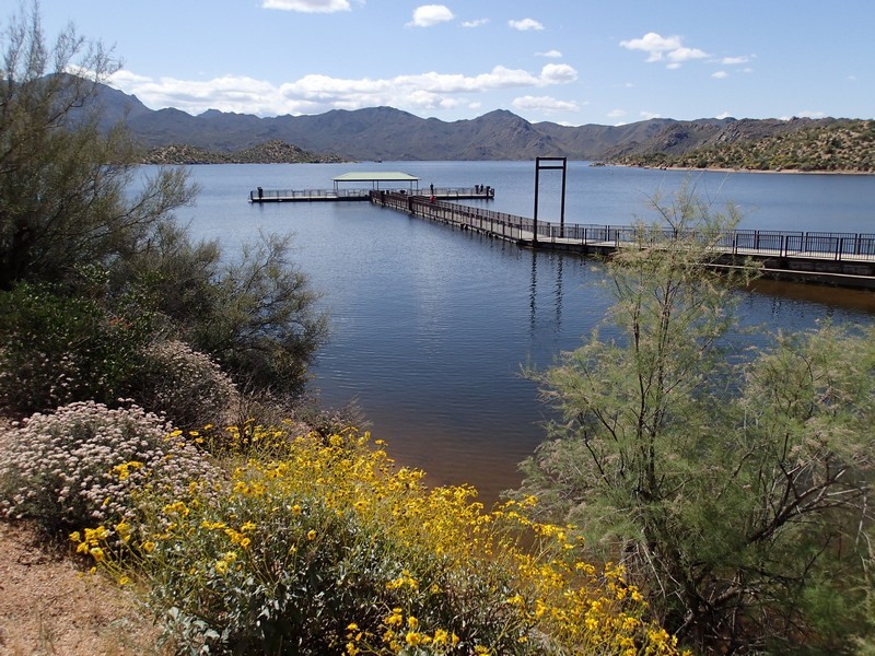
Hike the Palo Verde trail along Bartlett Reservoir near Phoenix, Arizona.
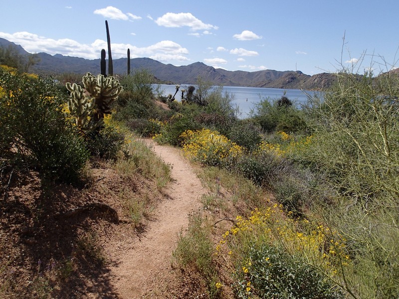
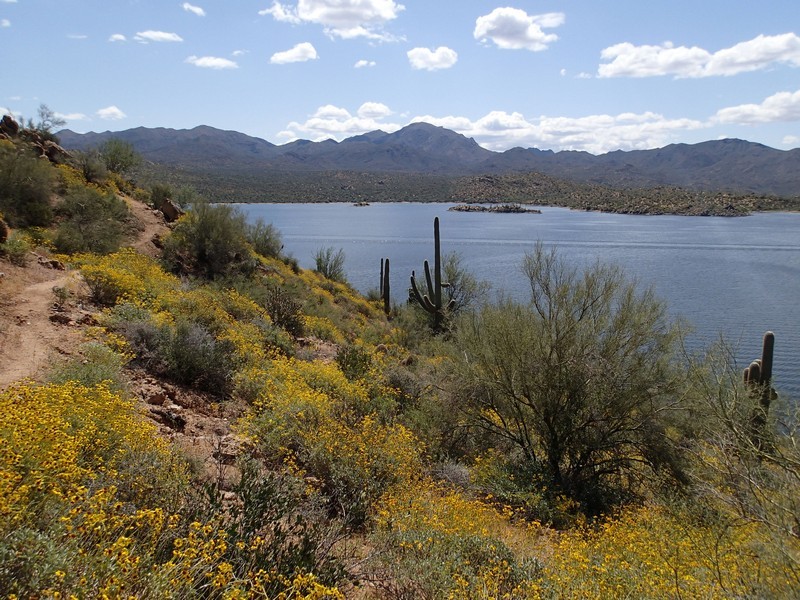
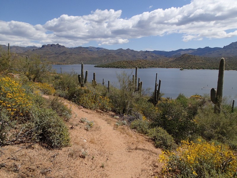
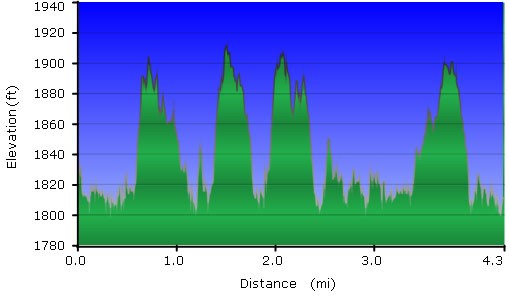
The well worn trail starts at the Rattlesnake cove picnic area and follows the western edge of the Bartlett Reservoir as it winds north. This is a classic Saguaro desert, with the usual suspects of Cholla cactus and scrub, although with the very unique backdrop of a nearby lake. We hit this hike on a near perfect winter day, with a high of 74F, a light breeze off the lake, and clear skies. You can see the four peaks and the Mazatal mountains from this trail, but the eyes always seem to travel back to the Reservoir. The trail travels up and down through small coves created by the Reservoir.
For most of the trail, there are pretty good signs pointing the correct direction. There is one section that requires some route finding skills. As you get close to the turn around point (SB cove), there are two trail signs, one pointing right and one pointing straight (JCT on the map). The trail to the right leads out to a view on a point extending into the reservoir. The trail pointing left takes the more direct route to SB cove. We chose to stick close to the water and went right. After passing this point, it can be difficult to stay on trail. Watch for cairns here and keep your bearings. We lost the trail a few times after this point, but ended up finding it again without too much trouble. The turn around point for this hike is easy to see, as the SB cove has a boat launch and several boaters enjoying the nice beaches here. This is the turn around point.
As an alternate, you could do a point to point if you had a car or bike shuttle, as there is a paved road from this point back to Rattlesnake Cove. If you're lucky enough, you could even run a boat shuttle from this point.
The best treat for us was actually on the drive back, as we spotted two Arizona Bobcats from the road. Unfortunately for us, they were a little to shy to pose for pictures.
