
- Hikes in Arizona
- Phoenix Area and Central Arizona
- Quartz Peak
Quartz Peak
Location
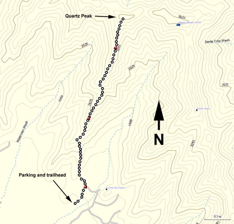
To get to the trailhead: from the Phoenix area, take I-10 West. Take exit 126 (Estrella Parkway). Go 8.3 miles south (left) on this road to Elliot Road. Turn right on Elliot road and go 2.7 miles to Rainbow Valley road. Turn left on signed Rainbow Valley road. Take Rainbow Valley road 9.5 miles to the intersection with Riggs road. Turn left here onto Riggs Road and follow this road 3.9 miles. This road will end in a T intersection (at Bullard Ave). Turn right and then immediately turn left onto the unsigned dirt road. Take this dirt road 5.4 miles. This road requires a high clearance vehicle and can be sandy, so use good judgement. After driving the 5.4 miles on this dirt road, you'll reach some power lines. Turn right here and go 1.9 miles on another unsigned dirt road (although there is a small hiking marker at this intersection). After driving 1.9 miles, make a left turn here (small hiking marker at this intersection) and head towards the mountains for 1.9 miles to the well marked trailhead. High clearance vehicle is recommended. Don't take this road if it has been wet. Keep your eye out for 4WD and dirt bike enthusiasts here. The trailhead has a restroom but no water.
ALTERNATE 4WD ROUTE: Take I-10 South to SR347. In the town of Maricopa, turn right (West) on SR238. Take this road 9.4 miles to mile 35. A power line crosses the road here. Just after the power line on the right is a gate. Go through this gate and take this rocky 4WD road 9.9 miles. The road stays under the power lines the whole time. After 9.9 miles, turn right and go another 1.9 miles towards the mountains to the well marked trailhead. Keep your eye out for 4WD and dirt bike enthusiasts here.
Hike details
Season
- January
- February
- March
- April
- October
- November
- December
Solitude
Difficulty
Permits
Hike to Quartz peak near Phoenix, Arizona
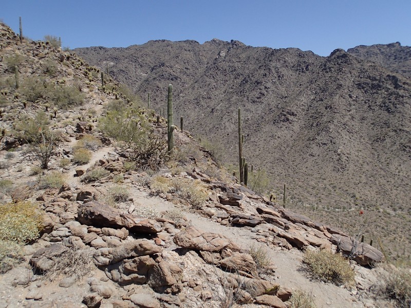
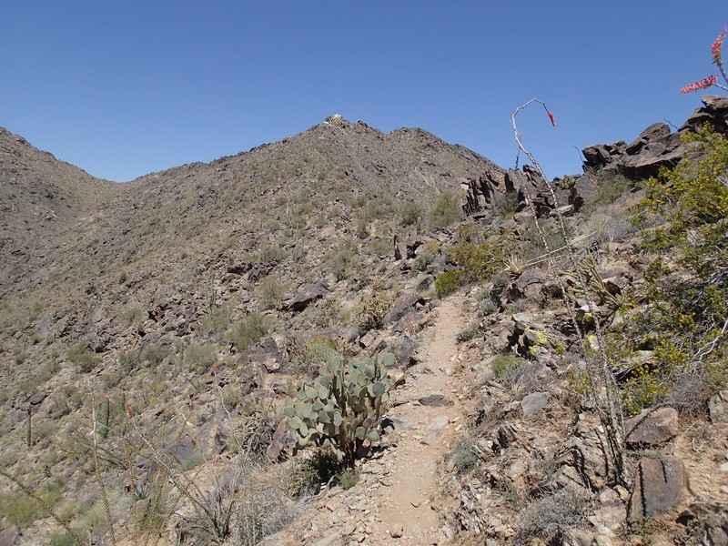
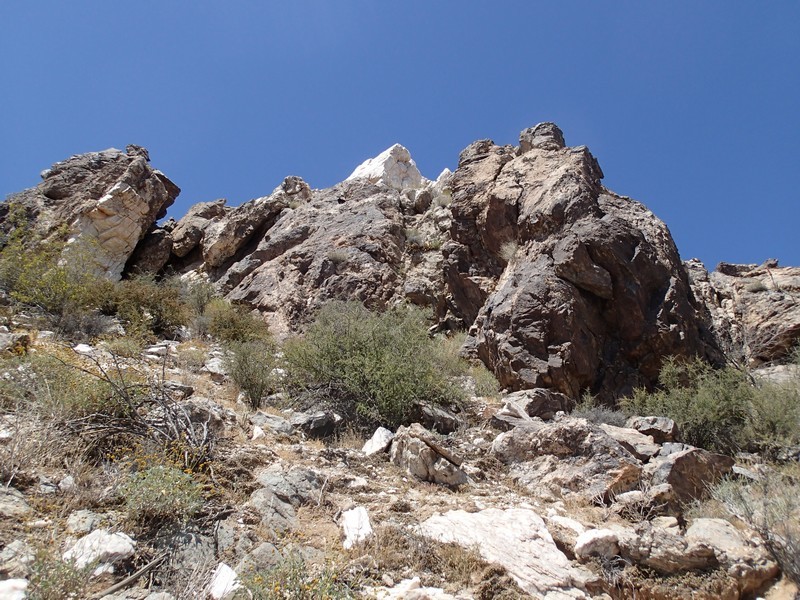
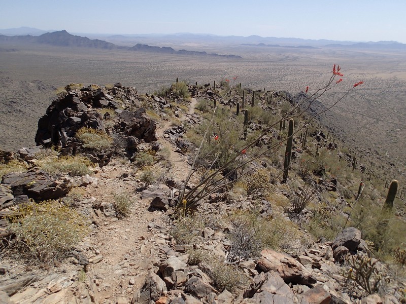
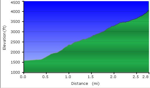
The hike starts in a typical Sonoran desert, with Cholla and Saguaro along the trail. The flat start of the hike gets you warmed up for the climb. Once the trail reaches the base of the Sierra Estrella mountain range, be prepared for sustained climbing. The trail is well marked and in good shape. The higher the climb, the better the views, and there are plenty on this hike.
At about mile 2.5, the trail starts to fade, eventually becoming a series of rock cairns. Continue climbing here, as the views from the peak are well worth the added effort. Your route finding skills will come in handy here. Try to stay along the ridgeline that you have been hiking the entire time and you will be able to stay on the right route. Your goal is the white tipped peak you see at each false summit. The last part of the hike to the top takes a little scrambling.
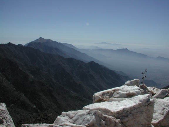
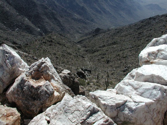
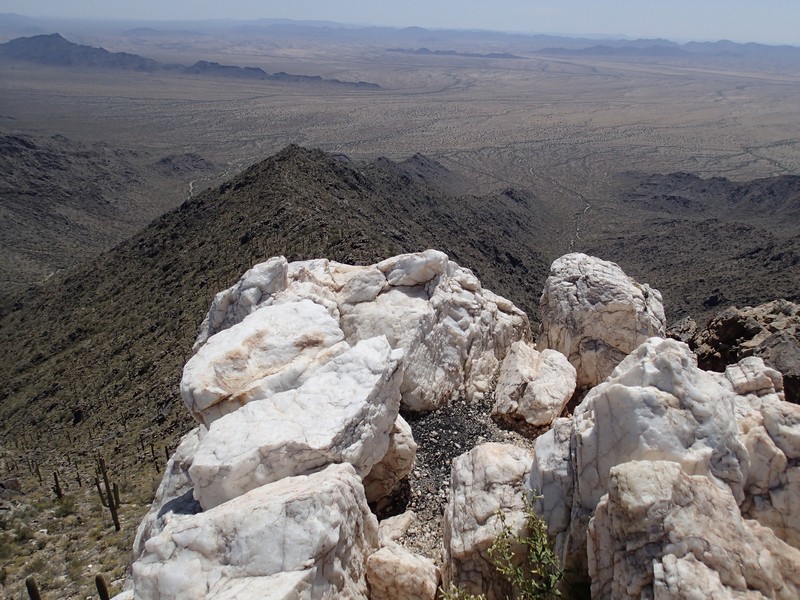
There is a dual reward for your effort. The top is made up of pink quartz boulders, which stay cool and make for a nice geological change from the typical desert peak. The other reward is the outstanding 360 views at the top. You can see the entire Sierra Estrella range from here, as well as downtown Phoenix to the North East and Rainbow Valley to the west.
Enjoy this view while you can. Rainbow Valley is in the process of being sold to developers. The view of this pristine desert near Phoenix will be drastically changing in the near future. There aren't many secluded desert mountain climbs this close to Phoenix any more, so enjoy this one.
Return by the same route.
