
- Hikes in Arizona
- Phoenix Area and Central Arizona
- Devils Chasm
Devils Chasm
Location
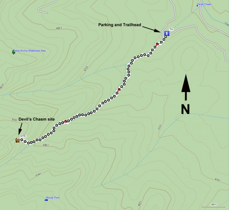
To get to the trailhead: from the Phoenix area, take US-60 East towards Globe. Just after Miami and before globe, take HWY-88 (or 188 depending on the sign) left towards Roosevelt. Make a right onto well signed HWY 288. About two miles after crossing the Salt River, turn right onto Cherry Creek Road (signed as FR203), a well graded dirt road. You will continue to follow this road for 22.5 miles. Some waypoints follow (remembering to stay on FR203 the whole time):
After 8.8 miles, a sign for Coon Creek FR203 takes you across the creek and onto private property. Please respect this property so we can continue to have access to this area.
After 11.7 miles, you'll cross the creek again.
After 19.5 miles, you pass the Ellison Ranch and cross the creek again. After this point, the road becomes 4WD mandatory.
After 21 miles, you will see a sign that explains the "Sierra Ancha Cliff Dwellings" in this area.
After 22.5 miles, park near the Forest Service sign near some camping on the left.
Hike details
Season
- January
- February
- March
- April
- October
- November
- December
Solitude
Difficulty
Permits
Hike to Devils Chasm in Arizona
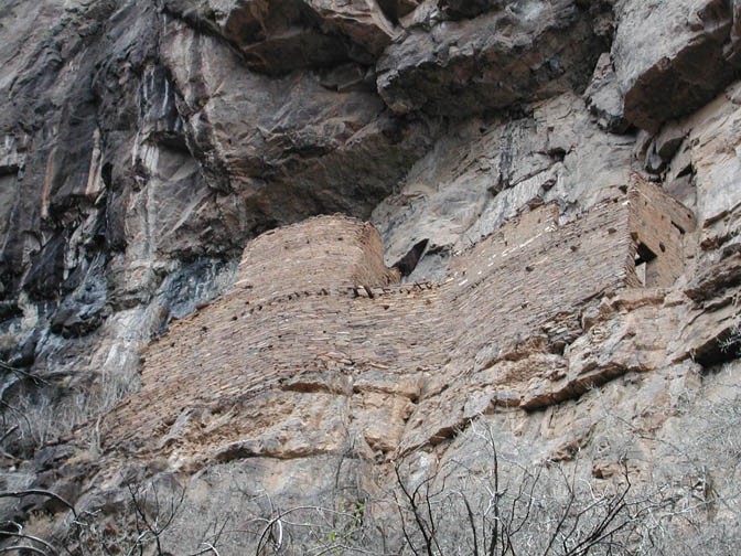
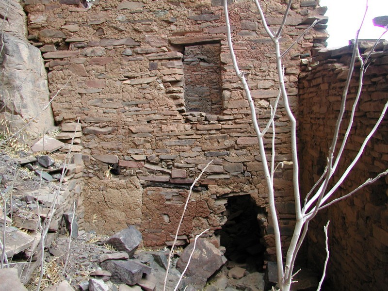
The ruins that are the destination for this hike were built and occupied by the Salado Native Americans between 1280 and 1350 AD. The approach to get to these ruins is nearly as impressive as the ruins themselves.
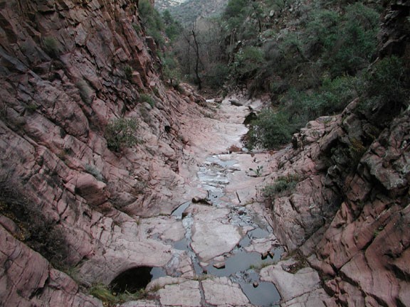
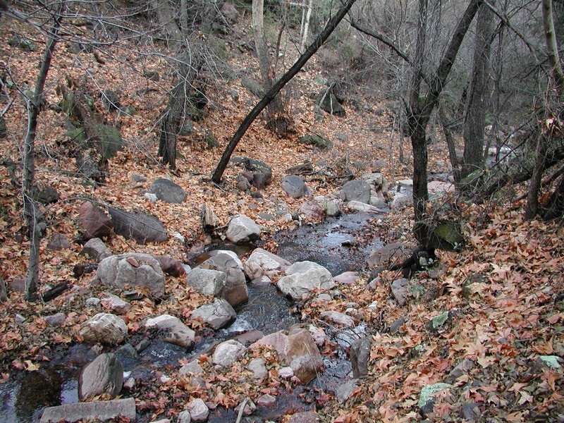
The hike starts at the makeshift parking area. There is a trail to creek left that parallels the drainage. The trail can be difficult to follow in places, so keep a sharp eye out for Rock Cairns and faint trails. If you have stayed on the trail, you will enter some slick rock narrows. There is a rock fall here that you need to scramble to the right to navigate. There are some additional scrambles as you continue your progress up this part of the canyon. The scrambles aren't difficult, but have a little exposure. Continuing your progress up creek, you will eventually be on a trail on the left part of the canyon. After you reach two large boulders, start to look to your right for a steep paths up the creek wall on your right. This path is quite steep and have very poor foot and handholds. This is the toughest part of the hike. Keep looking up on the canyon walls to your right and after some climbing, the ruins will come into view. There is a scramble route into the ruins on the left.
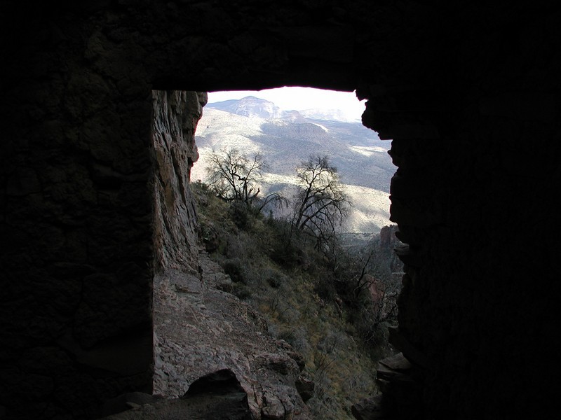
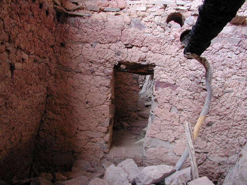
These ruins are in excellent shape, with several rooms, doors, and a roof all well preserved. Some of these doors are a snug fit! Keep your eyes out for pottery shards and stones used for grinding corn, which are also in evidence. While enjoying these ruins, try to imagine why these people lived in such an area. Please be very gentle with this area and leave everything as it is for your children to enjoy one day.
As you are descending again, keep your eyes open to the right of the ruins and you can see additional walls. Looks like they were building a guest suite when the time came to leave. There is also a small cave to your left to explore as you near these ruins.
Return by the same route.
