
- Hikes in Arizona
- Mogollon Rim
- Military Sinkhole Trail #179
Military Sinkhole Trail #179
Location
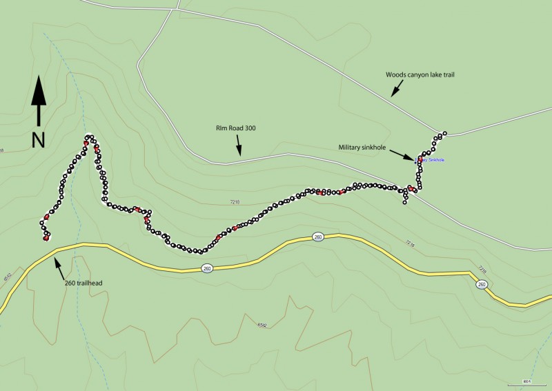
To the Trailhead: From the Phoenix area, take HWY-87 to the junction of HWY-260. Turn right on HWY-260 and go about 26.0 miles to the signed trailhead for the 260 Trailhead on your left. There is a restroom here and plenty of parking, but no water.
Alternate Trailhead: Continue on HWY-260 until you see the turn off for FR300 (Signed as Rim Lakes or Woods Canyon Lake). Go about 1.9 miles to the Military Sinkhole Scenic Vista on your left and park. The signed trailhead is just to the west of the parking lot.
Hike details
Season
- June
- July
- August
- January
- February
- December
Solitude
Difficulty
Permits
Hike up the Mogollon rim via the Military Sinkhole trail in Arizona.
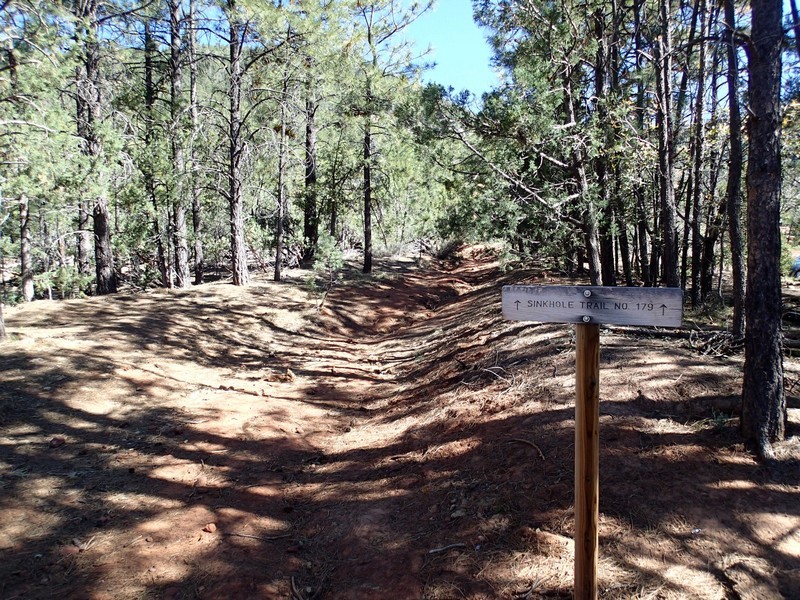
From the parking area, take an immediate right to a signed and well worn trail. Don't make the mistake of taking the well signed Highline trail #31.
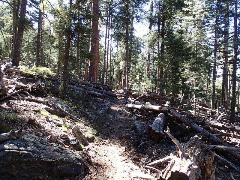
The first part of this hike bends East as it follows along the bottom contour of the rim, slowly gaining altitude. This section is well shaded, very lush, and the well worn trail is not too difficult to follow. One of the prime highlights of this trail is the solitude. It is quite calming to walk silently and enjoy the hopping horny toads, lizards, and birds as you walk through here. During our hike we were uniquely rewarded for our silence. About 15 minutes into the hike, we startled two black bears. One was a medium size brown colored mother with her small black colored cub. This was the first time in 30 years of Arizona hiking I had ever seen a bear and it was a truly exhilarating experience. Unfortunately, they were too quick for me to snap a picture so you'll just have to take my word for it!
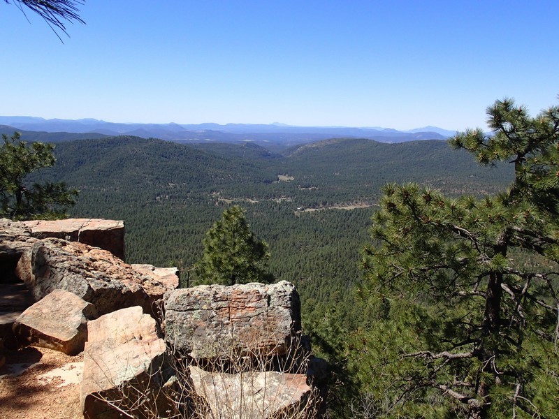
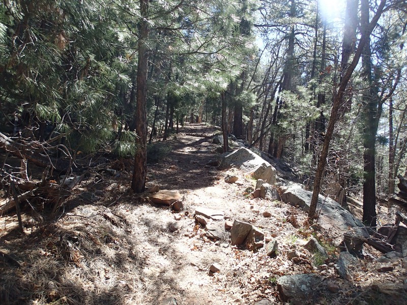
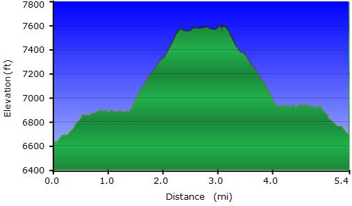
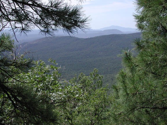
As the trail continues it's gradual climb through Oak and Pine trees, it soon turns into a wider road and the forest thins out. This change is desirable, as now periodic views of the forest below the Mogollon Rim open up to delight and inspire. The final mile of this hike climbs more steeply and eventually tops out at the Military Sinkhole Scenic Vista.
The vista is a nice place to pick a rock and have a snack while enjoying the mesmerizing views of the forest below.
In case you're wondering where the sinkhole is... you'll have to keep walking across FR300 to find it. It's another 1/4 of a mile from the rim. The trail is named for the upper portion of it, which was constructed by the troops commanded by General Crook. General Crook was fighting native Americans at the time and they used the sinkhole as a watering stop. The sinkhole itself looks more like a valley then a sinkhole, so it isn't very impressive. The views from the rim are much more interesting!
When you've had enough, head back the way you came. Keep an eye out for bears!
