
- Hikes in Arizona
- Mogollon Rim
- Pine Canyon
Pine Canyon
Location
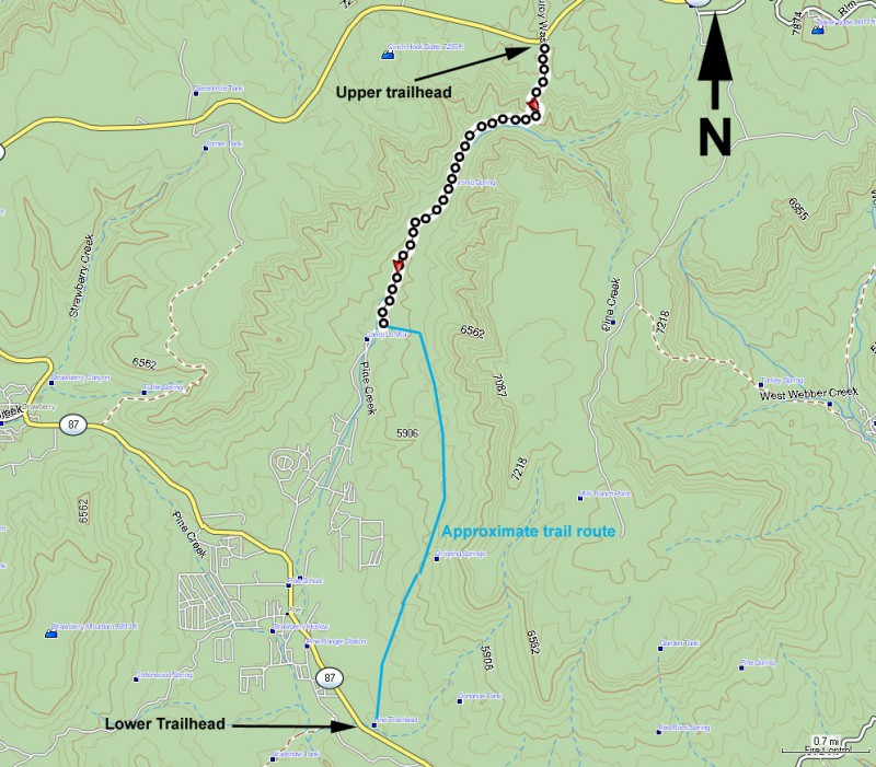
To get to the trailhead: from the Phoenix area, take HWY-87 North toward Payson. Stay on HWY -87 as you head towards the town of Pine.
LOWER TRAILHEAD: Just after mile marker 267, turn right and follow the sign for the Pine Canyon Trail.
UPPER TRAILHEAD: Continue past the town of Pine and the town of Strawberry on HWY-87. At mile marker 279.7, turn right onto FR6038. This turnoff is not well signed so you need to be on alert after passing mile marker 279. Once turning onto FR6038, it is less than 0.1 miles to the trailhead. Passenger cars are OK here. There is a trail head sign on the left that reads Pine Creek Trail.
Hike details
Season
- June
- July
- August
- January
- February
- December
Solitude
Difficulty
Permits
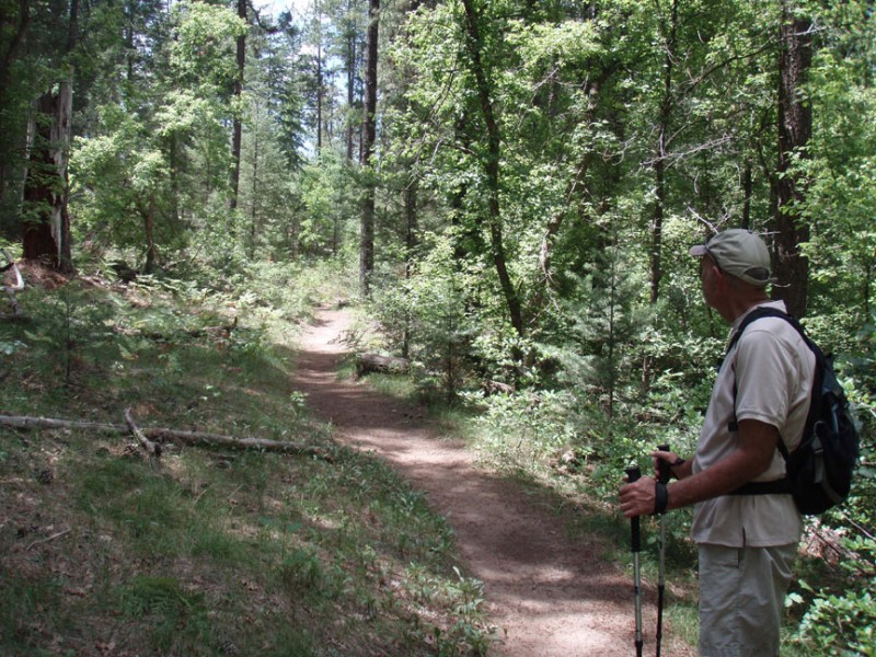
Hike on the Pine canyon trail on the Mogollon rim in Arizona.
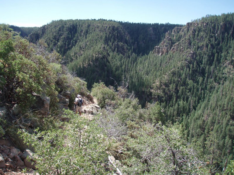
The Pine Canyon Trail goes from the top of the Mogollon rim down to the town of Pine while roughly following the Pine Creek as it travels through Pine Canyon.
We started this hike at the upper trailhead. The trail starts as a wide forest road, but quickly turns into a normal trail once you reach the canyon wall. From here, it is a switch backing descent 1400 feet to the creek through a Ponderosa pine forest. The views here are tremendous and make this section quite enjoyable.
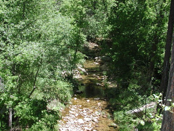
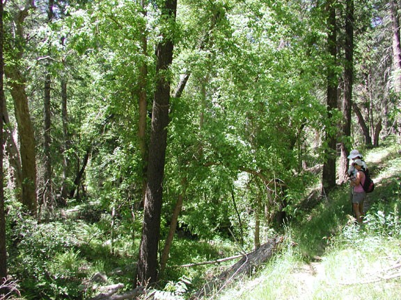
After descending about 2.5 miles, you will reach the creek. As the trail moves closer to the creek, the scenery changes to a lush old growth forest, with soft ferns accentuating gigantic trees. There are plenty of butterflies in this area enjoying the flowers. Making this area possible is the clear Pine creek providing the needed water. This area is truly magical, especially for Arizona.
When we did this hike, there was a good bit of dead fall to navigate around. In some cases, signs have been put up to help navigate. There are also signs for some of the side canyons, as well as a sign marking "Tiny Cave". The cave is pretty underwhelming.
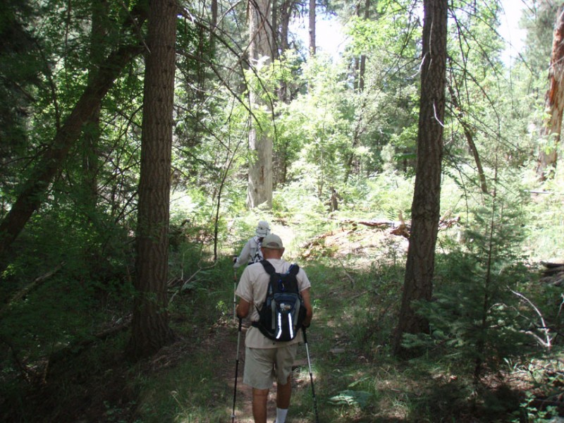
This mystical green forest continues for several miles. I turned around at the 4 mile point to head back up the canyon to the car, as my companions continued on the trail to the lower trailhead.
I made it to the upper trailhead and drove back into Pine to pick them up at the lower trailhead, but they were not there. They had inadvertently taken one of the side trails that detoured into the town of Pine. Seems there are a number of trails in the lower area and it is easy to get on one of these side trails.
The mossy and lush forest is the true destination of this hike. If you are interested in a less strenuous alternative, I would recommend using the lower trailhead and hiking into the forest. When the trail starts up the side of the canyon, turn around. Of course, the penalty for this is missing the great views of the canyon from the top of the rim.
Whichever way you choose, you will enjoy this wonderful place.
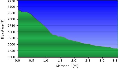
I tried to get a GPS map of our hike, but since my companions got lost, it is not accurate for the length of the hike. The blue line on the map is a very, very general indication of where the trail goes. The black line is the correct GPS points of the trail. The profile is only from the section of the trail from the upper trailhead to the camp.
