
- Hikes in Arizona
- Mogollon Rim
- Box Canyon (Christopher Creek- *Technical)
Box Canyon (Christopher Creek- *Technical)
Location
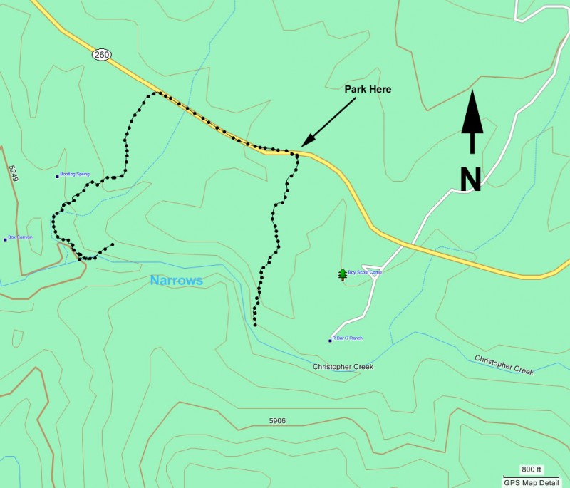
From the Phoenix area, take HWY 87 North towards Payson. Once in Payson, take HWY 260 east toward Kohl's Ranch, AZ. Once you near mile marker 271, you have several parking choices.
, You can turn right on the unmarked road at mile 269.9 and park on the side of the road.
, Between mile markers 271 and 272 (at mile 271.3), there is an unmarked informal parking area on the right. There is a break in the guard rail that provides a parking location. The crown of the side of the road is such that you'll probably want a high clearance vehicle if you decide to park here. The trail has been marked with a pink ribbon by hikers, but there's no guarantee how long this will last.
, East of the other two parking areas and east of the boy scout camp (private) is the signed road for Christopher Creek campground. Turn right here and park at the day use area ($6 self pay fee).
Hike details
another 1.0 miles down the box canyon.
for the technical canyon loop, it's three slow miles.
- Out and Back
- Loop
Season
- June
- July
- August
- January
- February
- December
Solitude
Difficulty
,,,Kids love the swimming... bring them along but turn around when it gets technical
Skills
Permits
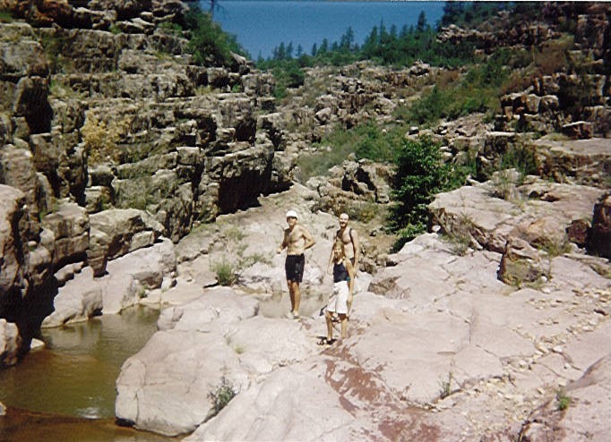
Canyoneering in Box canyon of Christopher creek, Arizona.
Access to this area is in a constant state of change. There is construction ongoing on HWY-260 and as a result, the historic place to park is gone. See the details in the 'How to get there' section for suggestions on where to park. This write up assumes you parked at mile marker 271.3. If you didn't, hike along HWY-260 from either of the two other parking spots to this location to start the hike.
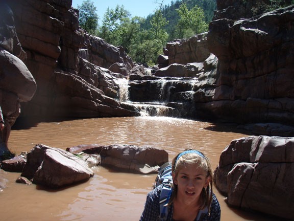
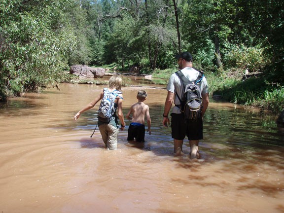
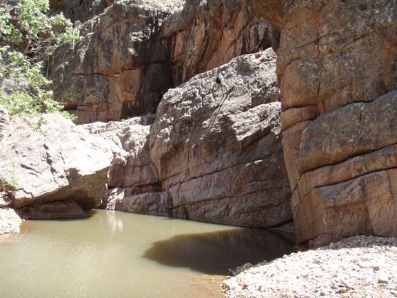
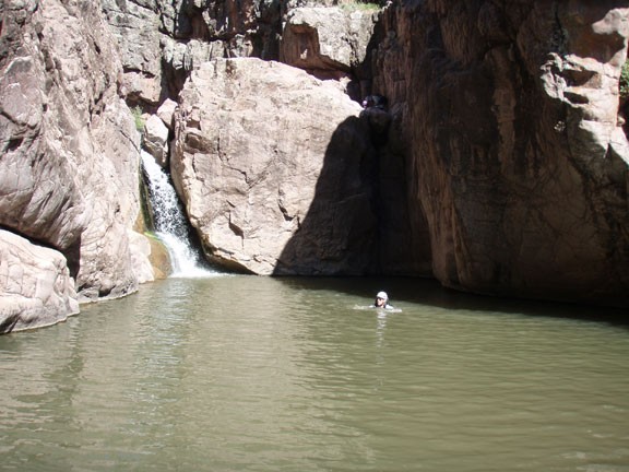
This is a great hike to escape the Phoenix heat in the summer. From the trail shown from HWY-260, it's about a 30 minute walk along a well marked trail through a pine forest to the canyon creek. Once you get to the creek, the fun begins. Start making your way through the water down creek. Your progress will be marked with swimming from one pool and jumping into the next. Warning: Don't jump if you can't see the bottom and know the water depth or obstacles. We've done this canyon in varying water conditions. Sometimes the water is clear and sometimes it is cloudy. Always check the water depth before jumping; no exceptions. Flash floods change this canyon all the time. Stuff that was safe to jump into can become unsafe after a rain. Please use good common sense. Continue until you get tired, find a nice place to hang out, or get to a place that looks too dangerous for your abilities to make your way back. This place is a blast!
It's a popular place in the summer. If you get there early, you will have more privacy. Also, the further downstream you go, the less people there are. You used to be able to go up-creek, but the boy scouts have put up barbed wire and no trespassing signs across the creek.
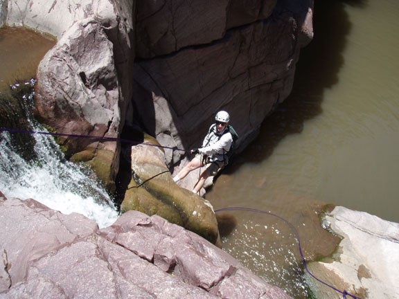
For the downstream direction of hiking, when the water rushes over a place that is too difficult to downclimb, this marks the turnaround point for those without technical canyoneering skills. For those with rappel anchors, a 100' rope, belay devices, helmets, and training, this is the first rappel area. You could downclimb it, but it's a bit sketchy. The rappel is only about 10 feet. We used sling in a crack on canyon left to rappel down the waterfall. There is also two bolts on canyon right that results in about a 40' rappel.
The second rappel is about 40 feet. We rappelled using sling high up on canyon left (looking downstream), with the rappel ending in a large pool of water. There are also two chains from bolts hanging from the wall in this location that can be used.
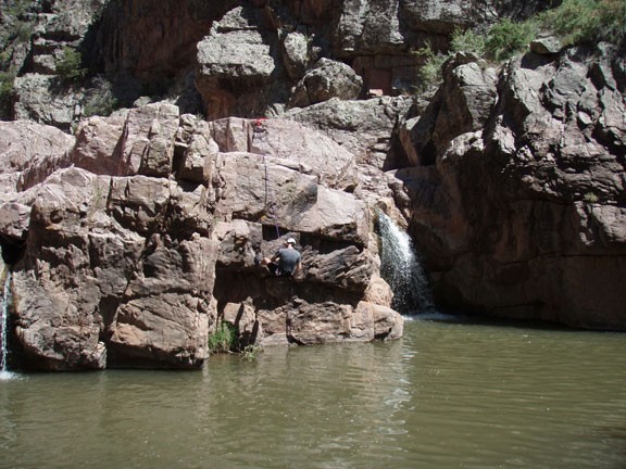
The third rappel is about 25 feet. There are two obvious bolts in the middle of the canyon to rappel into the water. Although it looks tempting to jump here, don't do it. The water is actually shallow.
The fourth rappel (and the most fun) is about 35 feet. There is a single bolt on the left side of the canyon we rappelled off of. About halfway down the rappel becomes overhanging, finishing in a swim.
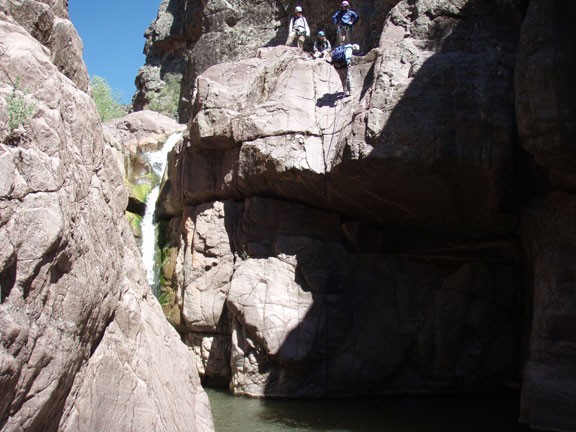
The fifth rappel is about 20 feet. You can sling the chock stone on canyon left or the right. We chose the left, but they both have very awkward starts. The bottom of the rappel results in a swim.
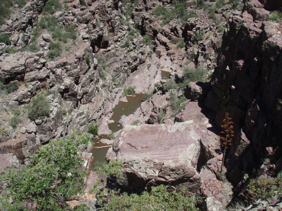
After this final rappel and swim, continue down the canyon until a very prominent side canyon enters from the right. Find a way to the bottom of this canyon (we went up and over on the right side of Christopher Creek to get there with a bit of scrambling). Stay in the bottom of this side canyon as long as you can. Eventually, it will cliff out. Look at the rocky incline on your left and follow the cairns up and out of the canyon, eventually leading to HWY-260. The cairns can sometimes be tough to find, so use those route finding skills.
After finding HWY-260, turn right and walk the short 0.5 miles back to your car.
