
- Hikes in Arizona
- Phoenix Area and Central Arizona
- Pinnacle Peak
Pinnacle Peak
Location
From the Phoenix area, take US-101 North to the Pima Road Exit. Continue North on Pima until you reach Happy Valley Road. Make a right turn (East) onto Happy Valley Road and go about 1.5 miles to Alma School Road. Turn left (North) onto Alma School Road and follow for about 0.7 miles. Turn left on Pinnacle Peak and travel another 0.25 miles to the trailhead and parking. Parking can get crowded on weekends.
Hike details
Season
- January
- February
- March
- April
- October
- November
- December
Solitude
Difficulty
Permits
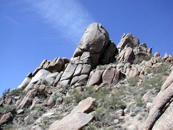
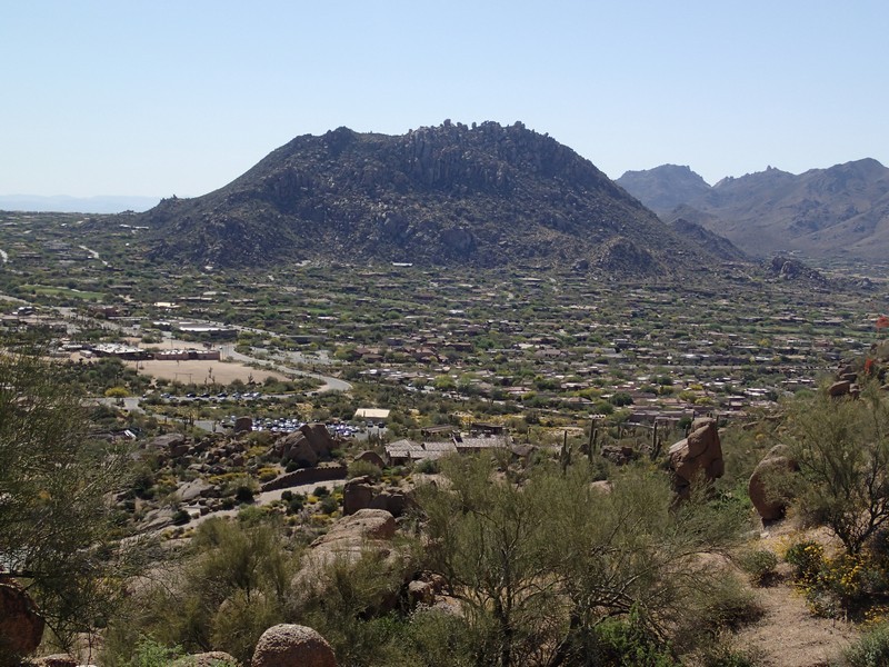
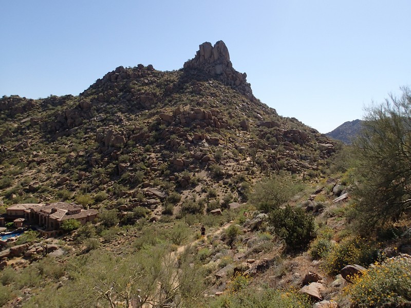
Hike along Pinnacle peak in Scottsdale, Arizona.
This trail has a storied history. Back in the 1989, hikers and rock climbers had access to this peak for recreation. This area was "temporarily" closed in 1995 as new homes and a golf course were put up around the peak. The closure was supposed to last one year. When it came time to re-open the access to the peak, the new homeowners decided they didn't want to share the peak with anyone and refused access. Now, after nearly seven years, access to this trail and it's excellent climbing routes are once again open to the public (as of April 2002).
For a detailed history of this epic battle, visit the web site of the Phoenix Rock Gym at www.phoenixrockgym.com.
This trail is well marked and located in the North part of Scottsdale. These two facts make it a very popular trail on weekends.
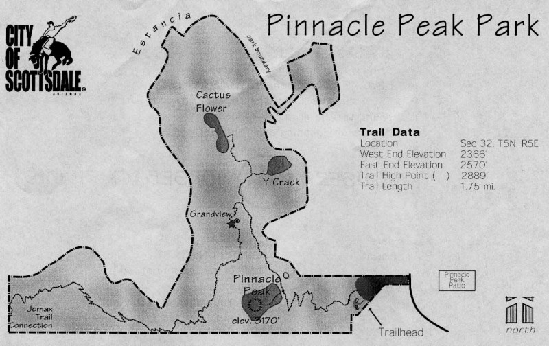
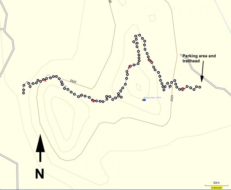
Follow this link for a map of the trail.
The trail starts at the parking area and traverses the base of the peak to a viewpoint. You can continue on the trail to the west end of the park for more of the same. There is no parking at the West end of the trail.
Since there is a large number of people with all different abilities, remember your hiking etiquette. Yield to those people going uphill. Let faster hikers pass you. Horses are also allowed on this trail. Remember, hikers always yield to horses. Dogs are not allowed.
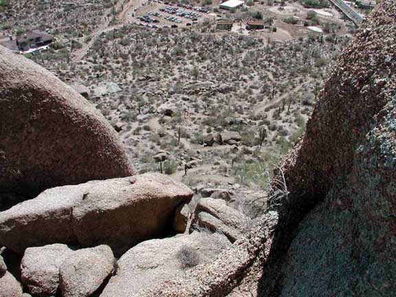
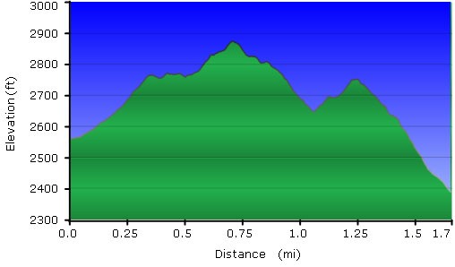
The hike is pleasant and easy. The trail quickly switchbacks as you climb out of the parking area. Look around for views of the parking area and the expensive homes around as you climb higher.
Once you reach the maximum elevation (a helpful sign marks it for you), take a look around and enjoy the view. If you still have energy, like we did, you can walk all the way to the West entrance to the trail.
When you are finished snapping pictures and enjoying the views, return the way you came.
